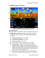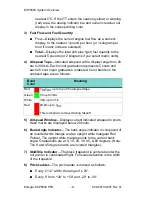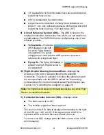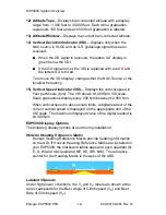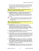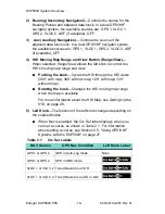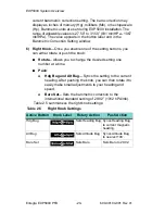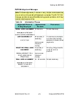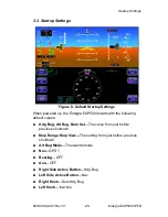
EXP5000 Lower Half Display
600-00104-001 Rev 01
-13-
Entegra EXP5000 PFD
The wind vector on the HSI is very useful in any phase of flight
where you need to take winds aloft into account. You can use a
combination of the wind vector and projected track line in
navigation tasks.
4) Projected Track Line
—The dashed gray projected track line
originates from the aircraft present position symbol and
terminates at the triangle along the outer edge of the compass
rose. It displays a projection of the current ground track of the
aircraft.
➥
To take the guesswork out of determining proper crab angles
for wind corrections, align the projected track line with the
desired course.
5) Bearing Pointer
—The blue dual-line bearing pointer is
associated with the Bearing source and displays the current
bearing to the Bearing waypoint (GPS 1 or GPS 2) or to the
station (VLOC 1 or VLOC 2). A bearing pointer does not display if
you tune the VLOC source to an ILS or LOC station.
6) Course Deviation Indicator (CDI)
—The green single-line CDI
displays deviation from the set or desired course.
7) To-From Flag
—The small green arrow indicates whether you are
heading
to
or
from
the current VOR or GPS waypoint. If you are
heading
to
the VOR, the arrow points the direction you are flying.
If
from
, the arrow points towards your most recent VOR or
waypoint.
8) HSI Moving Map
—Displays up to a maximum of 15 waypoints
and labels from the active flight plan. The active leg of the flight
plan is depicted in magenta, and all other legs of the flight plan
are depicted in white. The moving map will also display waypoints
and labels of an approach and hold.
9) HSI Map Range
—When the moving map is selected for display
on the HSI via the
View
knob, the outer and inner rings of the
Note
: Under very light wind conditions or when wind speed cannot be
calculated, wind data will be replaced by dashes.
Note:
In dual-PFD equipped aircraft, differences between the two wind
vectors during light winds are normal.

