Map Layers Help
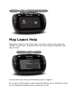
Each type of object on the map exists on a layer, and you can toggle the
visibility of each layer. Hide information you aren't using to keep the map
easy to read.
The elevation topo-lines and hill shading can be toggled.
If you enjoy technical data, extra onscreen readouts can be enabled to show
current latitude/longitude and the actual zoom level.


