


© Satmap Systems Ltd
© Satmap Systems Ltd
41
8.00
MAIN MENU:
ROUTES MENU
8.00b Following a Route
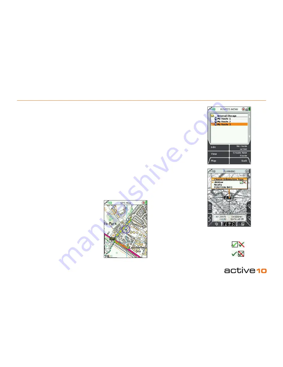
A route is made up of individual waypoints,
shown as small green circles which turn blue
as you approach the next waypoint. The route
color can be either blue or yellow, with varying
transparency, depending on the active route
color chosen
(section 8.02f)
. The default route
color is blue.
To follow a route, you need to first 'activate' it
(section 8.00a)
.
As you begin to follow the yellow/blue route,
the next waypoint along turns blue. The
current leg between waypoints is shown to
have blue edging and blue arrowheads. As
you approach this point, the waypoint name
is displayed
(section 8.02e)
and the unit will
beep. As you pass this waypoint it will turn
from blue to green, and the next waypoint
marker will turn blue, and so on.
8.00a Active and Inactive Routes
There are three ways to 'activate' a route:
• Highlight the route in the
ROUTES MENU
and press
Activate
. An active route is
indicated by a tick next to the route name.
To deactivate, highlight the ticked route
name and press
No route active
.
•
Alternatively
you can go to the
ROUTES
MENU
, press
View
and then
Start
, which
activates the route automatically.
•
If you can see the route on the
GPS MAP
or
PLANNING
screen, center press the joystick
anywhere on the route. This will bring up the
Choose Information Type
window
(section
11.00)
. Select the route, and then move the
joystick left/right to highlight the green tick.
An activate route has relevant data choices
available for display on the GPS MAP screen
in either 2 or 4 data box overlays
(sections
7.04
–
7.08)
. Refer to
MAIN MENU →
Settings → Set Trip Data
to control whether
changing an activated route during a trip will
reset the log data.
When active, the route is shown as a yellow
or blue highlighted line with red arrowheads
indicating the direction of travel. Inactive
routes are shown as gray highlighted lines
when displayed.
Inactive routes may be hidden or have just
their start points displayed
(section 7.14)
.
Note: Showing your inactive routes will take
up operating memory.
Active route
Inactive route
Figure 8.00b
Figure 8.00a


