


105
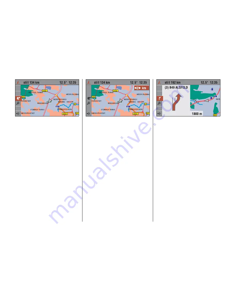
Map display
3
Next to the arrow displayed for guidance a
map display with the route drawn in can be
selected.
☞
Select the “
Map
” menu item or the
Ï
symbol on the guidance screen.
✔
A map with the current position is
displayed. The calculated route is
drawn on this map as a white line. The
current position of the vehicle is shown
by an arrow.
Changing map scale
3
☞
Select the “
Scale
” menu item or the
Ñ
symbol on the guidance screen.
✔
The currently set display scale is
shown.
☞
Change the scale by turning the click
dial and confirm the value set.
✔
The map will be redrawn to the
selected display scale.
The map scale can be set between
100 m and 200 km.
Changing map positioning
3
You can change the positioning of the map
display in the “Navi Settings” menu, see
page 117.
Displaying special destinations
3
You can have special destinations (POIs)
(e.g. petrol station, hotels, etc.) displayed
on the map.
Activating the display of POIs, see
page 117.
POIs symbol overview see page 122.
Combined map/arrow display
3
The “split screen” shows a combination of
map and arrow display on the guidance
screen.
☞
Select the “
Map / Pictogram
” menu item
or the
Ð
symbol on the guidance
screen.
Содержание CD 70 NAVI
Страница 1: ...OPEL CD 70 NAVI Infotainment System...
Страница 2: ......
Страница 3: ......
Страница 4: ......


