background image


14 


Photo Comments 

Support multi-language comments. The comments will be uploaded to Flickr, packed 

in the kml file. 

Media List View 

Users can import not only photos. All other media files are allowed to be imported 

and tagged to tracks according to the file create times. 

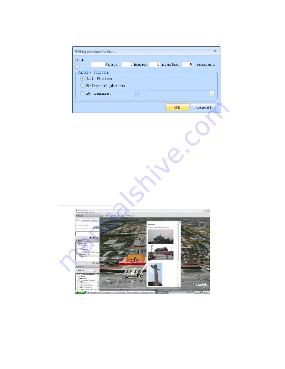
Google Earth Viewing 

Command “File” -> “View in Google Earth” will invoke Google Earth to view the 

tracks and photos. Users have to install the Google earth. 

http://earth.google.com/ 


Save As KMZ File 

Menu command “File” -> “Export as Kmz…” to save the tracks and photos in kmz file. 

You can import kmz file to Google Earth. You can also send kmz file to friends to 

Содержание GPS ezTour

Страница 1: ...GPS ezTour User s Manual Version 1 1 ...

Страница 2: ...otos 10 GeoTag Save GPS Information into Photos 11 Photo List Window 11 Upload Photos to Flickr Locr 12 Shift Photo Time 13 Photo Comments 14 Media List View 14 Google Earth Viewing 14 Save As KMZ File 14 Export As Html 15 Speed Altitude View 15 Track Editing 16 Save and Open Project 19 Time Zone Setting and Daylight Saving Time 19 Options 20 System Requirement 22 ...

Страница 3: ...er is turn on Step 2 Menu command File Read log Users have to input product key at the first time The product key is on the cover of installation CD GPS Photo Tagger will automatically detect the port and baud rate and read in the GPS tracks A track list window will be popped up Select the tracks to import ...

Страница 4: ...3 Tracks will be shown on the Google Map window ...

Страница 5: ...button you can press the POI button to mark the point When the POI button is pressed while logging a POI icon will appear on the track through the ezTour utility Press the POI icon on the ezTour to edit the name of the track and add notes ...

Страница 6: ...ored in device so the device memory are enough for next usage Data Logger Configuration Connect Data Logger to PC Menu command File Config GPS If Data Logger is not connected the GPS Log Setting area will be disabled Please make sure the Data Logger power switch is turn on when connect ...

Страница 7: ...anual Setting Users can also manually set the port and baud rate Although it can speed up the initial connect time but it is not recommended unless users understand the valid port and baud rate GPS Log Setting There are 4 log modes General mode vehicle mode cycling mode and hiking mode Users can also change the default setting of these 4 modes Log every seconds ...

Страница 8: ...entage of memory is used in the Data Logger device Users can use Clear Log to clear all the memory When data logger memory is full Overwrite Overwrite the earliest logged data Stop Log Stop data logging Track List Window Tracks are list on the top Users can change the colors and line widths of tracks Press Play button Google map window will animate the whole trip by moving the current position Che...

Страница 9: ...8 Add Place Mark To add a new place mark please click on the blue balloon icon and then click on the position of new place marker The Place Mark Property dialog will be pop up for editing ...

Страница 10: ... Add Photos Users can add photo from a file folder or selected files Add photo from a folder Menu command Photo Add Photo From Folder Select a folder to add photo Add photo from selected files Menu command Photo Add Photo From Files Use Ctrl Click or Shift Click to select multiple files ...

Страница 11: ...elete photo When photos are added GPS Photo Tagger will automatically match photo and GPS logged waypoints by time Place marks will be created as a placeholder for photos Browse photos Click on the next photo and prev photo buttons to browse the photos Current photo and current place mark will be synchronized ...

Страница 12: ...hotos will save the latitude longitude and altitude into photo A progress window will show the writing progress Photo List Window Photo list window will show the attributes of photos The information includes file name date place mark latitude longitude and Geotagged flag Synchronized ...

Страница 13: ...hoto Upload Photos to Flickr will invoke upload wizard Users can set Title description Tag Public or Private and Upload photo size Menu command Photo Upload Photos to Locr will invoke upload wizard for Locr Please type in the user name and password ...

Страница 14: ...will be put on map Go to Flickr You Your map you can browse your photos on the map Shift Photo Time Menu command Photo Shift photo time will invoke the shift photo time window All the photo will be added or subtracted the specified time The dates are saved in the Exit parts of Jpeg or Tiff file After the shift GPS Photo Tagger will automatically match the photo and track waypoints again User can p...

Страница 15: ...ported and tagged to tracks according to the file create times Google Earth Viewing Command File View in Google Earth will invoke Google Earth to view the tracks and photos Users have to install the Google earth http earth google com Save As KMZ File Menu command File Export as Kmz to save the tracks and photos in kmz file You can import kmz file to Google Earth You can also send kmz file to frien...

Страница 16: ... Photo size in KMZ Export As Html Command File Export Html File will invoke a preview dialog Users can save it as html file or mht file and share with friends Speed Altitude View Show speed graph altitude graph or both at the same time The waypoints with photos on it will be marked with square Moving cursor on red square will display the photo You can pan left pan right zoom in zoom out in the alt...

Страница 17: ...16 Track Editing Switch to folder Track Editor on the left window Move the cursor on the track will show the preselected waypoint time Click on track to select the whole track ...

Страница 18: ...ple selections Ctrl Click on waypoints will toggle the waypoints selections Area selection Click on Area Selection button drag an rectangle area All the waypoints and place marks in the rectangle area will be selected Delete waypoints Click on Remove button to remove the selected objects Split tracks Click on a waypoint and click right mouse button Select command Split Track ...

Страница 19: ...18 Undo Redo press undo redo buttons to undo redo the edit actions Multiple layers of undo redo are supported Merge tracks Command Track Merge Tracks Select the tracks Press OK button ...

Страница 20: ...ne of your digital camera The Display time zone is set for displaying purpose For example If you are an Englishman and you travel to United State The Photo time zone should be set to England because your digital camera time zone is in England and the display time zone should be set to United State The Photo time zone by default is set to the PC default value In most of the case the default value i...

Страница 21: ...isplaying Imperial Miles feet will be used for displaying Lat Long Degrees minutes seconds Latitude and longitude will be display like 23 12 20 Degrees Latitude and longitude will be display like 23 22152 Photo Time Zone The time zone of your digital camera time setting Max photo track diff time ...

Страница 22: ...t time is more than the Max photo track diff time it will not match the photo Group Photos when distance is less than When two photos distance is less than the setting these two photos will be put in the same place mark Photo size in KMZ The size of the photos packed in the KMZ file It is related to the command File Export As KMZ Preferred Language Set the languages for menu buttons and messages ...

Страница 23: ...I 1000 Mhz 256MB RAM 128 MB disk space Network speed 256 Kbits sec 800x600 16 bit High color screen Recommended System Requirement Windows XP or Vista Pentium IV 2 4GHz above 512MB RAM 2G Bytes free disk space Network speed 768 Kbits sec 1280x1024 32 bit True Color screen ...

Отзывы: