


Garmin G3X Pilot’s Guide
190-01115-00 Rev. K
131
GPS Navigation
System
Overview
Flight
Instruments
EIS
CNS
Interface
GPS
Navigation
Flight
Planning
Hazar
d
Avoidance
Additional
Featur
es
AFCS
Annun/Alerts
Appendix
Index
SECTION 5 GPS NAVIGATION
5.1 INTRODUCTION
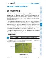
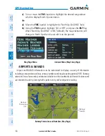
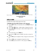
The Map Page displays aviation data (e.g., airports, VORs, airways, airspaces),
geographic data (e.g., cities, lakes, highways, borders), and topographic data (map
shading indicating elevation) to be used for situational awareness only. The Navigation
Map can be oriented three different ways: North Up (NORTH UP), Track Up (TRK UP) or
Desired Track Up (DTK UP).
An aircraft icon is placed on the Navigation Map at the location corresponding
to the calculated present position. The aircraft position and the flight plan legs are
accurately based on GPS calculations. The basemap upon which these are placed are
from a source with less resolution, therefore the relative position of the aircraft to map
features is not exact. The leg of the active flight plan currently being flown is shown as
a magenta line on the navigation map. The other legs are shown in white.
The Direct-to Window, the Flight Plan Pages, and the Nearest Airports Pages can be
displayed by pressing the corresponding hardkeys.
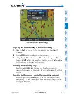
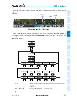
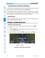
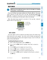
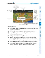
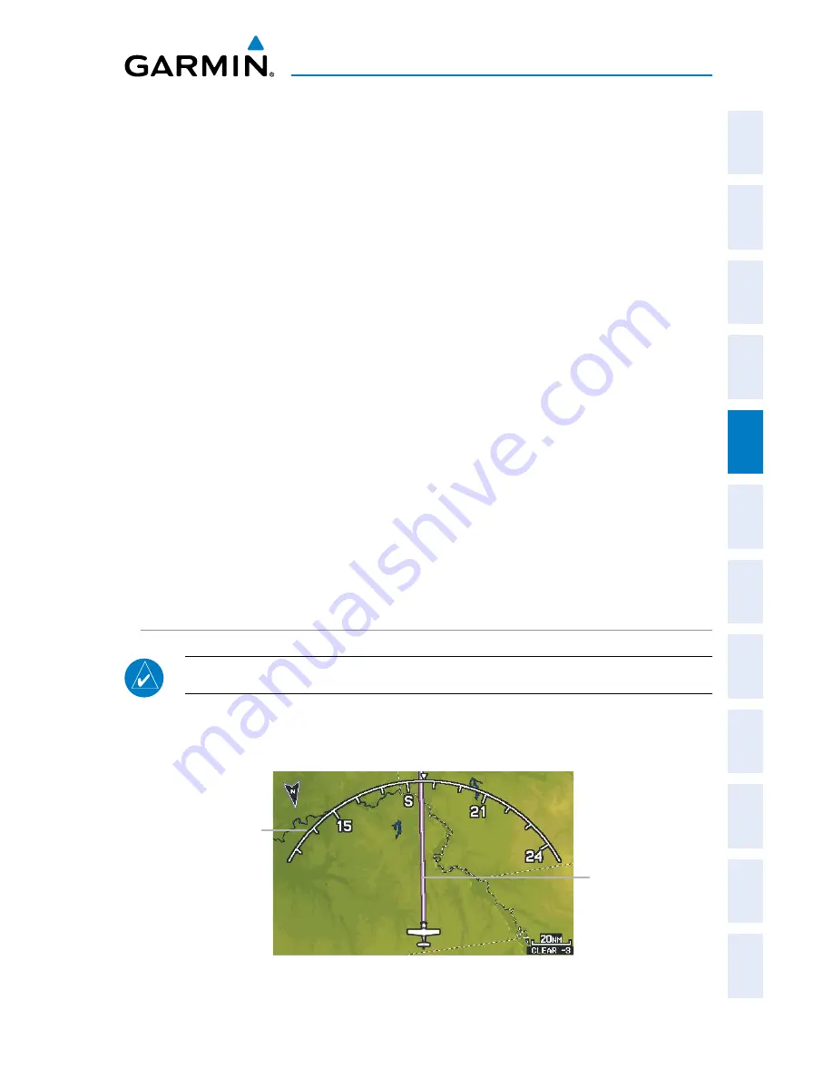
COMPASS ARC
NOTE:
The compass arc is not available in ‘North Up’ map orientation.
A compass arc representing the aircraft’s ground track, appears by default on the
Map Page. The route line represents the course.
Compass Arc (Map Page)
Route Line
Compass Arc
Содержание G3X Touch
Страница 1: ...G3X Pilot s Guide ...
Страница 2: ......
Страница 4: ......
Страница 10: ...Garmin G3X Pilot s Guide 190 01115 00 Rev K Warnings Cautions Notes Blank Page ...
Страница 16: ...Garmin G3X Pilot s Guide 190 01115 00 Rev K RR 6 Blank Page ...
Страница 469: ......