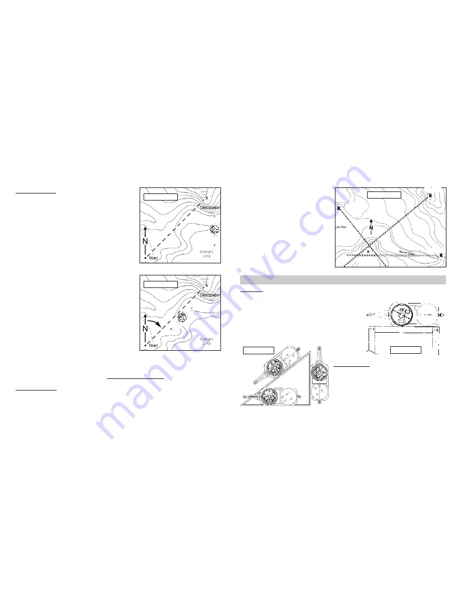
1. Identify three landmarks in the field,
that are identifiable on a topo-map.
2. Orient map to true north (see section
7.1)
3. Sight an azimuth to each landmark
and mark them on the map. (Fig 33)
4. Draw a line on the map for each
landmark azimuth.
5. Your position is within the small tri-
angle, or point formed by the intersec-
tion of the three lines. (Fig 33)
8.1 Level
The GEO transit can be used as a level, to run level lines, or to determine points of elevation.
1. Adjust Vernier to 0° inclination, using the vernier
adjustment.
2. Place transit on its side, on an object, or
use the tripod. (Fig 34)
3. Tilt instrument until bubble is centered in the long
level.
8.2 Plumb Bob
1. Suspend the transit in an open position from
the large sight -- See right image figure 35.
2. Use the small sight as the pointer.
7.1 Map Azimuth
It is possible to read a map azimuth from your position
to a destination. Orient your map to true north, then
determine a map azimuth by using the GEO transit.
1. On a USGS topographic map, place a “point” at a
starting position and an “X” at a destination.
2. Draw a line connecting both marks.
3. At the starting “point”, draw a true north line.
(Fig 31)
•
Use true north indicator in the legend, or the
edge of printed topographic map.
4. Adjust GEO for declination.
5. With large sight pointing at true north on the map,
place tranist along edge of printed map.
6. Rotate map and compass until the “
N
” points at 0°.
(Fig 31)
The map is aligned to true north. Now, determine the
azimuth from “Start” to the “Destination”.
7. Position the GEO transit so the large sight points
at the destination and is next to the azimuth line.
(Fig 32)
8. Read azimuth where the “
N
” points.
From the “Start” position in the field, sight the azimuth determined from the map, and you will
be facing the “Destination”. See section, 3 - Azimuth Measurement, for help.
7.2 Triangulation
Use Triangulation to find your approximate position, using the GEO and a map. Make sure the
GEO is adjusted for magnetic declination.
18
17
Figure 34
Figure 35
Figure 31
Figure 32
Figure 33
Baldy Peak
Boat Ramp
Beaver Falls
Your Position
50°
90°
320°
8 -- Additional Measurements
Содержание GeoTransit
Страница 15: ......


