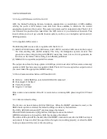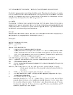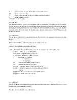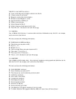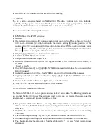
5-4 The meaning of GPS information (The data that can be analyzed and re-structured)
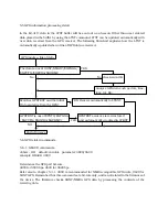
The EJ-41U analyzes data received from the GPS receiver. Then, based on that data, it converts
from one format to another. When the initial part of the input data and the GPSTEXT command
matches, it re-transmits that data as a LTEXT beacon. It also allows the transmission of a non-
compatible format string without the data being converted.
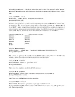
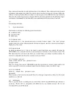
5-4-1 SONY
The following is a format that is output by the Sony IPS-5000 series. The EJ-41U is able to
analyze it, but cannot re-structure it. It is a 110 bite fixed data string starting with [SONY] and
ending with [CR][LF]. It contains date, time, latitude, longitude, altitude, speed and direction of
the GPS receiver and telemetry from the satellite(s).
Example:
SONY80950716090346N3546569E102180040139507016090345D4BDHIFGXHbCI
RDFFFPEiFHSCKCQGBRFFeBEDDcCOCHdDH10<CR><LF>
Description:
SONY80 : GPS firmware’s version
950701 : current date
6
: day
090346 : Current time in UTC
N
: N for North, S for South to indicate the latitude
3546569: the latitude in degree. This number can be shown in DMD (NEMA) or DMS
that is selectable with a command. The identifier will appear on the later part of the
data. In the DMD (NEMA) system it means 35’46.569”, in DMS it means 35’46”56.9’’’.
E
: E for East, W for west to indicate the longitude.
13918458: The longitude in degrees. In DMD 139’18.458”, in DMS 139’18’’,45.8’’’.
+0218 : Altitude, It indicates the altitude in meters. Same as Geoid for NEMA format.
004
: GPS receiver’s speed in km/h.
013
: The direction of the GPS receiver in degrees. 000 stands for 0 degrees north, up to 360
degrees clockwise.
950701, 6, 090345: The date, day and time when the receiver detected latitude, longitude,
altitude, speed and direction. Time is usually indicated 1 second before the
actual time.
D
: DOP value. Uses characters [A] to [Q] to indicates relative values.
4
: The dimension process mode. [3] stands for the 2-dimension measurements, [4] for
3-dimension measurements.
B
: Location ID. B stands for Japan, Korea
DHIFG to CCOCH: the status of satellites being received on each channel. This
example shows the status of the satellites received in channels 1 to 8 to receive data.
Each 5 letters defines 1 channel. The first letter shows the satellite number, 2
nd
shows
the elevation angle, the 3
rd
shows direction angle, 4
th
shows channel status and 5
th
shows the signal-level of each satellite.

