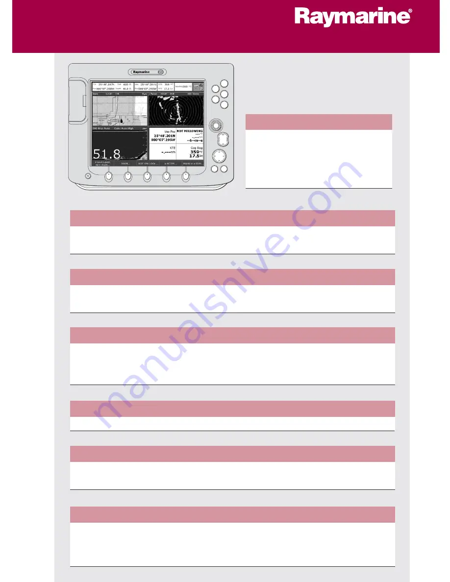
background image

General Operation

The control panel
Using the controls
Setting up the display
Using CompactFlash cards

Card 1

Card 2

Card 3

Card 4

What's under the boat?

Understanding the fishfinder
Using the fishfinder 

Card 13

Card 14

Basic Navigation

Working with waypoints
How do I get to a point?

Card 7

Card 8

What is around me?

Understanding the radar
Avoiding a collision
Using MARPA

Card 9

Card 10

Card 11

Where am I going?

Monitoring a course

Card 12

D6721_3

Other functions

Monitoring data and engines
Viewing video images
Operating a networked E-Series Display 

Card 15

Card 15

Card 16

What can I see?

Understanding the chart
Using the chart

Card 5

Card 6

PAGE

ACTIVE

WPTS

MOB

MENU

DATA

CANCEL

OK

RANGE

IN

OUT

E-Series Display

Operating Guide

www.raymarine.com

Summary of Contents for E-Series

Page 1: ...a point Card 7 Card 8 What is around me Understanding the radar Avoiding a collision Using MARPA Card 9 Card 10 Card 11 Where am I going Monitoring a course Card 12 D6721_3 Other functions Monitoring...

Page 2: ...previous set of soft keys or menu MENU Press to access the set up menus Press and hold to access help information ACTIVE When multiple windows are open Press to select required window Press and hold...

Page 3: ...e displayed If a key has several options each press will highlight the next option If a key displays a single value or a slider above use the rotary control to adjust Within the text of this document...

Page 4: ...o confirm Highlight required page set To customise EDIT PAGE SET Follow on screen instructions OR The applications are shown using a combination of page sets pages and windows There are four pre confi...

Page 5: ...CF CARD REMOVAL The system will now complete its checks 3 When instructed to do so open the chart card door and remove the card 4 Firmly click the chart door shut and press OK twice with the unit powe...

Page 6: ...ursor When cursor reaches window edge chart pans to a differ ent area Press and hold to pan larger areas Press RANGE OUT to see a larger area of the chart Press RANGE IN to see a smaller area in more...

Page 7: ...that you are travelling in It is used in conjunction with motion mode see below to control how your boat and chart relate to one another and how they are displayed on screen The default mode for char...

Page 8: ...tion using Lat Long or Loran TD co ordinates Waypoints are represented in chart or radar applications as an X this can be changed if required and by a vertical line labelled WPT in Fishfinder The deta...

Page 9: ...of a series of waypoints These waypoints can either be placed specifically for that route and or you can use existing waypoints You can save a route for future use or follow it immediately Quick Rout...

Page 10: ...ng Typically your boat s position is at the centre of the display and its dead ahead bearing is indicated by a vertical heading line known as the Ship s Heading Marker SHM Remember that the radar pict...

Page 11: ...displayed on the screen or is displayed by offsetting the centre Is inactive for 10 seconds after it is placed or re sized to avoid inappropriate alarms Sector Zone SHM Circular Zone SHM IMPORTANT A g...

Page 12: ...ar Plotting Aid MARPA functions are used for target tracking and risk analysis MARPA improves your standards of collision avoidance by obtaining detailed information for up to 10 targets and provides...

Page 13: ...s DATA CHART VECTORS COG HDG VECTORS Use the Course Deviation Indicator CDI With your display receiving accurate heading and position information you can to monitor your course and accurately steer to...

Page 14: ...ETTINGS ZOOM BOTTOM LOCK A SCOPE PRESENTATION 200 kHz Auto Gain Auto High Depth markers Target Bottom Bottom of transducer Frequency Gain mode Frequency mode Target depth Bottom depth What can I see o...

Page 15: ...FF FISHFINDER SETTINGS Press Select MAN FREQUENCY AUTO MAN Select required frequency To see more detail of the bottom structure target images etc zoom in and enlarge a portion of the image FISHFINDER...

Page 16: ...player or on board camera VIDEO 1 VIDEO 2 VIDEO 3 VIDEO 4 PRESENTATION The engine monitor application enables you to view data from one or two system compatible engines The information is displayed i...

Page 17: ...well as data from NMEA and SeaTalk Each time the master display detects a change on any display e g waypoint route or track added or edited the data is copied to the database which in turn is copied t...

Page 18: ...d Unit D Nashua NH 03063 4219 USA 603 881 5200 603 864 4756 fax www raymarine com D6826_1 Raymarine Ltd Quay Point Northarbour Road Portsmouth Hampshire England PO6 3TD 44 0 23 9269 3611 44 0 23 9269...

Reviews: