Summary of Contents for eXplorist 200 - Hiking GPS Receiver
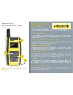
Page 1: ...st 200 Reference Manual Topics eXplorist 200 GPS Receiver Using the eXplorist 200 Starting Up Navigation Screens Points of Interest Routes Track Logs Preferences Specifications Accessories Contacting...

Page 2: ...e receiver and will void the warranty LICENSE AGREEMENT Thales Navigation grants you the purchaser the right to use the software supplied in and with Thales Navigation GPS products the SOFTWARE in the...

Page 3: ...ng the Display Backlight On Off 9 Using the eXplorist for the First Time 10 Conclusion 13 Navigation Screens 14 Accessing the Navigation Screens 14 Map Screen 14 Map Screen Overview 15 Changing Map Sc...

Page 4: ...Preloaded POI using Alphabetical 31 Editing a User Created POI 32 Deleting a User Created POI 33 Viewing a User Created POI on the Map Screen 34 Copying a Preloaded POI 35 Viewing a Preloaded POI on...

Page 5: ...the GPS 61 Setting the Map Units 63 Selecting Navigational Units of Measure 63 Selecting the North Reference 64 Selecting the Coordinate System 65 Selecting the Map Datum 66 Using the Power Management...

Page 6: ...nna eXplorist 200 GPS Receiver front Built in background map Preloaded points of interest Rugged design rubber protected 8 MB of background map Superior tracking with 14 parallel channels 14 hour batt...

Page 7: ...oomed out to 1700 mi 2700 km Also used to quickly step through the list of POIs when doing an alphabetical search MENU Brings up a menu with available options Options can be selected by using the arro...

Page 8: ...eXplorist 200 GPS Receiver 3 Battery Door Fastener Unscrew to open battery door to install batteries eXplorist 200 GPS Receiver back Battery Door Wrist Lanyard Strap Mounting Hole...

Page 9: ...ed time You can select from 5 10 30 or 60 minutes Use the display backlight sparingly The most severe drain on the batteries is the use of the display backlight You will notice a drastic drop in batte...

Page 10: ...ites Do Point the antenna up toward the sky Maintain a clear view of the sky Don t Cover the antenna with your hand or other objects Point the antenna down Stand under trees or other heavy foliage Sta...

Page 11: ...that your eXplorist automatically updates the route providing you with up to date information about getting to your destination GOTO routes are the simplest and most commonly used feature of your eXpl...

Page 12: ...that represents the trail you have taken This is exactly what the eXplorist does It saves the computed positions as hidden points of interest and strings them together to represent your travels This i...

Page 13: ...u to graphi cally see your position the route you are navigating the path you have trekked Track and points of interest icons There is a built in odometer so that you can log the length of your journe...

Page 14: ...the POWER button If you change your mind and decide to leave the eXplorist on just press the ESC button If you press the POWER button during this countdown period the eXplorist will immediately turn...

Page 15: ...outside and have a clear unobstructed view of the sky Without a clear view this will take much longer and could result in the eXplorist being unable to compute the initial position automatically The...

Page 16: ...your initial fix in a few minutes If the eXplorist determines that it is unable to track the satellites within a few minutes it will present you with the following screens in an effort to better deter...

Page 17: ...button is highlighted at the bottom of the display Review the information you entered if correct press ENTER Tip If the time or the date is incorrect you can fix it now Use the Arrow joystick to high...

Page 18: ...osition will be set to a null value If you have traveled with your eXplorist with it turned off the last position saved may be so far away that when the eXplorist begins looking for satellites the one...

Page 19: ...joystick to move the cursor The arrow cursor changes to a crosshair cursor with any available information about the position of the cursor at the bottom of the display You can also save the position...

Page 20: ...he Map screen displays your position indicated by the arrow icon in the center of the map The arrow not only displays your position but also when moving will point in the direction you are heading The...

Page 21: ...f the screen changes to provide information about the cursor position To exit the cursor mode press the ESC button When pressed the Map screen is returned to the Position mode with your present positi...

Page 22: ...e 3 Press ENTER 4 The title bar for one of the fields is highlighted Use the Arrow joystick to highlight the title bar for the field you want to customize 5 Press ENTER 6 Highlight the information you...

Page 23: ...th Track Up In track up the top of the map display changes to reflect your heading If you are not moving the top of the display indicates true north Note In Course Up and Track Up a north indicator is...

Page 24: ...easily depending on where you are navigating To change the primary usage 1 While viewing the Map screen press MENU 2 Use the Arrow joystick to highlight Map Setup 3 Press ENTER 4 Use the Arrow joystic...

Page 25: ...n you are moving Compass Screen Overview The top of the screen the header bar displays the name of the destination if you have an active route Without an active route the destination name is blank Als...

Page 26: ...ustomize page 3 Press ENTER 4 The title bar for one of the fields is highlighted Use the Arrow joystick to highlight the title bar for the field you want to customize 5 Press ENTER 6 Highlight the inf...

Page 27: ...eld when the eXplorist is using WAAS information to increase the accuracy of the position fix Date and time are shown automatically adjusted from time information supplied from the atomic clocks in th...

Page 28: ...trip odometer to zero To reset the trip odometer 1 While viewing the Position screen press MENU 2 Use the Arrow joystick to highlight Reset Trip 3 Press ENTER 4 Use the Arrow joystick to highlight Ye...

Page 29: ...en Type of position fix and the number of satellites being tracked is displayed A 2D Position Fix requires three satellites a 3D Position Fix requires four satellites or more Graphical indication of t...

Page 30: ...atabase will be to mark your present position There are two levels of marking your position The first that will be described will be quick marking your position The second method provides you with the...

Page 31: ...ed in the information block at the top of the keypad 4b If the Name field was selected Use the Arrow joystick to select the character desired and press ENTER If you make a mistake highlight Back and p...

Page 32: ...nge the coordinate system used by your eXplorist 1 Press MARK 2 Use the Arrow joystick to highlight the Location field 3 Press ENTER 4 Depending on the coordinate system used the information will be d...

Page 33: ...er method of marking a position while in the Cursor mode is to use the crosshair cursor to mark a map object road city etc 1 While viewing the Map screen use the Arrow joystick to put the eXplorist in...

Page 34: ...e bearing and distance from your present position is displayed at the bottom of the screen Searching for a User Entered POI When searching for a POI that you have entered you have two options to choos...

Page 35: ...joystick to highlight Pts of Interest 3 Press ENTER 4 Use the Arrow joystick in an up down motion to highlight Background Map 5 Use the Arrow joystick in a left right motion to select Nearest 6 Press...

Page 36: ...ystick to highlight the category Cities Highways Airports Waterways or Parks for the POI 8 Press ENTER 9 Use the Arrow joystick and the ENTER button to enter the first few characters of the POI you ar...

Page 37: ...e Arrow joystick to select the icon desired and press ENTER To aid in your selection the type of icon selected is displayed in the information block at the top of the keypad 13b If the Name field was...

Page 38: ...w will be displayed confirming the deletion 1 Press MENU 2 Use the Arrow joystick to highlight Pts of Interest 3 Press ENTER 4 Use the Arrow joystick up down to highlight My Pts of Interest 5 Use the...

Page 39: ...to be viewed 8 Press ENTER 9 Use the Arrow joystick to highlight View on Map 10 Press ENTER 11 The Map screen will be displayed in the Cursor mode The cursor will be directly over the POI you have sel...

Page 40: ...12 through 14 are optional 12 Use the Arrow joystick to highlight the field you want to change 13 Press ENTER 14a If the Icon field was selected Use the Arrow joystick to select the icon desired and p...

Page 41: ...ght OK and press ENTER to continue 8 Use the Arrow joystick to highlight the POI to be viewed 9 Press ENTER 10 Use the Arrow joystick to highlight View 11 Press ENTER 12 The Map screen will be display...

Page 42: ...advantage of a multi leg route is that it can be saved in the eXplorist s memory to be activated and used over and over A third type of route is a backtrack route The creation of backtrack routes is...

Page 43: ...creation of this GOTO After you press ENTER the last viewed navigation screen will be displayed updated as needed to provide information about the GOTO route you have created On the Map screen a line...

Page 44: ...hat you want to create a GOTO from the current cursor position Highlight Yes If you highlight No and press ENTER the eXplorist assumes that you still want to create a GOTO just not to the current curs...

Page 45: ...map objects in the same location 5 Press ENTER 6 Use the Arrow joystick to highlight Goto 7 Press ENTER 8 If a GOTO is active you will be asked to deactivate it and create a new GOTO route Highlight...

Page 46: ...s of a multi leg route Multi leg routes can be saved in memory A maximum of 20 routes can be saved Each saved route can have up to 29 legs in the route Multi leg routes remain active even after the eX...

Page 47: ...s already in the route list Inserting Use the Arrow joystick to highlight the POI that you want to insert a new leg before Press MENU highlight Insert POI and press ENTER Search the POI database for t...

Page 48: ...ss MENU 2 Use the Arrow joystick to highlight Routes 3 Press ENTER 4 Use the Arrow joystick to highlight the name of the route you want to activate or deactivate Active routes have their names bolded...

Page 49: ...he route is active you can select legs only from active routes you would follow the instructions below and tell the eXplorist to set the next leg to the ranger station The route would be recomputed el...

Page 50: ...d in front of Press MENU highlight Insert POI and press ENTER Search the POI database for the new POI The new POI will be added inserting into the route you are creating Deleting Use the Arrow joystic...

Page 51: ...was discussed earlier Camp Bridge Marker Ranger Swim would now be Swim Ranger Marker Bridge Camp 1 Press MENU 2 Use the Arrow joystick to highlight Routes 3 Press ENTER 4 Use the Arrow joystick to hig...

Page 52: ...an create a new one 1 Press MENU 2 Use the Arrow joystick to highlight Routes 3 Press ENTER 4 Use the Arrow joystick to highlight the name of the route you want to delete 5 Press MENU 6 Highlight Dele...

Page 53: ...2 Use the Arrow joystick to highlight Routes 3 Press ENTER 4 Use the Arrow joystick to highlight the name of the route you want to copy 5 Press ENTER 6 Press MENU 7 Use the Arrow joystick to highligh...

Page 54: ...R 4 Use the Arrow joystick to highlight the name of the route you want to view 5 Press ENTER 6 Use the Arrow joystick to highlight View on Map 7 Press ENTER The route is displayed with the map scaled...

Page 55: ...find many other additional uses for track logs once you feel comfortable with them Track Logs As mentioned above track logs are records of your travels using electronic breadcrumbs to record where yo...

Page 56: ...ppears only when the active track is not being recorded 6 Press ENTER Note The eXplorist will fill in a straight line from the point where track logging was stopped to the point where it has been resu...

Page 57: ...Press ENTER 4 Use the Arrow joystick to highlight Active Track 5 Press MENU 6 Highlight Stop Logging If Resume Logging is displayed the Track Log has already been stopped Go to step 10 7 Press ENTER 8...

Page 58: ...an seven characters long 1 Press MENU 2 Use the Arrow joystick to highlight Track Log 3 Press ENTER 4 Use the Arrow joystick to highlight Active Track 5 Press MENU 6 Highlight Save 7 Press ENTER 8 If...

Page 59: ...orist will now begin computing the navigation information needed to guide you back to your starting point NOTE When you have an active BackTrack route the eXplorist will not be recording track informa...

Page 60: ...If you do not the other functions will still work but you will probably have a lot more track log information than you want 1 Press MENU 2 Use the Arrow joystick to highlight Track Log 3 Press ENTER 4...

Page 61: ...e the Arrow joystick to highlight Active Track or any track log you have previously saved 5 Press MENU 6 Highlight Convert to Route 7 Press ENTER 8 Use the Arrow joystick and ENTER button to assign a...

Page 62: ...Arrow joystick to highlight Track Log 3 Press ENTER 4 Use the Arrow joystick to highlight Active Track or any track log you have previously saved 5 Press MENU 6 Highlight View on Map 7 Press ENTER The...

Page 63: ...reviously saved 5 Press MENU 6 Highlight Follow Track 7 Press ENTER 8 Track logging will be turned off alert status Press ENTER The last viewed navigation screen is displayed with the track log select...

Page 64: ...longer needed 1 Press MENU 2 Use the Arrow joystick to highlight Track Log 3 Press ENTER 4 Use the Arrow joystick to highlight any track log you have previously saved 5 Press MENU 6 Highlight Delete T...

Page 65: ...arge distance while turned off Access to setting the units of measure for information displayed A means to set the north reference used to be either magnetic north or True North The coordinate system...

Page 66: ...ing for the satellites that it thinks are overhead If the satellites are not there the eXplorist begins polling the skies trying to determine which satellites are in view This process can take time an...

Page 67: ...ote Time is one of the first pieces of information transmitted by the satellites Even without enough satellite information to compute a position fix the time displayed may have already been corrected...

Page 68: ...Knots or KM KPH 1 Press MENU 2 Use the Arrow joystick to highlight Preferences 3 Press ENTER 4 Use the Arrow joystick to highlight Map Units 5 Press ENTER 6 Use the Arrow joystick to highlight the da...

Page 69: ...tick to highlight Map Units 5 Press ENTER 6 Use the Arrow joystick to highlight the data field for North Reference 7 Press ENTER 8 Use the Arrow joystick to highlight Magnetic or TRUE 9 Press ENTER Th...

Page 70: ...row joystick to highlight Preferences 3 Press ENTER 4 Use the Arrow joystick to highlight Map Units 5 Press ENTER 6 Use the Arrow joystick to highlight the data field for Coord System 7 Press ENTER 8...

Page 71: ...ress MENU 2 Use the Arrow joystick to highlight Preferences 3 Press ENTER 4 Use the Arrow joystick to highlight Map Units 5 Press ENTER 6 Use the Arrow joystick to highlight the data field for Map Dat...

Page 72: ...s from running out if you accidentally leave the eXplorist on 1 Press MENU 2 Use the Arrow joystick to highlight Preferences 3 Press ENTER 4 Use the Arrow joystick to highlight Pwr Management 5 Press...

Page 73: ...klight to remain on while no buttons have been pressed 1 Press MENU 2 Use the Arrow joystick to highlight Preferences 3 Press ENTER 4 Use the Arrow joystick to highlight Pwr Management 5 Press ENTER 6...

Page 74: ...7 Press ENTER 8 Use the Arrow joystick and ENTER button to input your name 9 Use the Arrow joystick to highlight OK when the name is entered 10 Press ENTER 11 Optional Use the Arrow joystick to highli...

Page 75: ...Italian Portugu s Portuguese Svenska Swedish and Norsk Norwegian Selecting the Language for Your eXplorist 1 Press MENU 2 Use the Arrow joystick to highlight Preferences 3 Press ENTER 4 Use the Arrow...

Page 76: ...Memory you can also set all of the defaults in the eXplorist to the factory defaults Clearing All Track Logs 1 Press MENU 2 Use the Arrow joystick to highlight Preferences 3 Press ENTER 4 Use the Arro...

Page 77: ...es 3 Press ENTER 4 Use the Arrow joystick to highlight Clear Memory 5 Press ENTER 6 Use the Arrow joystick to highlight Routes 7 Confirm Use the Arrow joystick to highlight Yes to confirm or No to can...

Page 78: ...rrow joystick to highlight Preferences 3 Press ENTER 4 Use the Arrow joystick to highlight Reset Default 5 Press ENTER 6 Use the Arrow joystick to highlight All 7 Confirm Use the Arrow joystick to hig...

Page 79: ...eady state Limits Speed 951 MPH 1530 5 km h Altitude 60 000 ft 18 600 meters Physical Size 4 6 x 2 1 x 1 3 h x w x d 11 7 cm x 5 3 cm x 3 3 cm Weight 4 ounces 110 grams with 2 AA batteries installed D...

Page 80: ...ser entered Total Up to 500 saved points of interest Name Length 8 characters including spaces Built in included with background map Categories Cities highways airports waterways and parks Navigation...

Page 81: ...er wherever your adventure takes you Part number 702209 Bike Mounting Mount your Magellan eXplorist on your bicycle snowmobile or motorcycle for convenient operation and viewing The easy to install mo...

Page 82: ...hone Our technical support phone representatives are available Monday through Friday 6 00 a m to 5 00 p m P S T P D T Telephone 800 707 9971 or 1 909 394 5000 Outside North America You may also reach...

Page 83: ...supportfr thalesnavigation com free of charge phone access available from Eire UK Portugal Spain France Belgium The Netherlands Germany Austria Switzerland Norway Sweden Denmark and Finland For Magell...

Reviews: