


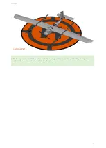


Mission Planning
Survey
To create a mapping mission, a survey grid will need to be created in Swift
. Select the
Survey
button from the
Plan
tab to add
one. You will be prompted to load a KM L (or KM Z) file or to draw a new area by placing polygon points on the map. Polygons that
can be saved for future use. The survey grid makes all calculations based off the camera you selected from the
list. Adjusting the flight altitude will allow you to change the ground sampling distance (GSD), or simply put, the imagery resolution.
Reaching the start of a survey will cause the camera to begin taking photos. The camera will continue to take photos until the last
waypoint in the survey is reached. If you need to land before a survey is complete, the camera will continue taking photos until on the
ground. This is fine, but those photos may need to be deleted before processing.
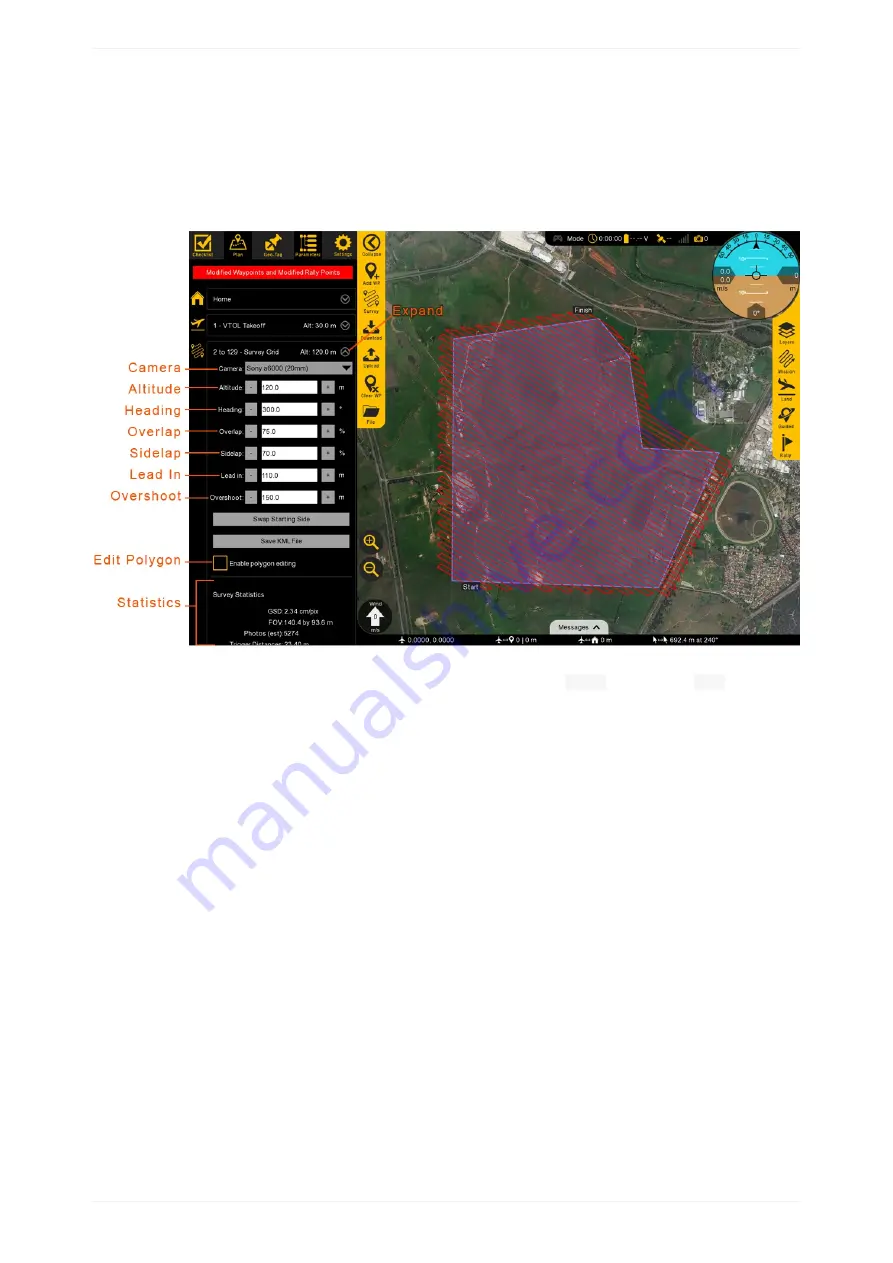
Settings for the survey mission can be modified by expanding the survey item in the list of mission items.
Camera
Expand to reveal the list of existing camera profiles. A custom camera profile can be added by going to the Settings Tab, then Camera.
Altitude
Altitude should be set based on the resolution requirements for your mission. It is critical to also account for safety factors such as
surrounding terrain, air traffic, and local regulations. Flying higher will always increase your ground coverage vs. time but at the expense
of reduced resolution.
Heading
Adjusting the heading control the direction of the flight legs. Flight legs should be perpendicular to the prevailing wind (crosswind). This
will cause the aircraft to crab in flight but will result in a consistent ground speed from one flight leg to the next. A headwind/downwind
scenario will cause the aircraft to have a slow ground speed one direction, and a high ground speed in the other direction. A high ground
M ission Planning
56
Summary of Contents for Lynx VTOL
Page 6: ...Package Contents Package Contents 6...
Page 18: ...3 Right click on the USB Serial Port and select properties Getting Started 18...
Page 19: ...4 Swap to the Port Settings tab and select Advance Getting Started 19...
Page 86: ...Landing 86...
Page 87: ...Payloads Standard Mapping Payload Multispectral Mapping Payload Custom Payloads Payloads 87...
Page 94: ...Standard Mapping Payload 94...
Page 108: ...Mounting Custom Payloads 108...
Page 110: ...Post Processing Geo Tagging PPK Tagging Base Station Reference Stations Post Processing 110...
Page 114: ...Geo Tagging 114...
Page 130: ...Battery Charging Charging Storage Battery Management 130...
Page 136: ...Second Battery Start Charging 136...
Page 143: ...Second Battery Start Storage 143...
Page 149: ...Replacing the Main Propeller 149...
Page 167: ...Getting Logs 167...
Page 171: ...2019 02 11 Ensure the landing checklist matches the GCS landing checklist Manual Changelog 171...


