

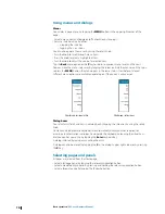


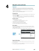
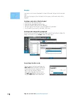


Chart settings
Settings and display options made in the Chart settings page are common for all chart
panels.
3D boat selection
Determines which icon to use on 3D charts.
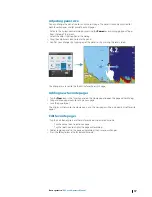
Range Rings
The range rings can be used to present the distance from your vessel to other chart objects.
The range scale is set automatically by the system to suit the chart scale.
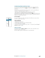
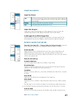
Vessels’ extension lines
Sets the length of the extension lines for your vessel and for other vessels shown as AIS
targets.
• A: Heading
• B: Course Over Ground (COG)
The length of the extension lines are either
set as a fixed distance, or to indicate the
distance the vessel will move in the selected
time period. If no options are ticked on for
This vessel
then no extension lines will be
shown for your vessel.
Own vessel heading is based on information
from the active heading sensor and COG
from active GPS sensor.
For other vessels COG data is included in the
message received from the AIS system.
Synchronize 2D/3D chart
Links the position shown on one chart with the position shown on the other chart when a
2D and a 3D chart are shown side by side.
Pop-up information
Selects whether basic information for chart items shall be displayed when you tap the item.
Grid lines
Turns on/off viewing of longitude and latitude grid lines on the chart.
Waypoints, Routes, Tracks
Turns on/off displaying of these items on chart panels.
28
Charts
| NSS evo2 Operator Manual
Summary of Contents for NSS evo2
Page 1: ...ENGLISH NSSevo2 Operator Manual simrad yachting com ...
Page 2: ......
Page 99: ......
Page 100: ...0980 988 10592 001 ...


