RAZAIR
‐
A1
‐
METRO
‐
III
‐
AFM
‐
001
2
‐
13
When
the
GPS
is
selected
as
the
nav
source,
the
bearing
pointer
for
the
primary
nav
source
indicates
the
bearing
to
the
current
active
waypoint.
CONTROLLING
THE
DISPLAY
The
EHSI
is
capable
of
displaying
a
large
amount
of
data
at
once.
Caution
must
be
taken
to
avoid
undesirable
clutter.
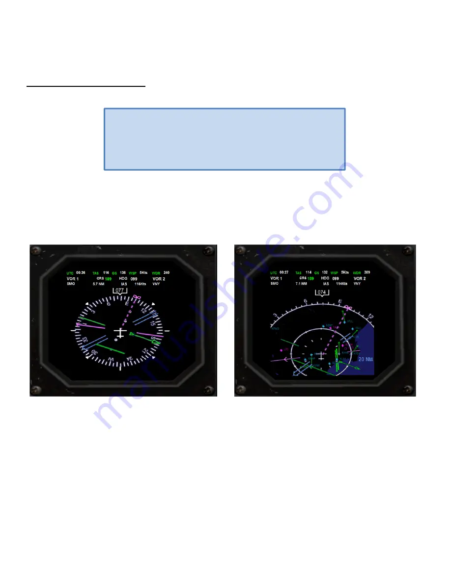
ARC
VIEW
AND
360
‐
DEGREE
VIEW.
The
EHSI
allows
you
to
switch
between
a
traditional
360
‐
degree
view
of
the
compass
rose
and
a
forward
‐
looking
ARC
view.
The
ARC
view
places
the
aircraft
symbol
at
the
bottom
of
the
display
and
the
heading
indicator
along
an
arc
of
120
‐
degrees
around
the
top
of
the
screen.
ARC
view
maximizes
the
display
of
the
ground
track
ahead
of
the
aircraft
and
provides
the
greatest
amount
of
screen
area
for
the
map
data.
Fig.
94
360
‐
Degree
view
mode.
Fig.
95
ARC
view
mode.
The
view
can
be
changed
by
clicking
on
the
corresponding
button
in
the
EHSI
control
panel:
To
select
the
360
‐
degree
view
click
on
the
HSI
button.
To
select
the
ARC
view
click
on
the
ARC
button
DISPLAYING
THE
MOVING
MAP
The
EHSI
can
display
a
moving
map
with
navigation
data
such
as
flight
plan
route
(if
a
flight
plan
is
present
in
the
system),
nearby
airports,
navaids,
intersections
and
airspaces.
The
moving
map
can
be
displayed
in
both
360
‐
Degree
and
ARC
view
by
clicking
on
the
MAP
button
in
the
EHSI
control
panel.
Successive
clicking
will
cycle
through
the
map
data
as
follows:
Basic
(water,
airports,
ILS
(only
in
ARC
view)
and
NOTE
Because
the
virtual
cockpit
EHSI
display
can
be
hard
to
read,
we
have
developed
a
2D
repeater
that
will
appear
whenever
you
click
on
the
EHSI
screen.
The
screen
works
as
a
toggle
switch
hiding/showing
the
2D
repeater
display.


