Rand McNally GPS Navigator
User’s Guide
| CUSTOMIZING SETTINGS
6
Help (866) 627-3526
5 CUSTOMIZING SETTINGS
You can personalize many functions of your GPS Navigator through
various
Settings
options The main
Settings
screen identifies the
categories of settings you can customize Each is described below
Scroll using the arrows to select the setting you want to modify
and tap
After modifying any settings, tap
Save
to apply the changes you made
or
Cancel
to return to the
Main menu
without saving your changes
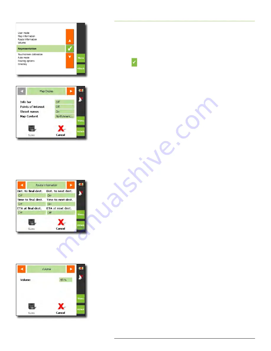
Map Display
You can modify the following map displays:
ü
Info bar
–
Bottom of the map displays the scale of the map,
inclination, the compass, and the altitude
ü
Points of Interest
–
Map shows POI using icons for major cat-
egories
ü
Street names (2D)
–
Street names on the map in 2D mode
ü
Tap the on/off field corresponding to each option to toggle
between on/off
ü
Map Content
–
Change the geographical area displayed on
the map Choices are US & Canada, Alaska,
Hawaii or Puerto Rico
Route Information
You can modify whether the following route information is dis-
played on the map by tapping the corresponding field to each op-
tion below Tapping the field toggles between off and on:
ü
Distance to final destination
ü
Time to final destination
ü
Estimated time of arrival at final destination
If you have indicated more than one destination to
navigate to, you can also modify:
ü
Distance to next destination
ü
Time to next destination
ü
Estimated time of arrival at next destination
For each of the above settings you can indicate to display
(On)
or not
(Off)
on map
Volume
Select a percentage value to modify volume For example, 10% is soft,
90% is loud These settings can also be controlled from the hardware
volume buttons on the right side of the GPS Navigator
Settings screen
Map Display screen
Route information screen
Volume screen


