GNSS Module Series
LG69T(AA,AD)_EVB_User_Guide 23 / 31
6.1.1.
QGNSS Interface Explanation
You can view GNSS information, such as C/N
0
message, time, position, speed, and precision in the
QGNSS interface. See the following table to find out more about these parameters.
Table 6: QGNSS Interface Explanation
Icon
Explanation
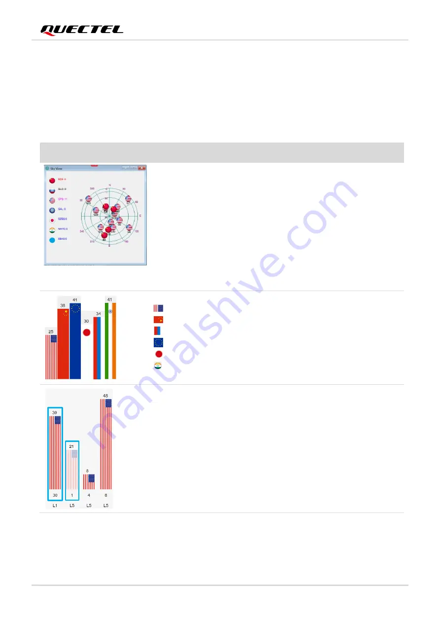
This sky view interface shows the position of the satellites in use.
1)
The left column icon shows the satellites in use and their number.
⚫
BDS: 4
⚫
GLO (GLONASS): 0
⚫
GPS: 11
⚫
GAL (Galileo): 0
⚫
QZSS: 0
⚫
NavIC (IRNSS)SBAS: 0
2)
The grid map on the right shows the position of the satellites in use.
GPS satellite
BDS satellite
GLONASS satellite
Galileo satellite
QZSS satellite
NavIC (IRNSS) satellite
⚫
PRN 30 C/N
0
is 39 dB-Hz.
⚫
Column in
bright red
means that the navigation data of the satellites
are in use.
⚫
PRN 1 C/N
0
is 21 dB-Hz.
⚫
Column in
light red
means that the navigation data of this satellites
are not in use.


