58
Field procedure
8.1 General scanning procedure
In general every scan always starts on the bottom right corner of your scan area. Starting from this
point, you should walk scan path by scan path, whereby every following path is situated on the left side
of its previous path. During walking these lines, the measurement values will be recorded and
depending on the selected operating mode either transferred directly to a computer or saved into the
memory of the device.
The device stops at the end of each finished scan line, so that the user can find the starting position of
the next line. In this way, all paths will be recorded and the area will be measured.
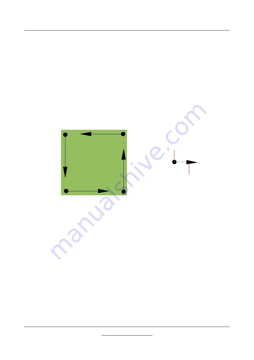
Figure 8.1 shows all 4 possible starting positions and the corresponding first scanning path. Depending
on the composition of your terrain you can determine the optimal starting point for your measurement
by yourself.
The scanning paths may be referred as "Zig-Zag" or "Parallel" traverses. Also the number of impulses
(measure points), which are recorded during one scanning path can be adjusted individually depending
on the size of your scan area (length of scanning path).
8.1.1 Scan Mode
There are two general techniques to surveying an area with the eXp 4000:
•
Zig-Zag
The starting position of two scanning paths next to each other is on the opposite side of the
measured area. You will record data on your scanning path and on the return path as well.
•
Parallel
The starting position of two scanning paths is always on the same side of the measured area. You
will only record data in one way and in one direction, while you should return and walk back to
the starting position of the next scanning path without recording data.
Figure 8.2 represents both techniques schematically.
OKM Ortungstechnik GmbH
Figure 8.1: Starting position of a scan area
1
2
3
4
Start of
1. scanning
path
End of
1. scanning
path


