background image

16 

GPSBIKE MANUAL EN

GPSBIKE MANUAL EN 

17

Bluetooth

®

 navigation system for motorcycles

Bluetooth

®

 navigation system for motorcycles

GPSBIKE

GPSBIKE

GPSBIKE

GPSBIKE

Customise NDrive 

Volume 

From the main menu select Configuration

 and then General. Use +/- to adjust the volume  according to 

your preference. You can also quickly adjust the volume from the Main  Map Screen: just click on the Lower 
Bar placed near the Menu button at the bottom of the screen and slide your finger across it.

Language 

From the main menu select Configuration

 and then

 click on Language and 

then select from the available options. To confirm, click on 

Save

.

Speed 

From the main menu select Configuration

 and then 

 . You can choose to display 

the speed in kilometre per hour (kph) or miles per hour (mph). To confirm your choice, select Save.

Keyboard type 

From the main menu select Configuration 

and then  

. Use the +/- keys to select 

the desired keyboard. To confirm your choice, select 

Save

.

Map appearance 

From the main menu select Configuration

 and then 

 . The following items are 

customisable:

• 

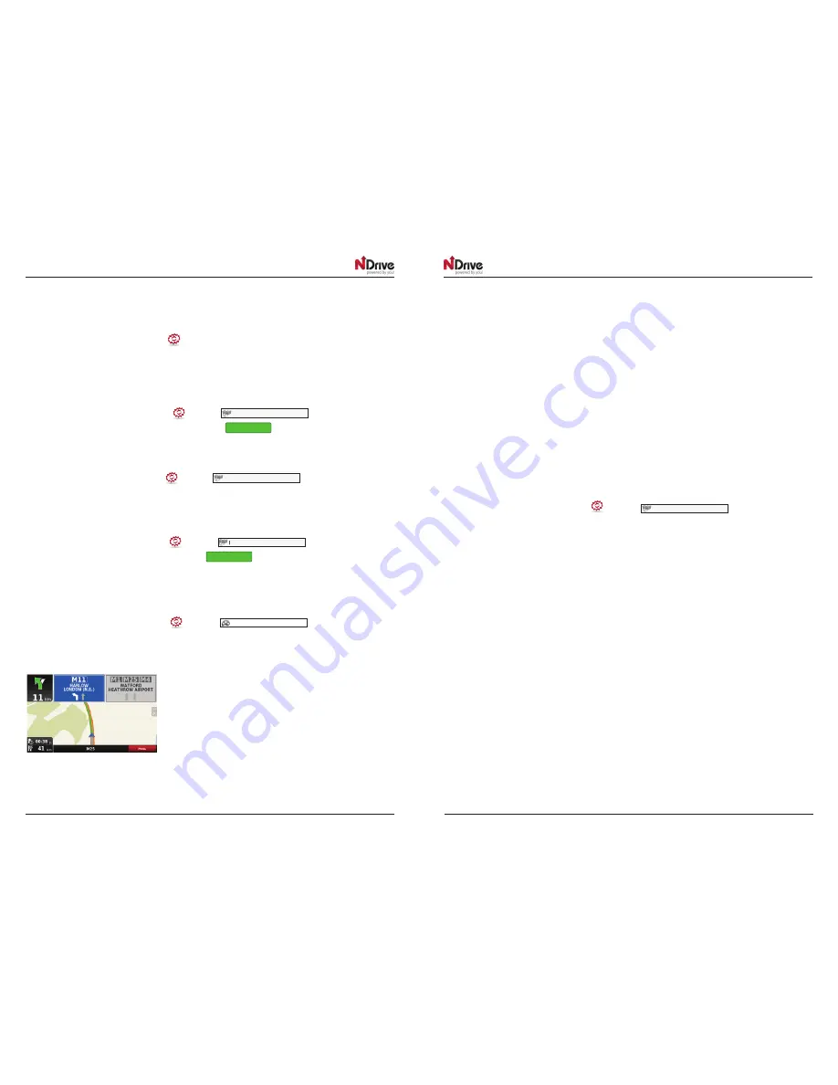
Lane assistance

Displays information about the lanes at junctions and turns. At intersections, it will display the signposts allowing 
you to pick the right lane. You may choose between the simplified and detailed view.

• 

North up in 2D

This option is only available in Pedestrian and Adventure modes. When enabled, the map will be displayed 
with North orientation and the locator will rotate according to your movements. When disabled, the locator 
will be pointing up and the map will rotate according to your movements. 

[This option is available in version 11.2]

• 

Templates

The map colour scheme can be customized according to the time of day, by choosing among the available 
templates. If you select “Enable auto toggle” the colour scheme will change automatically between day/
night mode, according to a specific schedule defined by the system.

 Points of Interest

From the POI categories list, select the ones you wish to be displayed on the map.

Navigation Options

From the main menu select Configuration 

 and then 

. You may select among 

the following routing options, which will influence the routing calculation:

•  

Fastest  –  calculates  the  fastest  route,  regardless  of  the  distance.  It  is  highly recommended that 
you select this option: The planned route will not only be the fastest, it will also be more economical 
and pleasant, since better and faster roads such as highways are given priority.

•  

Shortest – calculates the shortest route, regardless of the quality of the road. Attention: This route may 
take more time and some of the roads may be narrow or steep.

•  

Tolls – select “avoid” if you don’t want to use toll roads on your route or “yes” to allow NDrive to use 
tolls when calculating the route. Please note that even if you have selected the option ”avoid”, 
NDrive will consider toll roads, if that is the only option.

•  

Pedestrian Mode – NDrive will calculate your route using the shortest path available for walking 
or riding a bicycle; routing calculation will not consider traffic signs and routing is limited to 20 km 
distances.

•  

Adventure Mode – allows you to navigate to a location or coordinates off the beaten track; select 
this mode for outdoor use or travelling by sea or air. In this mode, the distance to your destination 
is calculated in a direct aerial line and a compass will be displayed to guide you towards your 
destination. 

 International settings

 International settings

 International settings

 International settings

 Map view

Summary of Contents for GPSBIKE

Page 1: ...GPSBIKE MANUAL EN 1 BLUETOOTH NAVIGATION SYSTEM FOR MOTORCYCLES GPSBIKE GPSBIKE USER GUIDE GPSBIKE GPSBIKE BLUETOOTH NAVIGATION SYSTEM FOR MOTORCYCLES ...

Page 2: ...f Interest POI 10 Navigate to a Postal code 11 Use coordinates to navigate to a location 11 Perform a Google search to navigate to a location 11 Navigate to a recent location 11 Save a favourite location 11 Navigate to a favourite location 12 Navigate Home 12 Set Home Location 12 Stop navigating in the current route 12 See an overview of my routes 12 See the list of all manoeuvres included in my r...

Page 3: ...nced settings 20 Get new maps voices or other features 20 Interacting with Social Media 21 Share favourites 21 Share an itinerary 21 Share my routes 22 Share my locations 22 Import a location published by a friend 22 Navigate to a Foursquare venue 23 Define check in options 23 Log out of Facebook Foursquare 23 Share my current location via SMS 23 E mail my current route 24 Local Offers 25 Take adv...

Page 4: ...ive modes estimated time left to destination speed limit on the current street current speed Estimated time of arrival Distance left to destination current time Context If you click on any point on the map the context bar shows up on the bottom and these four actions can be performed Basic operations Exploring menu screens All menu screens have two buttons on the top which allow you to do the foll...

Page 5: ...hould keep in mind When searching for a street you con simply write the initials separated by a space and results will show up For example enter C P W and Central Park West will show up on the results list Start writing the first letters and results will be automatically updated on the list below Performing a search When a search is being performed this type of screen allows you to enter search de...

Page 6: ...armacies or Events requires an internet connection for information update Alternatively simply click on a POI or any other point on the map and then click on the Navigate in the bottom bar See Main Map Screen section Navigate to a Postal code From the main menu select Go To and then Search locations Select Postal code and after selecting the country use the keyboard to filter your search After com...

Page 7: ... Change and then Delete Delete recent locations From the main menu select Go To and then Recent Locations Click Delete to clear all recent locations Use itineraries From the main menu select Go To and then Itineraries You can then create a new itinerary or select an itinerary from the list if you have already created any Create an itinerary To create an itinerary click Add New Itinerary Edit the n...

Page 8: ...lick Calculate Alternative an alternative route will be calculated according to the defined routing options If afterwards you prefer the first route click Calculate Original Avoid going through specific streets or roads From the main menu select My Routes and then Alternatives Click Avoid Part Of Route select the segments you wish and then click Avoid A new route will be calculated accordingly If ...

Page 9: ...scheme can be customized according to the time of day by choosing among the available templates If you select Enable auto toggle the colour scheme will change automatically between day night mode according to a specific schedule defined by the system Points of Interest From the POI categories list select the ones you wish to be displayed on the map Navigation Options From the main menu select Conf...

Page 10: ...ed format will define the input method on navigation by coordinates you can choose between the following formats DMS Degrees minutes and seconds DMM Degrees and minutes DDD Degrees and decimal degrees Import data to NDrive First you will have to connect the device to your computer Windows Mac using a USB cable or use a memory card reader Copy the kml files from your source to the corresponding NDr...

Page 11: ...s located You can skip this step if the state is correct This button is only enabled for countries that are divided into states such as the USA Type the name of your destination city here If your city name already appears you may skip this button and go directly to Street Type your destination street here You can also select City Centre if you don t know the name of the street or if you want to to...

Page 12: ... selected and a route has been calculated It will allow you to consult additional information about your route Displays your route from the current position to your destination on the map Displays a list of all the manoeuvres from your current position to your destination You may click on one of them to see it on the map Stops the current turn by turn voice guidance Configure route calculation opt...

Page 13: ...ght on the F5 control module The blue light must be steady because in this mode F5 can also have intercom functionality Pairing with Interphone F4 F3 F2 once you ve selected the device insert the code 0000 the number zero four times press the arrow in the upper right and wait for the red dot to disappear from the connection symbol Correct pairing is indicated by the blue light on the F4 F3 F2 cont...

Page 14: ...ns or changes not expressly approved by Cellular Italia S p A will cancel the user s authori sation to use the device Bluetooth is a trademark owned by Bluetooth SIG Inc For further information visit the website http www cellularline com This product has a battery than cannot be replaced by the user Do not attempt to open the device to remove the battery as this could cause malfunctions and seriou...

Reviews: