


UNCLASSIFIED
Code:
Date:
Issue:
Revision:
Page:
GMV-magicGNSS-MAN-0002
05 July 2018
1
2
23 of 44
magicGNSSUT
GMV 2018; all rights reserved
UNCLASSIFIED
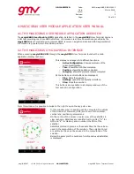
magicGNSS User Terminal Manual
The protections level frame presents the
horizontal and vertical protection levels
calculated for a given Target Integrity Risk
(TIR), in the example 0.05.
Target Integrity Risk value can be configured in
the settings tab by the user previous to the
execution start. Note that different applications
may require different TIR, so a TIR of 0.05 is
noticeably less restrictive than a TIR of 0.001.
The refresh button
allows the user to delete
all previous positions/PLs and consider
subsequent positions/PLs only for being plotted.
This action cannot be undone, in the sense that
once the refresh button has been touched,
deleted position/PL cannot be recovered for
being plotted. However, they are still available
in the output position files.
Satellite Status
Satellite status view provides the real time status of the PPP
processing in a per satellite basis. In this sense the view
presents a grid with all the satellites in operation per
constellation, and highlights the satellites with different
colours depending on the status at the last processed epoch.
The legend distinguishes between four different status:
No observation: Typically this happens when the
satellite is not in view or the signal status flag is not
healthy. This satellite is not used in the PPP
computation.
Observation available: Observations for the satellite
are received, but no valid navigation data is available,
hence the satellite cannot be used in the PPP
processing.
Observation and Navigation available: Observations
and valid navigation is available for the satellite,
nevertheless there is not corrections to augment the
orbit and clock. In this conditions the satellite is not
used in the PPP processing.
Observation, navigation and corrections available: all
the required information to use the satellite in the PPP
processing is avaiable.
Recorded Sessions
The recorded session view allows the user to see the list of recorded sessions during the PPP processing.
Sessions information can be extracted, edited and removed.
The extraction of the session information is done in KML format compatible with mapping applications
like Google Earth. The KML includes all the epochs and positions estimates associated to the timestamp
as well as the land markers introduced by the user. The KML is exported to the user terminal storage