background image

nüvi 30/40/50 Owner’s Manual 

13

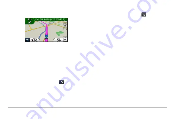
An icon displaying the current speed limit may 

appear as you travel on major roadways. 

Taking a Detour

While navigating a route, you can use detours to 

avoid obstacles ahead of you, such as construction 

zones.

NOTE

: If the route you are currently taking is the only 

reasonable option, the device might not calculate a 

detour.

While navigating a route, select   to return to 

the main menu.

Select 

Detour

Stopping the Route

While navigating a route, select   > 

Stop

.

Navigating Off Road

You can create straight-line routes that do not follow 

roadways. 

Select 

Settings

 > 

Navigation

.

Select 

Route Preference

 > 

Off Road

 > 

OK

The route will be calculated as a straight line to 

the location.

Changing the Map Data Field

From the map, select a data field.

Select a type of data to display.

Select 

OK

.

Summary of Contents for nuvi 30

Page 1: ...n vi 30 40 50 owner s manual August 2011 190 01336 00_0A Printed in Taiwan...

Page 2: ...sion hereto is strictly prohibited Information in this document is subject to change without notice Garmin reserves the right to change or improve its products and to make changes in the content witho...

Page 3: ...s 16 About Memory Cards 17 Transferring Files from Your Computer 17 Deleting Files 18 Customizing the Device 18 System Settings 18 Navigation Settings 19 Display Settings 19 Time Settings 19 Language...

Page 4: ......

Page 5: ...attery To prevent the possibility of personal injury or product damage caused by battery exposure to extreme heat remove the device from the vehicle when exiting or store it out of direct sunlight Not...

Page 6: ...w of the sky to acquire satellite signals When the bars are green the device has acquired satellite signals About myDashboard Use myDashboard to register your device check for software and map updates...

Page 7: ...within 90 days of acquiring satellites while driving your device could be eligible for one free map update Go to www garmin com numaps for terms and conditions Updating Maps 1 Open myDashboard page 2...

Page 8: ...2 Select or Adjusting the Volume 1 Select Volume 2 Select an option Select or Select the Mute check box Status Bar Icons The status bar is located at the top of the main menu The status bar icons dis...

Page 9: ...to enter a letter or number Select to add a space Select to change the character case Select and to move the cursor Select to delete a character Select and hold to erase the entire entry Select Mode...

Page 10: ...you can search within some categories 1 Select Where To Points of Interest 2 Select a category 3 If necessary select a subcategory 4 Select Spell 5 Enter all or part of the name 6 Select Done Searchin...

Page 11: ...Select the information balloon 3 Select Delete and select Yes Editing Your Home Location Information 1 Select Where To Favorites Home 2 Select the information balloon 3 Select Edit 4 Enter your change...

Page 12: ...r the address number and select Done 5 Enter the street name and select Done 6 If necessary select the street 7 If necessary select the address Finding a Location by Browsing the Map 1 Select Where To...

Page 13: ...de coordinate 4 Enter the new coordinate and select Done 5 Select the longitude coordinate 6 Enter the new coordinate and select Done 7 Select Next 8 Select Go Using the Location Map The location map...

Page 14: ...menu select Where To Browse Map 4 Select an area on the map An information balloon appears for the location 5 Select Set Location Favorites You can save locations in your Favorites so you can quickly...

Page 15: ...Select Change Phone Number To assign categories to the Favorite select Change Categories To change the symbol used to mark the Favorite on a map select Change Map Symbol 7 Edit the information 8 Selec...

Page 16: ...s responsibility to abide by all posted speed limit signs and to use safe driving judgment at all times Garmin will not be responsible for any traffic fines or citations that you may receive for fail...

Page 17: ...option the device might not calculate a detour 1 While navigating a route select to return to the main menu 2 Select Detour Stopping the Route While navigating a route select Stop Navigating Off Road...

Page 18: ...el to view the nearest locations in that category Map Pages Viewing Trip Information The trip information page displays your present speed and provides statistics about your trip TIP If you make frequ...

Page 19: ...ge of the junction appears for junctions on major roadways Viewing the Entire Route on the Map 1 While navigating an automobile route select the navigation bar at the top of the map 2 Select Show Map...

Page 20: ...m the map select to view the junction if available Data Management You can store files such as JPEG image files on your device The device has a memory card slot for additional data storage NOTE The de...

Page 21: ...1 Connect the device to your computer page 2 Your device and memory card appear as removable drives in My Computer in Windows and as mounted volumes on Mac computers NOTE Some computers with multiple...

Page 22: ...stomizing the Device 1 Select Settings 2 Select a setting category 3 Select the setting to change it System Settings Select Settings System GPS Simulator stops the device from receiving a GPS signal a...

Page 23: ...rise time and the sunset time for your current location Auto Screenshot allows you to take a picture of the device screen Screenshots are saved in the Screenshot folder of the device storage Brightnes...

Page 24: ...rth Up displays the map in 2D with North at the top 3D displays the map in three dimensions 3D in Track Up Vehicle select Change to change the icon used to display your position on the map Download ad...

Page 25: ...this device to malfunction Do not store the device where prolonged exposure to extreme temperatures can occur because it can cause permanent damage Never use a hard or sharp object to operate the tou...

Page 26: ...our device at http my garmin com Erasing User Data 1 Turn the device on 2 Hold your finger on the lower right corner of the device screen 3 Keep your finger pressed until the pop up window appears 4 S...

Page 27: ...end piece 2 Remove the end piece the metal tip and the fuse glass and metal cylinder 3 Install a 1 A fast blow fuse 4 Place the metal tip in the end piece 5 Screw the end piece back into the vehicle...

Page 28: ...or these locations the n vi includes the locations of hundreds of safety cameras Your n vi alerts you when you are approaching a safety camera and can warn you if you are driving too fast The data is...

Page 29: ...erify the vehicle is turned on and is supplying power to the power outlet Your device can only charge between 32 F and 113 F between 0 C and 45 C If the device is placed in direct sunlight or in a hot...

Page 30: ...er and into your device The device automatically turns on and goes into USB mass storage mode 4 Verify your device is connected to a USB port and not a USB hub I cannot see any new removable drives in...

Page 31: ......

Page 32: ...eet Olathe Kansas 66062 USA Garmin Europe Ltd Liberty House Hounsdown Business Park Southampton Hampshire SO40 9LR UK Garmin Corporation No 68 Zhangshu 2nd Road Xizhi Dist New Taipei City 221 Taiwan R...

Reviews: