


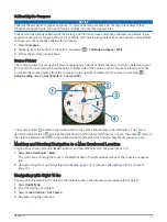


Increasing the Accuracy of a Waypoint Location
You can refine a waypoint location for more accuracy. When averaging, the device takes several readings at the
same location and uses the average value to provide more accuracy.
1 Select Waypoint Manager.
2 Select a waypoint.
3 Select
> Average Location.
4 Move to the waypoint location.
5 Select Start.
6 Follow the on-screen instructions.
7 When the confidence status bar reaches 100%, select Save.
For best results, collect 4 to 8 samples for the waypoint, waiting at least 90 minutes between samples.
Projecting a Waypoint
You can create a new location by projecting the distance and bearing from a marked location to a new location.
1 Select Waypoint Manager.
2 Select a waypoint.
3 Select
> Project Waypoint.
4 Enter the bearing, and select
.
5 Select a unit of measure.
6 Enter the distance, and select
.
7 Select Save.
Routes
A route is a sequence of waypoints or locations that leads you to your final destination.
Creating a Route
1 Select Route Planner > Create Route > Select First Point.
2 Select a category.
3 Select the first point in the route.
4 Select Use.
5 Select Select Next Point to add additional points to the route.
6 Select to save the route.
Editing the Name of a Route
1 Select Route Planner.
2 Select a route.
3 Select Change Name.
4 Enter the new name.
Routes
7
Summary of Contents for eTrex Touch 25
Page 1: ...eTrex Touch 25 35 Owner s Manual ...
Page 6: ......
Page 41: ......
Page 42: ...support garmin com GUID C293BF8A 157E 4E04 B49B 1348E15C7788 v5 July 2021 ...


