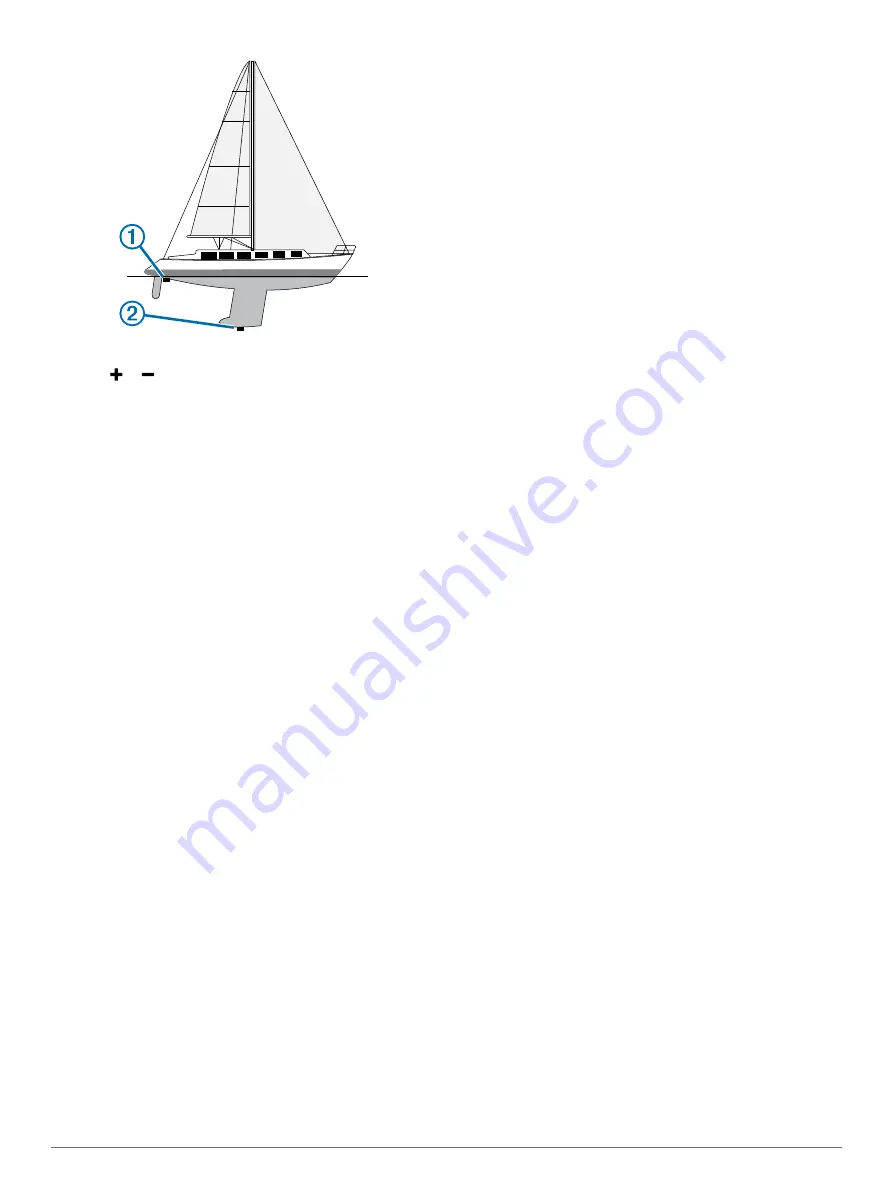
2
Select
Settings
>
My Vessel
>
Keel Offset
.
3
Select or based on the location of the transducer.
4
Enter the distance measured in step 1.
Setting the Water Temperature Offset
Before you can set the water temperature offset, you must have
a NMEA 0183 water-temperature sensor or a temperature-
capable transducer to measure water temperature.
The temperature offset compensates for the temperature
reading from a temperature sensor.
1
Measure the water temperature using the temperature sensor
or temperature-capable transducer that is connected to the
chartplotter.
2
Measure the water temperature using a different temperature
sensor or a thermometer that is known to be accurate.
3
Subtract the water temperature measured in step 1 from the
water temperature measured in step 2.
This is the temperature offset. Enter this value in step 5 as a
positive number if the sensor connected to the chartplotter
measures the water temperature as being colder than it
actually is. Enter this value in step 5 as a negative number if
the sensor connected to the chartplotter measures the water
temperature as being warmer than it actually is.
4
Select
Settings
>
My Vessel
>
Temp. Offset
.
5
Enter the temperature offset calculated in step 3.
Communications Settings
NOTE:
Some settings and options require additional charts or
hardware.
Select
Settings
>
Communications
.
Serial Port
: Sets the input/output format for the serial port to
use when connecting the chartplotter to external NMEA
devices, computers, or other Garmin devices.
NMEA 0183 Setup
: Sets the NMEA 0183 sentences the
chartplotter transmits, how many digits to the right of the
decimal point are transmitted in a NMEA output, and how
NMEA 0183
The chartplotters support the NMEA 0183 standard, which is
used to connect various NMEA 0183 devices, such as VHF
radios, NMEA instruments, autopilots, wind sensors, and
heading sensors.
To connect the chartplotter to optional NMEA 0183 devices, see
the chartplotter installation instructions.
The approved NMEA 0183 sentences for the chartplotter are
GPAPB, GPBOD, GPBWC, GPGGA, GPGLL, GPGSA, GPGSV,
GPRMB, GPRMC, GPRTE, GPVTG, GPWPL, GPXTE, and
Garmin proprietary sentences PGRME, PGRMM, and PGRMZ.
This chartplotter also includes support for the WPL sentence,
DSC, and sonar NMEA 0183 input with support for the DPT
(depth) or DBT, MTW (water temperature), and VHW (water
temperature, speed, and heading) sentences.
NMEA 0183 Settings
Select
Settings
>
Communications
>
NMEA 0183 Setup
.
Sounder
: Enables NMEA 0183 output sentences for the
sounder (if applicable).
Route
: Enables NMEA 0183 output sentences for routes.
System
: Enables NMEA 0183 output sentences for system
information.
Garmin
: Enables NMEA 0183 output sentences for Garmin
proprietary sentences.
Posn Precision
: Adjusts the number of digits to the right of the
decimal point for transmission of NMEA output.
Waypoint IDs
: Sets the device to transmit waypoint names or
numbers via NMEA 0183 while navigating. Using numbers
may resolve compatibility issues with older NMEA 0183
autopilots.
Diagnostics
: Displays NMEA 0183 diagnostic information.
Defaults
: Restores the NMEA 0183 settings to the original
factory defaults.
Setting Alarms
Navigation Alarms
Select
Settings
>
Alarms
>
Navigation
.
Arrival
: Sets an alarm to sound when you are within a specified
distance or time from a turn or a destination.
Anchor Drag
: Sets an alarm to sound when you exceed a
specified drift distance while anchored.
Off Course
: Sets an alarm to sound when you are off course by
a specified distance.
System Alarms
Alarm Clock
: Sets an alarm clock.
Device Voltage
: Sets an alarm to sound when the battery
reaches a specified low voltage.
GPS Accuracy
: Sets an alarm to sound when the GPS location
accuracy falls outside the user-defined value.
Units Settings
Select
Settings
>
Units
.
System Units
: Sets the unit format for the device.
Variance
: Sets the magnetic declination, the angle between
magnetic north and true north, for your present location.
Heading
: Sets the direction references used in calculating
heading information. True sets geographic north as the north
reference. Grid sets grid north as the north reference (000º).
Magnetic sets the magnetic north as the north reference.
Position Format
: Sets the position format in which a given
location reading appears. Do not change this setting unless
you are using a map or chart that specifies a different
position format.
Map Datum
: Sets the coordinate system on which the map is
structured. Do not change this setting unless you are using a
map or chart that specifies a different map datum.
Pressure Ref. Time
: Sets the reference time used to calculate
the barometer trend. The trend is indicated in the barometer
field.
Time Format
: Sets a 12-hour, 24-hour, or UTC time format.
20
Device Configuration


