background image

• Select 

Optimize Order

 to arrange the stops on your trip 

in the most-efficient order.

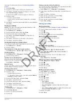
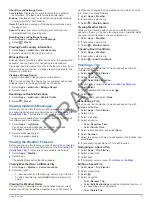
Viewing Previous Routes and Destinations

Before you can use this feature, you must enable the travel 

history feature (

Device and Privacy Settings

).

You can view your previous routes and places you have 

stopped on the map.

Select 

Apps

 > 

Where I've Been

.

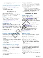
Data Management

You can store files on your device. The device has a memory 

card slot for additional data storage.

NOTE: 

The device is not compatible with Windows® 95, 98, 

Me, Windows NT®, and Mac® OS 10.3 and earlier.

File Types

The device supports these file types.
• Maps and GPX waypoint files from myGarmin™ mapping 

software, including MapSource®, BaseCamp™, and 

HomePort™ (

Custom Points of Interest

).

• GPI custom POI files from Garmin POI Loader (

Installing POI 

Loader Software

).

About Memory Cards

You can purchase memory cards from an electronics supplier, 

or purchase pre-loaded Garmin mapping software 

(

www.garmin.com/trip_planning

). In addition to map and data 

storage, the memory card can be used to store files such as 

maps, images, geocaches, routes, waypoints, and custom 

POIs.

Installing a Memory Card

The device supports microSD™ and microSDHC memory cards.

1

Insert a memory card into the slot on the device.

2

Press it in until it clicks.

Connecting the Device to Your Computer

You can connect the device to your computer using the USB 

cable included with your device.

1

Plug the small end of the USB cable into the port on the 

device.

2

Plug the larger end of the USB cable into a port on your 

computer.
A picture of your device connected to a computer appears on 

the device screen.
Depending on your computer operating system, the device 

appears as either a portable device, a removable drive, or a 

removable volume.

Transferring Data From Your Computer

1

Connect the device to your computer (

Connecting the Device 

to Your Computer

).

Depending on your computer operating system, the device 

appears as either a portable device, a removable drive, or a 

removable volume.

2

On your computer, open the file browser.

3

Select a file.

4

Select 

Edit

 > 

Copy

.

5

Browse to a folder on the device.

NOTE: 

For a removable drive or volume, you should not 

place files in the Garmin folder.

6

Select 

Edit

 > 

Paste

.

Disconnecting the USB Cable

If your device is connected to your computer as a removable 

drive or volume, you must safely disconnect your device from 

your computer to avoid data loss. If your device is connected to 

your Windows computer as a portable device, it is not 

necessary to safely disconnect.

1

Complete an action:
• For Windows computers, select the 

Safely Remove 

Hardware

 icon in the system tray, and select your device.

• For Mac computers, drag the volume icon to the trash.

2

Disconnect the cable from your computer.

Customizing the Device

Map and Vehicle Settings

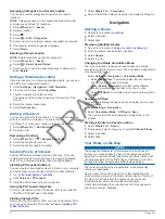
To open the Map and Vehicle settings, from the main menu, 

select 

Settings

 > 

Map & Vehicle

.

Vehicle

: Changes the icon to represent your position on the 

map. Go to 

www.garmingarage.com

 for more icons.

Driving Map View

: Sets the perspective on the map.

Map Detail

: Sets the level of detail on the map. More detail may 

cause the map to draw slower.

Map Theme

: Changes the color of the map data.

Map Tools

: Selects the shortcuts that appear in the map tools 

menu.

Map Layers

: Sets the data that appears on the map page 

(

Customizing the Map Layers

).

myMaps

: Sets which installed maps the device uses.

Enabling Maps

You can enable map products installed on your device.

TIP: 

To purchase additional map products, go to 

www.garmin.com/us/maps

.

1

Select 

Settings

 > 

Map & Vehicle

 > 

myMaps

.

2

Select a map.

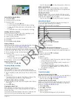
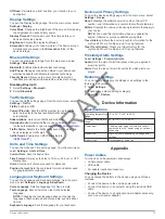
Navigation Settings

To open the Navigation settings page, from the main menu, 

select 

Settings

 > 

Navigation

.

Calculation Mode

: Sets route preference.

Avoidances

: Sets road features to avoid on a route.

Custom Avoidances

: Allows you to avoid specific roads or 

areas.

Advanced Detours

: Sets the length of the detour.

Safe Mode

: Disables all functions that require significant 

operator attention and could become a distraction while 

driving.

GPS Simulator

: Stops the device from receiving a GPS signal, 

and saves battery power.

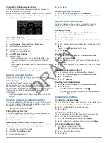
Route Preferences

To open the Calculation Mode settings page, from the main 

menu, select 

Settings

 > 

Navigation

 > 

Calculation Mode

.

The route calculation is based on road speeds and vehicle 

acceleration data for a given route.

Faster Time

: Calculates routes that are faster to drive but can 

be longer in distance.

Shorter Distance

: Calculates routes that are shorter in distance 

but can take more time to drive.

Less Fuel

: Calculates routes that could use less fuel than other 

routes.

12

Data Management

DRAFT

Summary of Contents for A4BVGB01 Series

Page 1: ...A4BVGB01 A4BVGB02 Series Owner s Manual July 2014 Printed in the USA 190 01579 00_0C D R A F T ...

Page 2: ...thout the express permission of Garmin BaseCamp HomePort MapSource myGarmin ecoRoute myTrends trafficTrends nüMaps Guarantee and nüMaps Lifetime are trademarks of Garmin Ltd or its subsidiaries These trademarks may not be used without the express permission of Garmin The Bluetooth word mark and logos are owned by the Bluetooth SIG Inc and any use of such name by Garmin is under license microSD and...

Page 3: ...g Trip Data from the Map 5 Viewing the Trip Information Page 6 Viewing the Trip Log 6 Resetting Trip Information 6 Using Suggested Routes 6 Viewing Current Location Information 6 Finding Nearby Services 6 Getting Directions to Your Current Location 6 Avoiding Road Features 6 About Custom Avoidances 6 Avoiding an Area 6 Avoiding a Road 6 Disabling a Custom Avoidance 6 Deleting Custom Avoidances 6 C...

Page 4: ... Bluetooth 13 Traffic Settings 13 Units and Time Settings 13 Language and Keyboard Settings 13 Device and Privacy Settings 13 Proximity Alerts Settings 13 Restoring Settings 13 Device Information 13 Specifications 13 Appendix 13 Power Cables 13 Charging the Device 13 Changing the Fuse in the Vehicle Power Cable 14 About Device Care 14 Cleaning the Outer Casing 14 Cleaning the Touchscreen 14 Avoidi...

Page 5: ...ime subscription which provides quarterly map updates for the useful life of your device For terms and conditions go to www garmin com us maps numaps _ lifetime LMT This model includes a nüMaps Lifetime subscription lifetime traffic subscription and a traffic receiver Activating Lifetime Maps 1 Go to www garmin com express 2 Follow the on screen instructions NOTE If you register the device you can...

Page 6: ...he detailed maps loaded in your device contain locations such as restaurants hotels auto services and detailed street information You can use categories to browse for nearby businesses and attractions You can also search for addresses coordinates cities and intersections Finding Locations Finding a Location by Category 1 Select Where To 2 Select a category or select Categories 3 If necessary selec...

Page 7: ... first street name and select Next 4 If necessary select the street 5 Enter the second street name and select Next 6 If necessary select the street 7 If necessary select the intersection Finding a City 1 Select Where To Categories Cities 2 Select Enter Search 3 Enter a city name and select 4 Select a city Finding a Location Using Coordinates You can find a location using latitude and longitude coo...

Page 8: ...ore you can find custom POIs you must load custom POIs on your device using the POI Loader software Installing POI Loader Software 1 Select Where To Categories 2 Scroll to the Other Categories section and select a category Navigation Starting a Route 1 Search for a location Locations 2 Select a location 3 Select Go Previewing Multiple Routes 1 Search for a location Finding a Location by Category 2...

Page 9: ...to the turn or maneuver and the lane in which you should be traveling if available From the map select to view the next turn on the map Active Lane Guidance As you approach a turn while navigating a route a detailed simulation of the road appears beside the map A magenta line appears on the proper lane for the turn Viewing Junctions While navigating a route you can view the junctions on major road...

Page 10: ... another person how to get to your current location your device can give you a list of directions 1 From the map select the vehicle 2 Select Directions to Me 3 Select a starting location 4 Select Select Avoiding Road Features 1 Select Settings Navigation Avoidances 2 Select the road features to avoid on your routes and select Save About Custom Avoidances Custom avoidances allow you to avoid specif...

Page 11: ...evice If your device model does not include traffic you must purchase a Garmin traffic receiver accessory Go to www garmin com traffic for more information Your device can receive traffic signals from a station broadcasting traffic data NOTE In some areas traffic information may be received from FM radio stations using HD Radio technology 1 Connect the traffic compatible power cable to an external...

Page 12: ...nd regions and may not be available on all models NOTE Voice Activated Navigation may not achieve desired performance when in a noisy environment Voice command allows you to use your device by saying words and commands The voice command menu provides voice prompts and a list of available commands Setting the Wakeup Phrase The wakeup phrase is a word or phrase you can say to activate voice command ...

Page 13: ... loaded from your phone to the device each time your phone and the device connect It may take a few minutes for the phone book to be available Some phones do not support this feature 1 Select Apps Phone Phone Book 2 Select a contact 3 Select Call Calling a Location 1 Select Apps Phone Browse Categories 2 Select a point of interest 3 Select Call Receiving a Call When you receive a call select Answe...

Page 14: ...Garmin Live Services display the Smartphone Link symbol and appear only when the device is connected to Smartphone Link Subscribing to Garmin Live Services Before you can subscribe to Garmin Live Services you must install the Smartphone Link app on your phone 1 Start the Smartphone Link app on your phone Connecting to Smartphone Link 2 Select Garmin Live Services A list of services and subscriptio...

Page 15: ...ther 2 Select a day The detailed forecast for that day appears Viewing Weather Near a Different City 1 Select Apps Weather Current Location 2 Select an option To view weather for a favorite city select a city in the list To add a favorite city select Add City and enter a city name Viewing the Weather Radar You can view an animated color coded radar map of current weather conditions as well as a we...

Page 16: ...n folder 6 Select Edit Paste Disconnecting the USB Cable If your device is connected to your computer as a removable drive or volume you must safely disconnect your device from your computer to avoid data loss If your device is connected to your Windows computer as a portable device it is not necessary to safely disconnect 1 Complete an action For Windows computers select the Safely Remove Hardwar...

Page 17: ...ge and Keyboard settings from the main menu select Settings Language Keyboard Voice Language Sets the language for voice prompts Text Language Sets all on screen text to the selected language NOTE Changing the text language does not change the language of user entered data or map data such as street names Keyboard Language Sets the language for your keyboard Device and Privacy Settings To open the...

Page 18: ...unt your device to the dashboard and comply with certain state regulations See www garmin com for more information 1 Clean and dry the dashboard where you are placing the disk 2 Remove the backing from the adhesive on the bottom of the disk 3 Place the disk on the dashboard 4 Remove the clear plastic cover from the top of the disk 5 Place the suction cup mount on top of the disk 6 Flip the lever d...

Page 19: ...ppear as a portable device on my computer On Mac computers and some Windows computers the device connects using USB mass storage mode In USB mass storage mode the device appears as a removable drive or volume and not as a portable device Windows versions prior to Windows XP Service Pack 3 use USB mass storage mode My device does not appear as either a portable device or a removable drive or volume...

Page 20: ...so ecoRoute fuel price changing 10 fuse changing 14 G Garmin Express 1 registering the device 1 updating software 1 Garmin Live Services 10 subscribing to 10 geocaching 3 going home 3 GPS 1 2 H hands free phone calls 8 help 9 See also product support home calling 9 editing location 3 going 3 phone number 9 setting locations 3 I ID number 13 intersections finding 3 J junction view 5 K keyboard 2 la...

Page 21: ... 5 subscriptions Garmin Live Services 10 nüMaps Lifetime 1 traffic 1 suction cup 14 T theft avoiding 14 time settings 2 13 traffic 7 8 13 activating a subscription 8 adding subscriptions 8 alternate route 7 cameras 7 8 incidents 7 lifetime subscriptions 1 map 7 receiver 7 searching for delays 7 trafficTrends 8 traffic cameras 7 saving 7 viewing 8 trafficTrends 8 disabling 8 travel history 13 trip ...

Page 22: ...1 55 69 33 99 39 02 36 699699 52 001 855 792 7671 0800 0233937 47 815 69 555 00800 4412 454 44 2380 662 915 35 1214 447 460 386 4 27 92 500 0861 GARMIN 427 646 27 0 11 251 9999 34 93 275 44 97 46 7744 52020 886 2 2642 9199 ext 2 0808 238 0000 44 0 870 8501242 49 0 180 6 427646 20 ct Anruf a d deutschen Festnetz Mobilfunk max 60 ct Anruf 913 397 8200 1 800 800 1020 D R A F T ...

Reviews: