


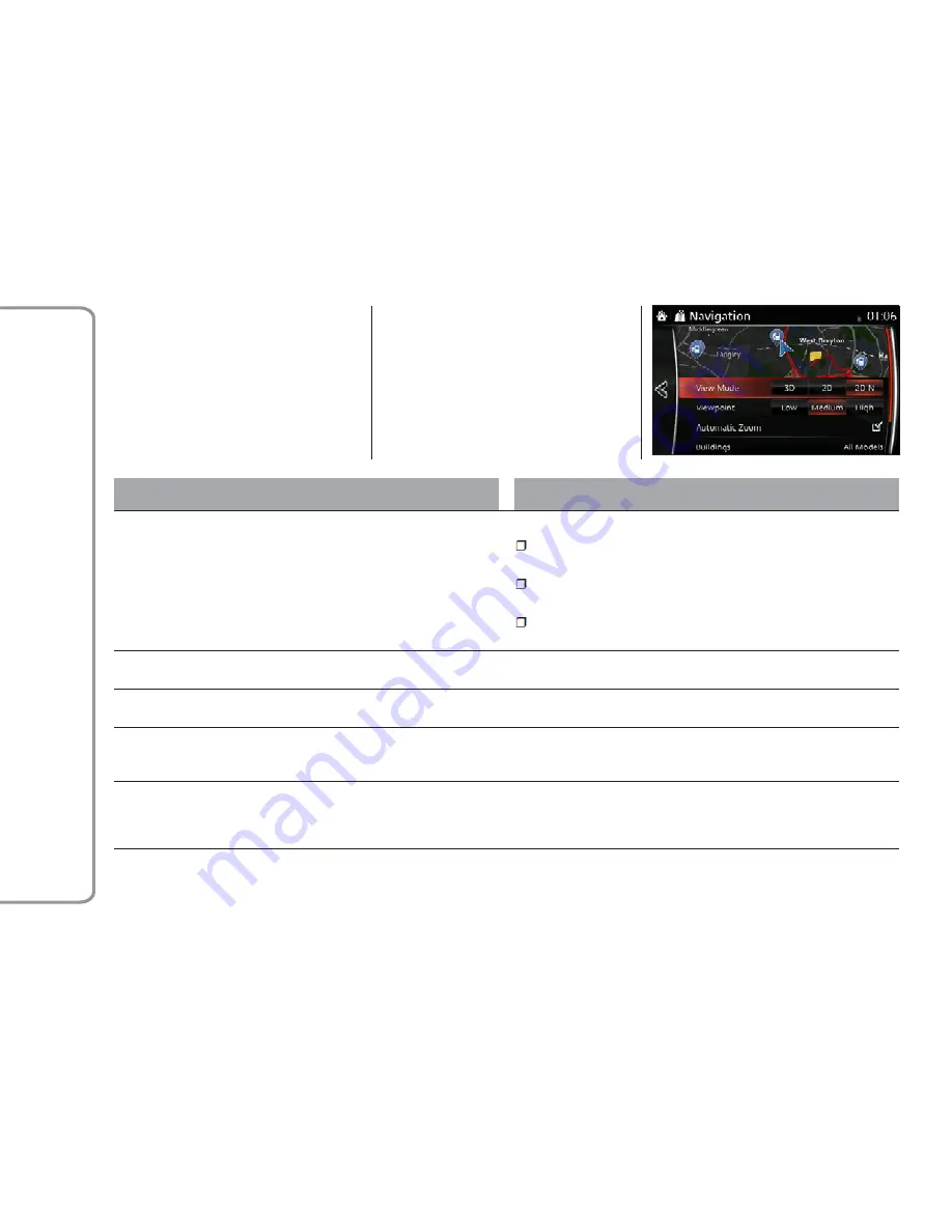
Map Settings
You can fine-tune the appearance of
the Map screen, adjust the map view to
your needs, show or suppress 3D
buildings, and manage Place visibility
settings (which Places to show on
the map).
The map is always shown on the
screen so that you can see the effect
when you change a setting. Scroll
the screen downward to display the
setting behind the lower part of the
screen.
Button
Descriptions
View Mode
When this button is selected, the map view mode can be changed:
3D:
Displays things such as actual construction sites three
dimensionally on the map
2D:
The map is rotated so that the direction of travel is displayed in
the upward direction
2D N:
The map is displayed so that north is up regardless of the
direction of travel
Viewpoint
Adjust the basic zoom and tilt levels to your needs. Three levels are
available.
Automatic Zoom
During route guidance in any map view mode, the function for
zooming in on approaching intersections turns on/off automatically.
Buildings
Show or hide 3D town models, 3D artistic or block representation of
all town building data containing actual building sizes and positions on
the map.
Expressway Overview
When enabled, the map zooms out to show an overview of the
surrounding area if the next route event (maneuver) is far away. The
system goes back to the normal map view when you approach the
next event.
GUID-420002-high.tif
96
FIAT
Connect
7.0


