For reference
167
Fo
r
re
fe
rence
3. Glossary
In order to use this device effectively, please keep the following definitions in mind.
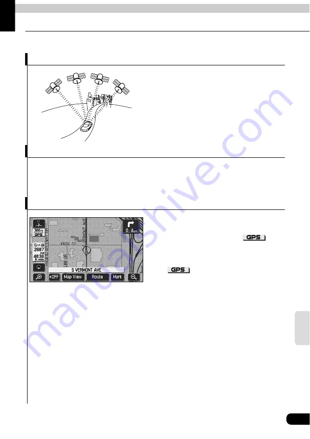
GPS (Global Positioning System)
The GPS is a system that uses signals received
from a satellite in a maximum orbit of
approximately 21,000 km above the earth to
indicate your present position (latitude,
longitude, altitude).
These satellites were launched into space by the
U.S. Department of Defense to be used for
military purposes. This system was released for
public utility.
Independent navigation
This technology uses data from a vehicle speed sensor and vibration gyro sensor to track the
path followed by your vehicle in order to pinpoint your present location.
The present location of your vehicle can be pinpointed even in tunnels and under elevated
roads.
Positioning
Signals are received from 3 or more GPS
satellites to pinpoint the present location of your
vehicle. The device will display a
mark
on the upper left part of the present location
screen when it is receiving signals from 3 or more
satellites and positioning is rendered possible.
(The
mark is not displayed on the
setting or registration screens.)
Summary of Contents for AVN6610
Page 9: ...9...
Page 15: ...15 Introduction...
Page 19: ...19 Introduction...
Page 133: ...133 RTTI Real Time Traffic Information...
Page 141: ...141 Optional function...
Page 153: ...153 Helpful tips...
Page 173: ...173 For reference...


