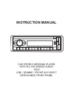
Cobra 8500 PRO HD, User Manual
The Cobra 8500 PRO HD is a state-of-the-art GPS navigation system designed for drivers who demand premium features. Ensure that you get the most out of your device by downloading the free user manual from manualshive.com. This manual provides detailed instructions on how to maximize the capabilities of your device.
Share
Download


Reviews:
No comments
Related manuals for 8500 PRO HD
MCD065
Brand: Caliber Pages: 8

DTS 2008
Brand: Cadillac Pages: 92

Star Celeste S140
Brand: Tyco Fire Product Pages: 4

F1FR40
Brand: Reliable Pages: 4

CAR689
Brand: Jensen Pages: 36

HITCH-35
Brand: Farenheit Pages: 4

CAW-1200-01
Brand: Kenwood Pages: 2

KDC-C471FM
Brand: Kenwood Pages: 27

KDC-C521FM - CD Changer With RF Modulator
Brand: Kenwood Pages: 36
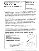
CA-DS100
Brand: Kenwood Pages: 2

467FM
Brand: Kenwood Pages: 21

CX-401W
Brand: Kenwood Pages: 23

GX806EF2
Brand: Kenwood Pages: 26

KDC-BT92SD
Brand: Kenwood Pages: 41

KDC-C467FM
Brand: Kenwood Pages: 26

KDC-C517FM
Brand: Kenwood Pages: 28

08AO6-4E2-200
Brand: Kenwood Pages: 16

KDC-C467
Brand: Kenwood Pages: 28


