

Deploy the Transducer
When used in conjunction with the retractable pivoting transducer arm
and rubber stopper, the transducer will automatically level itself in your ice
hole. To begin operation, take the transducer out of the recessed holder,
and rotate the adjustable ice arm out from inside the shuttle. Extend the
transducer arm, (the cable should already be threaded through it with
stopper in place) and deploy the transducer into the water.
Insert Map Chip & Power up the system
(map chip sold separately)
Using the MX-7gps can be as simple as installing a Navionics© Map Chip
(sold separately)
and pushing the Power Button—the factory settings will
allow you to use the MX-7gps in the most popular configuration. Hit the
Menu Key to explore all the options to customize your Display. With five
different sonar portals, four different color palettes, two cone angles, and
GPS Mapping, there are many possibilities.
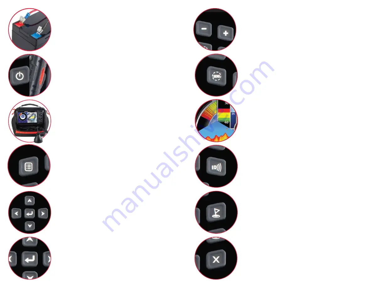
Adjust the Sensitivity
To adjust your sensitivity, first press the SENS button and the menu will
appear with Sensitivity highlighted. Pressing the PLUS/MINUS will adjust
your sensitivity, and the setting will now be displayed on the SENS gauge.
The best SENS setting is achieved by turning up your sensitivity until you
receive a clear and steady bottom reading. Now turn up the SENS until
you just begin to display your bait without it fading or flickering.
IR Button
When other sonar units are causing interference to the display, activate
the IR feature by depressing the IR key. There are 12-levels of Interfer-
ence Rejection, and each press of the PLUS/MINUS buttons will change
the level of Interference Rejection. The correct level of IR will be achieved
when the display is clear of display clutter. In some extreme cases, clutter
will be greatly reduced but not eliminated, try changing your Cone Angle.
Bottom Return
Hard-bottom readings (rock or gravel) will be displayed by a wide band of
RED light indicating a strong signal. Conversely, a soft bottom (mud or silt)
will return a weaker signal and will result in a narrower RED band or even
a combined RED and GREEN band. A soft bottom with weed growth will
often appear as a narrow RED or GREEN band combined with both solid
and broken YELLOW segments indicating weeds.
Waypoints
To mark your location as a waypoint simply touch the WAYPOINT button
located above the “X” EXIT button. If you would like to mark a waypoint
that is not your current location, simply search the map with the four
ARROW keys and press and hold the WAYPOINT button where you
would like the waypoint to be located.
Connect Power
Your MX-7gps comes virtually ready to fish. Open the top cover of the soft
pack, loosen the knobs and the monitor can now be positioned how you
want it. Once the monitor is positioned, tighten the knobs again to hold the
monitor in place. Look behind the monitor and connect the red wire to the
red terminal and the black wire to the black terminal on the battery.
Scrolling
When the GPS functions are enabled, use the arrow buttons to scroll
around map to find your next destination. You can also use the arrow
buttons to highlight the desired sub-menu and access other functions of
the MX-7gps.
Enter Key / Back Button
Many of the menu options within the MX-7gps are ON/OFF toggle or
Radio buttons. This button allows your to activate or deactive these
functions within the sub-menus. If you have not highlighted a function that
has a radio button, this will act as a “BACK” or previous screen button.
Menu
To access the menu options, start by pressing the Menu button just above
the power button. Use the arrow buttons to highlight the desired
sub-menu and access other functions of the MX-7gps. Some of these
functions are also accessible using the other buttons. When you press the
MENU button, four sub-menus will be revealed—SONAR SETTINGS,
GPS MAP SETTINGS, DISPLAY SETTINGS, and SYSTEM SETTINGS.
Zoom Function
When the GPS functions are enabled, the PLUS/MINUS buttons allow
you to zoom in or out of the GPS window. When accessing the SENS, IR,
or other functions within the menu system with a sliding scale, the
PLUS/MINUS buttons allow you to increase or decrease the functions.
Exit Menu
The “X” or EXIT button will take you out of any screen that you have
selected and return you the SONAR/GPS screen. If you have been
searching the GPS section for a new location, the EXIT button will return
you to your current GPS location on the map.