


52
53
English
English
Press
GOTO
, select NEAR by
CUR-
SOR
, choose the desired service
and press
ENTER
to confirm, or
CLR
to cancel the operation.
The GEONAV will show the three
destinations closest to the boat’s
position (if in Navigation mode),
or to the cursor’s position (if in
Cursor mode), and position auto-
matically on the closest destina-
tion (flashing).
Select one port at a time by using
the
CURSOR
key; a window will
show the distance and the time
to arrive (estimated on the boat’s
current speed). Press
ENTER
to
confirm the selection.
The GEONAV will insert a waypoint in the port selected, de-
lete automatically the existing route (if in Navigation mode), or
append the waypoint to the existing route (if in Cursor mode),
then go back to Navigation mode and enable automatically the
Autozoom function.
Route to a point (Lat/Lon)
Press
GOTO
and select L/L by the
CURSOR
key. Enter the geo-
graphical coordinates desired and confirm by pressing
ENTER
.
The GEONAV will move the manual cursor to the position
selected; insert a waypoint by pressing
ENTER
or a marker by
pressing
MARK
.
Tide or current forecast at the nearest survey station
NOTE: This function is available only with the NAVIONICS cartridges containing
Tides and Currents data.
Goto
insert a waypoint in the port position and append the new leg
to the existing route (if no route is available, the new waypoint
will be connected to the boat’s position).
Press the
PAGE
key to go back to Navigation mode and enable
automatically the Autozoom function.
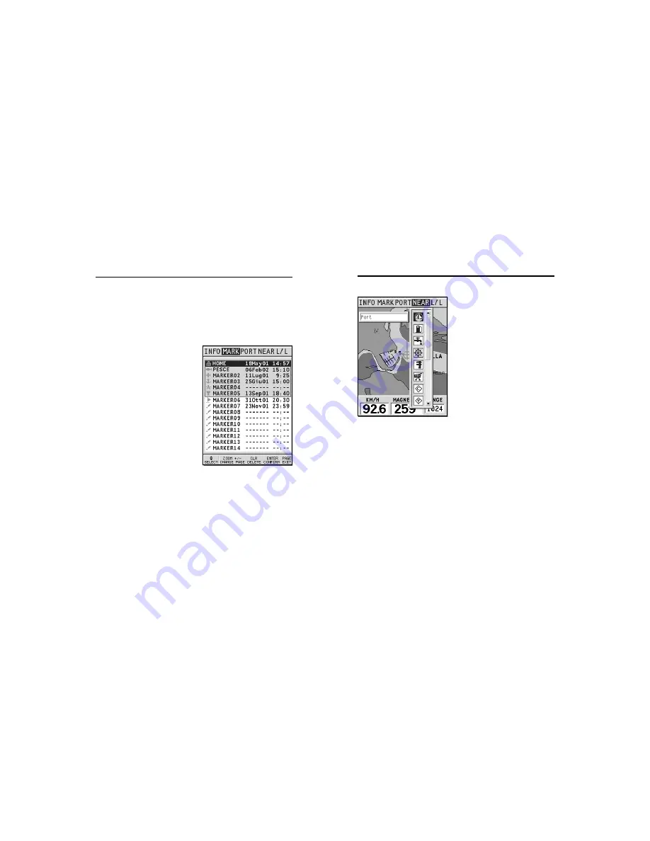
Route to a marker
Press
GOTO
and select MARK by
the
CURSOR
key. The catalog dis-
played will list the symbol, the
name and the insertion date/
time of each marker.
By using
CURSOR
, choose the de-
sired marker (the latest 8 mark-
ers used will be highlighted) from
the catalog displayed, then press
ENTER
to confirm.
Once the desired marker has
been selected, the GEONAV will
insert a waypoint at the marker
position and append the new leg
to the existing route (if no route
is available, the new waypoint
will be connected to the boat’s position).
Press the
PAGE
key to go back to Navigation mode and enable
automatically the Autozoom function.
NOTE: To delete a single marker, select it from the GOTO Marker list and press the
CLR key.
Route to the nearest service
NOTE: This option is available only with the NAVIONICS cartridges containing the
Port Services features. It allows finding and heading for the nearest port featuring the
service desired.


