EN
12
D. How do you measure distances on the map?
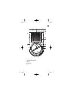
This compass features 3 scales enabling you to measure and calculate distances
on a map:
- 1 European scale in cm
- 1 scale in inches
- 1 European scale 1/25 000
The compass also features a UTM grid to use on maps with a UTM-WGS 84
projection.
Maps with a 1/25000 scale have a grid whose lines are spaced 1 km apart.
When reading the GPS position in the UTM system, position the O of the
compass grid on the corner corresponding to the coordinates given by the
GPS, then carry the decimal number of the position directly to the compass
scale.
Be careful about the direction in which the coordinates increase (especially in
the Southern Hemisphere).
Contact
As we strive to continually improve the products we develop, we are interested in
your feedback regarding the quality, the functionality and the usage of our
products.
- In France, please call the customer service center at :
0810 08 08 08
(local
call)
- For any other country, please leave a message under the relevant heading
on our website
www.decathlon.com
We promise to answer you promptly.
NOTICE_C200 TLL 9/08/06 12:17 Page 12


