2 - NAV PAGES
38
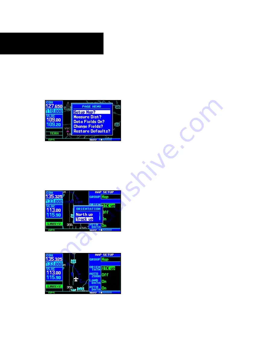
To change a map setup feature:
1. On the Map page, press
MENU
to bring up the
Page Menu. Then, turn the
large right
knob
to highlight “Setup Map?” and press
ENT
.
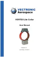
2. To change map orientation, turn the
small
right
knob to select “Map” and press
ENT
.
3. Turn the
large right
knob to highlight the
“Orientation” field and turn the
small right
knob to select the desired option. Select “North
up” to fix the top of the map display to a north
heading. Select “Track up” to adjust the top
of the map display to your current track head-
ing.
Select “DTK up” to fix the top of the map display
to your desired course. Press
ENT
to accept the
selected option.
4. To enable/disable automatic zoom, turn the
small right
knob to select “Map” and press
ENT
. Turn the
large right
knob to highlight
the “Auto Zoom” field and turn the
small
right
knob to select “On” or “Off”. Press
ENT
to accept the selected option. The automatic
zoom feature will automatically adjust the
map scale from 2000 NM through each lower
scale, stopping at 1.0 NM as you approach
your destination waypoint.
5. To enable/disable background land data, or all
Jeppesen aviation data, turn the
small right
knob to select “Map” and press
ENT
. Use the
large right knob
to highlight the appropri-
ate field and turn the
small right
knob to
select “On” or “Off”. Press
ENT
to accept the
selected option.
6. For airports, NAVAIDs, active flight plan
waypoints, user-created waypoints, state/pro-
vincial boundaries, rivers/lakes and cities: turn
the
small right
knob to select the appropriate
“Group” name (per the chart on the previous
page) and press
ENT
. Use the
large right
knob to highlight the zoom field for the desired
feature and turn the
small right
knob to
select the maximum scale at which the feature
should appear on screen. Or select “Off” to
never display the selected feature. Press
ENT
to accept the selected option. Next, turn the
large right
knob to highlight the text field for
the desired feature and turn the
small right
knob to select the desired text size, or select
“None” to disable text descriptions. Press
ENT
to accept the selected option.
Map Page Options
Содержание GNS 430AW
Страница 1: ...Pilot s Guide Reference 400W Series ...
Страница 10: ...INTRODUCTION viii Blank Page ...
Страница 38: ...28 1 COM Blank Page ...
Страница 70: ...2 NAV PAGES 60 Blank Page ...
Страница 90: ...4 FLIGHT PLANS 80 Active Flight Plan Shortcuts Blank Page ...
Страница 122: ...5 PROCEDURES 112 Blank Page ...
Страница 154: ...7 NRST PAGES 144 Nearest Airspaces Blank Page ...
Страница 186: ...10 FDE 176 Blank Page ...
Страница 213: ......


