background image

4

Wait several minutes while the software update process 

completes.
The device returns to normal operation after the software 

update process is complete.

5

Remove the memory card.

NOTE: 

If the memory card is removed before the device 

restarts fully, the software update is not complete.

GPS Satellite Signals

When you turn on the chartplotter, the GPS receiver must collect 

satellite data and establish the current location. When the 

chartplotter acquires satellite signals, 

 appears at the top of 

the Home screen. When the chartplotter loses satellite signals, 

 disappears and a flashing question mark appears over   on 

the chart.
For more information about GPS, go to 

www.garmin.com

/aboutGPS

.

Adjusting the Backlight

1

Select 

Settings

 > 

System

 > 

Display

 > 

Backlight

.

TIP: 

Press   from any screen to open the backlight settings.

2

Adjust the backlight.

Adjusting the Color Mode

1

Select 

Settings

 > 

System

 > 

Display

 > 

Color Mode

.

TIP: 

Press   from any screen to access the color settings.

2

Select an option.

Customizing the Home Screen

You can add items to and rearrange items on the Home screen.

1

From the Home screen, select 

Customize Home

.

2

Select an option:
• To rearrange an item, select 

Rearrange

, select the item to 

move, and select the new location.

• To add an item to the Home screen, select 

Add

, and 

select the new item.

• To remove an item you have added to the Home screen, 

select 

Remove

, and select the item.

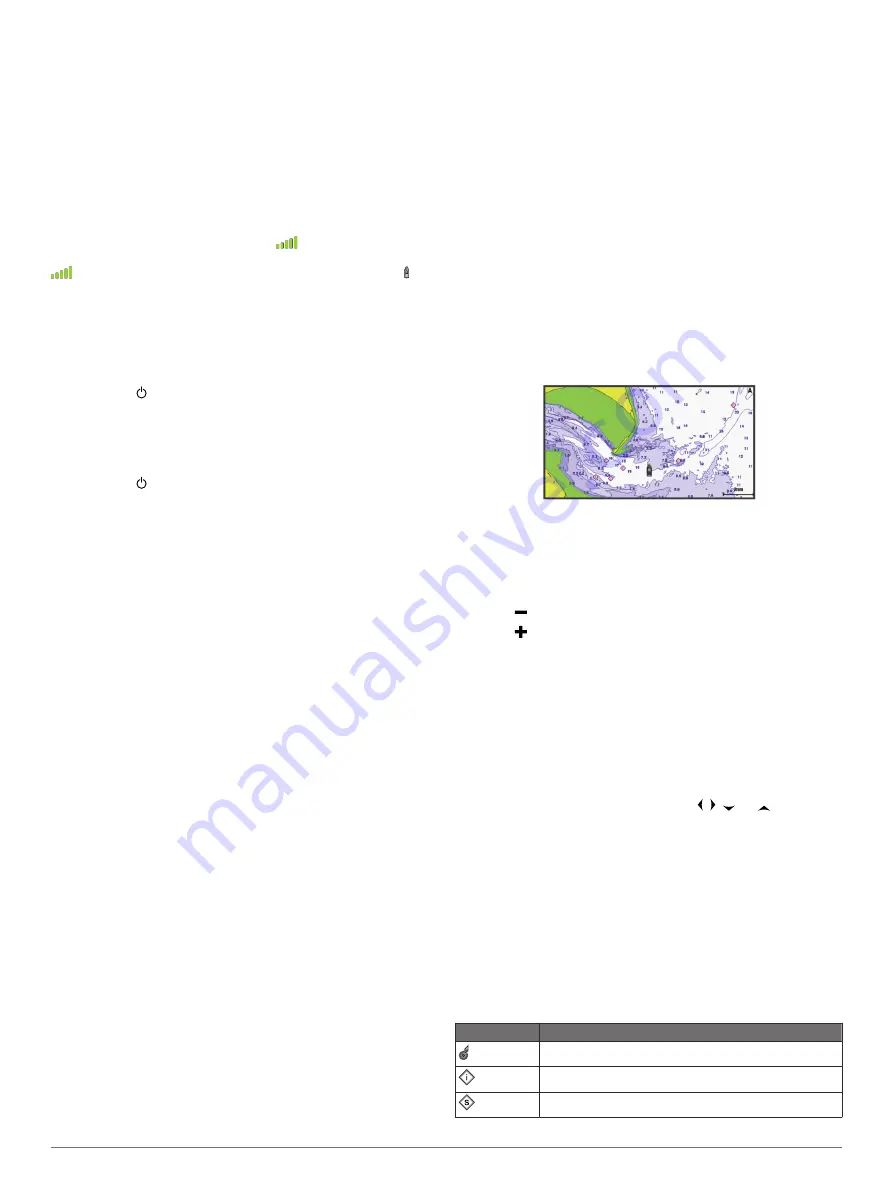
Charts and 3D Chart Views

The charts and 3D chart views that are available depend on the 

map data and accessories used.
You can open the charts and 3D chart views by selecting 

Charts.

Navigation Chart

: Shows navigation data available on your pre-

loaded maps and from supplemental maps, if available. The 

data includes buoys, lights, cables, depth soundings, 

marinas, and tide stations in an overhead view.

Perspective 3D

: Provides a view from above and behind the 

boat (according to your course) and provides a visual 

navigation aid. This view is helpful when navigating tricky 

shoals, reefs, bridges, or channels, and is beneficial when 

trying to identify entry and exit routes in unfamiliar harbors or 

anchorages.

Mariner’s Eye 3D

: Shows a detailed, three-dimensional view 

from above and behind the boat (according to your course) 

and provides a visual navigation aid. This view is helpful 

when navigating tricky shoals, reefs, bridges, or channels, 

and when trying to identify entry and exit routes in unfamiliar 

harbors or anchorages.

NOTE: 

Mariner's Eye 3D and Fish Eye 3D chart views are 

available with premium charts, in some areas.

Fish Eye 3D

: Provides an underwater view that visually 

represents the sea floor according to the chart information. 

When a sonar transducer is connected, suspended targets 

(such as fish) are indicated by red, green, and yellow 

spheres. Red indicates the largest targets and green 

indicates the smallest.

Fishing Chart

: Provides a detailed view of the bottom contours 

and depth soundings on the chart. This chart removes 

navigational data from the chart, provides detailed 

bathymetric data, and enhances bottom contours for depth 

recognition. This chart is best for offshore deep-sea fishing.

Navigation Chart and Offshore Fishing Chart

NOTE: 

The offshore Fishing chart is available with premium 

charts, in some areas.
The Navigation and Fishing charts allow you to plan your 

course, view map information, and follow a route. The Fishing 

chart is for offshore fishing.
To open the Navigation chart, select 

Charts

 > 

Navigation 

Chart

.

To open the Fishing chart, select 

Charts

 > 

Fishing Chart

.

Zooming In and Out of the Chart

The zoom level is indicated by the scale number at the bottom of 

the chart. The bar under the scale number represents that 

distance on the chart.
• Select   to zoom out.
• Select   to zoom in.

Panning the Chart with the Keys

You can move the chart to view an area other than your present 

location.

1

From the chart, use the arrow keys.

2

Select 

BACK

 to stop panning and return the screen to your 

present location.

NOTE: 

To pan from a combination screen, select SELECT.

Selecting an Item on the Map Using the Device Keys

1

From a chart or 3D chart view, select  ,  ,  , or   to move 

the cursor.

2

Select 

SELECT

.

Measuring a Distance on the Chart

Select 

Measure Distance

.

A push pin appears on the screen at your present location. 

The distance and angle from the pin is listed in the corner.

TIP: 

To reset the pin and measure from the current location of 

the cursor, select SELECT.

Chart Symbols

This table contains some of the common symbols you might see 

on the detailed charts.

Icon

Description

Buoy

Information

Marine services

2

Charts and 3D Chart Views

Содержание echomap 40 series

Страница 1: ...echoMAP 40 50 70 90 Series Owner s Manual December 2014 Printed in Taiwan 190 01834 00_0B...

Страница 2: ...f this product Garmin the Garmin logo BlueChart g2 Vision and Ultrascroll are trademarks of Garmin Ltd or its subsidiaries registered in the USA and other countries echoMAP HomePort and LakeV are trad...

Страница 3: ...S Location 9 Viewing a List of all Waypoints 9 Editing a Saved Waypoint 9 Browsing for and Navigating to a Saved Waypoint 9 Deleting a Waypoint or an MOB 9 Deleting All Waypoints 9 Routes 9 Creating a...

Страница 4: ...an Individual Routine Call to an AIS Target 18 Chartplotter Data Management 18 Copying Waypoints Routes and Tracks from HomePort to a Chartplotter 18 Copying Data from a Memory Card 18 Copying Waypoi...

Страница 5: ...ting More Information If you have any questions about your device you can contact Garmin Product Support The website www garmin com support offers many different troubleshooting tips to help resolve m...

Страница 6: ...he boat according to your course and provides a visual navigation aid This view is helpful when navigating tricky shoals reefs bridges or channels and when trying to identify entry and exit routes in...

Страница 7: ...formation Viewing Details about Navaids From the Navigation chart Fishing chart Perspective 3D chart view or Mariner s Eye 3D chart view you can view details about various types of navigation aids inc...

Страница 8: ...ion System The Automatic Identification System AIS enables you to identify and track other vessels and alerts you to area traffic When connected to an external AIS device the chartplotter can show som...

Страница 9: ...only with AIS The safe zone is used for collision avoidance and can be customized 1 Select Settings Alarms AIS AIS Alarm On A message banner appears and an alarm sounds when an AIS activated vessel e...

Страница 10: ...Display Sets which tracks to display on the chart based on track color Overlay Numbers Settings Edit Layout Sets the layout of the data overlay or data fields You can select the data to be shown withi...

Страница 11: ...vessels appear Details Shows details about AIS activated vessels Projected Heading Sets the projected heading time for AIS activated vessels Trails Shows the tracks of AIS vessels and select the leng...

Страница 12: ...Guidance feature is based on electronic chart information That data does not ensure obstacle and bottom clearance Carefully compare the course to all visual sightings and avoid any land shallow water...

Страница 13: ...magenta line NOTE When using Auto Guidance a gray segment within any part of the magenta line indicates that Auto Guidance cannot calculate part of the Auto Guidance line This is due to the settings f...

Страница 14: ...course is dynamic and it moves with your boat when you are off course 6 Review the course indicated by the magenta line 7 Follow the magenta line along each leg in the route steering to avoid land sh...

Страница 15: ...the magenta line steering to avoid land shallow water and other obstacles NOTE When using Auto Guidance a gray segment within any part of the magenta line indicates that Auto Guidance cannot calculat...

Страница 16: ...premium charts in some areas You can set the parameters the chartplotter uses when calculating an Auto Guidance line Safe Depth Sets the minimum depth chart depth datum the chartplotter uses when cal...

Страница 17: ...image of what is beneath the boat SideV Sonar View NOTE Not all models support SideV sonar and scanning transducers NOTE To receive SideV scanning sonar you need a compatible chartplotter and a compa...

Страница 18: ...tness settings If you want to highlight smaller fish targets or create a higher intensity display of a target you can increase the color gain or contrast setting This causes a loss in the differentiat...

Страница 19: ...gs apply to all models sounder modules and transducers From a sonar view select MENU Sonar Setup Depth Line Shows a quick reference depth line Scroll Speed Sets the rate at which the sonar scrolls fro...

Страница 20: ...ings you must download and install the HomePort application and record sonar data onto a memory card 1 Remove the memory card from the device 2 Insert the memory card into a card reader attached to a...

Страница 21: ...eceives a DSC distress call If position information was sent with the distress call that information is also available and recorded with the call designates a distress call in the DSC list and marks t...

Страница 22: ...ata from HomePort to the prepared memory card For more information see the HomePort help file Copying Data from a Memory Card 1 Insert a memory card into the card slot 2 Select User Data Manage Data D...

Страница 23: ...System Display Backlight Sets the backlight level Color Mode Sets the device to display day or night colors Screenshot Capture Allows the device to save images of the screen GPS Settings Select Setti...

Страница 24: ...ar NMEA 0183 input with support for the DPT depth or DBT MTW water temperature and VHW water temperature speed and heading sentences NMEA 0183 Settings Select Settings Communications NMEA 0183 Setup S...

Страница 25: ...capture a screenshot of any screen shown on your chartplotter as a bitmap bmp file You can transfer the screenshot to your computer Capturing Screenshots 1 Insert a memory card into the card slot 2 Se...

Страница 26: ...DSE Expanded digital selective calling HDG Heading deviation and variation HDM Heading magnetic MWD Wind direction and speed MDA Meteorological composite MWV Wind speed and angle Type Sentence Descri...

Страница 27: ...ffset 19 keys 1 power 1 L lane width 6 language 19 M man overboard 9 marine services 8 mark location 9 measuring distance charts 2 memory card 18 19 detailed maps 18 installing 1 slot 1 MOB device 5 N...

Страница 28: ...ates software 1 user data deleting 11 V vessel trails 7 17 VHF radio 17 calling an AIS target 18 distress calls 17 DSC channel 18 individual routine call 18 voltage 20 W WAAS 19 water temperature offs...

Страница 29: ......

Страница 30: ...39 02 36 699699 52 001 855 792 7671 0800 0233937 47 815 69 555 00800 4412 454 44 2380 662 915 35 1214 447 460 386 4 27 92 500 0861 GARMIN 427 646 27 0 11 251 9999 34 93 275 44 97 46 7744 52020 886 2 2...

Отзывы: