background image

Garmin aera 795/796 Quick Reference Guide

190-01194-01 Rev. A

35

Utilities

Overview

GPS Navigation

Flight Planning

Hazar

d A
voidance

Utilities

Appendix

Index

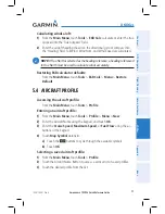
Calculating winds aloft:

1) 

  From the 

Main Menu

, touch 

Tools

 > 

E6B Calc

, calculate or enter the true 

airspeed into the ‘True Airspeed’ field.

2) 

Enter the aircraft heading shown on the directional gyro or compass into 
the ‘Heading’ field.  Tail Wind, Wind From, and Wind Speed are calculated.

 NOte: 

If True North is selected as the heading reference, a heading referenced 

to True North must be used to calculate winds accurately.

Restoring E6B calculator defaults:


From the 

Main Menu

, touch 

Tools

 > 

E6B Calc 

Menu 

Restore 

Default

.

5.4  aircraFt PrOFile

Accessing the aircraft profile:


From the 

Main Menu

, touch 

Tools

 > 

Profile

Entering an aircraft profile:

1) 

  From the 

Main Menu

, touch 

Tools

 > 

Profile 

Menu

 > 

New

2) 

  Enter the Aircraft Name using the keypad, and touch 

OK

.

3) 

  Enter the 

Cruise Speed

Maximum Speed

, or 

Fuel Flow

 using the 

+

/

-


buttons or the keypad.

4) 

 Touch 

Map Symbol

 datafield.

a) 

Touch the 

 buttons to cycle through the available symbols.

b) 

Touch 

OK

Selecting a saved aircraft profile:

1) 

  From the 

Main Menu

, touch 

Tools

 > 

Profile

2) 

  Touch the Aircraft Name Button to access a vertical list of saved profiles.

3) 

  Touch the desired profile from the list.

Содержание aera 795

Страница 1: ...models 795 and 796 Quick Reference Guide...

Страница 2: ......

Страница 3: ...Overview GPS Navigation Flight Planning Hazard Avoidance Utilities Appendix Index...

Страница 4: ...nual may be reproduced copied transmitted disseminated downloaded or stored in any storage medium for any purpose without the express written permission of Garmin Garmin hereby grants permission to do...

Страница 5: ...The displayed minimum safe altitudes MSAs are only advisory in nature and should not be relied upon as the sole source of obstacle and terrain avoidance information Always refer to current aeronautica...

Страница 6: ...owever the pilot must recognize that providing monitoring and or self test capability for all conceivable system failures is not practical Although unlikely it may be possible for erroneous operation...

Страница 7: ...e following temperature range from 32 to 77 F from 0 to 25 C Do not operate the device outside of the following temperature range from 4 to 131 F from 20 to 55 C Contact your local waste disposal depa...

Страница 8: ...ts components contain chemicals known to the State of California to cause cancer birth defects or reproductive harm This notice is being provided in accordance with California s Proposition 65 If you...

Страница 9: ...3 Map Panning 13 Map Range 15 Map Overlays 15 Section 2 GPS Navigation 17 2 1 Flight Data 17 Data Fields 17 Numeric Flight Data 17 2 2 HSI Panel 18 Setting the Bug Indicator 18 Manually Setting a Cour...

Страница 10: ...3 5 3 E6B Calculator 34 5 4 Aircraft Profile 35 5 5 Weight Balance 36 Section 6 Appendix 37 Miscellaneous Message Advisories 37 Airspace Messages 38 Data Field Numeric Data Options 39 Aural Alerts 41...

Страница 11: ...e purpose of this document is to provide a resource with which to find operating instructions on the major features of the aera 795 796 more easily This Quick Reference Guide is not intended to be a c...

Страница 12: ...ting Started Battery Installation Installing the battery 1 Locate the lithium ion battery that came in the product box 2 Locate the metal contacts on the end of the lithium ion battery 3 Insert the ba...

Страница 13: ...Guide 190 01194 01 Rev A 3 Overview Overview GPS Navigation Flight Planning Hazard Avoidance Utilities Appendix Index Battery Release Push to remove the battery Unit Overview Back Battery Out Power B...

Страница 14: ...ra 795 796 Pilot s Guide and connect the power cable to the aircraft power outlet cigarette lighter receptacle 2 Route the power cable so that it does not interfere with aircraft operation The unit be...

Страница 15: ...ons Back Returns to previous screen Cancels the map pointer Main Menu Shortcut Touch and hold to display the Main Menu Menu Displays the context sensitive option menu Direct to Displays the Direct to...

Страница 16: ...page button The current Page Button is now replaced by the new Page Button 4 Touch Save Main Menu Touch and hold the icon at any time to display the Main Menu Main Menu Icons Touch the following icon...

Страница 17: ...nearest intersections VRP Displays nearest Visual Reporting Point VRP Atlantic User WPT Displays nearest user waypoints City Displays nearest cities ARTCC Displays nearest ARTCCs FSS Displays nearest...

Страница 18: ...hr 24hr 36hr 48hr Pressure Displays Surface Pressure Sea Temp Displays Water Temperature Tools From the Main Menu touch the Tools Icon to access the second level Tools icons Touch the following second...

Страница 19: ...e Tools Setup to access the third level Setup Icons Touch the following third level icons to perform the associated function Display Displays backlight intensity timeout and color mode settings Sound...

Страница 20: ...x Index Basic Touchscreen Operation Touch the desired selection The icon view menu option datafield etc will momentarily turn blue when selected Basic Touchscreen Operation Scrolling and Panning Scrol...

Страница 21: ...x Zooming Zooming in and out on the touchscreen map displays Pinch fingers together zoom in or pull fingers apart zoom out Zoom In Zoom Out 1 4 Menus and Data Entry Option Menus The aera 795 796 has a...

Страница 22: ...re displayed on the data entry screen OK Exits the keypad function and the accepts changes BKSP Erases the current data Numeric Alpha Symbol Displays the numeric alpha or symbol keypad Cancel Cancels...

Страница 23: ...a options i e On Off Or Touch the buttons to cycle through a horizontal list if more than two data options are available If using the vertical list touch the desired data option from the list 1 5 Usin...

Страница 24: ...information box appears on the map and the highlighted map feature is displayed on the Map Feature Button the button located between the buttons If multiple features are present at the Map Pointer po...

Страница 25: ...rent map range is indicated in the lower right The scale bar represents the map scale To change the map range on any map use the out or in icons to zoom out increasing or zoom in decreasing Zoom Out Z...

Страница 26: ...Garmin aera 795 796 Quick Reference Guide 190 01194 01 Rev A 16 Overview Overview GPS Navigation Flight Planning Hazard Avoidance Utilities Appendix Index Blank Page...

Страница 27: ...ields menu option 4 Touch the desired Data Field to change A list of available Data Field Options is displayed 5 Touch the desired Data Field Option 6 Touch the OK Icon Numeric Flight Data The numeric...

Страница 28: ...tion to manually set your course to the destination Manually setting a course to the destination waypoint 1 From the Main Menu touch the Map icon or the Active FPL Icon 2 Touch the Menu Icon 3 Touch t...

Страница 29: ...3 Touch the Enable VNAV Indicator or Disable VNAV Indicator menu option only available when navigating a Direct To or Flight Plan Capturing cancelling VNAV profile 1 Enter a valid VNAV profile see Con...

Страница 30: ...oint categories Flight Plan Waypoints Nearest Airports or Recent Waypoints b Touch the desired waypoint from the list Selecting a runway for review by identifier facility name or city 1 From the Main...

Страница 31: ...through the list 4 If desired touch Menu Show Map except for ARTCC FSS or Airspace 5 Touch the Back Icon to return to the second level Nearest Icons Or Touch the Direct to Icon if applicable then the...

Страница 32: ...or Search by City fields b Enter the desired Identifier Facility Name or City using the keypad Refer to the Overview Section on Data Entry for more information c Touch the OK Icon Or a Touch More b T...

Страница 33: ...th a map displayed activate the map pointer by touching the desired waypoint If no airport NAVAID or User Waypoint exists at the desired location a temporary waypoint named MAP is automatically create...

Страница 34: ...Garmin aera 795 796 Quick Reference Guide 190 01194 01 Rev A 24 GPS Navigation Overview GPS Navigation Flight Planning Hazard Avoidance Utilities Appendix Index Blank Page...

Страница 35: ...ight Plan menu option 2 Touch the desired Data Field Button at the top of the Flight Plan 3 Touch the desired Data Field The currently selected Data Field is outlined blue 4 Touch the OK Icon 5 If des...

Страница 36: ...point Button 3 Enter the desired waypoint a Touch the buttons to Search by Identifier Search by Facility Name or Search by City using the keypad b Enter the desired waypoint c Touch the OK Icon Or a T...

Страница 37: ...desired waypoint from the list Loading an approach procedure into a stored flight plan 1 With an active or saved flight plan displayed touch the Menu Icon 2 Touch the Select Approach menu option A ve...

Страница 38: ...ars 4 Touch Yes Activating a Flight Plan Leg 1 From the Main Menu touch the Active FPL Icon 2 While navigating an active flight plan touch the desired leg to be activated An option menu automatically...

Страница 39: ...e FPL Icon Or a From the Main Menu touch the FPL List Icon b Touch the desired Saved Flight Plan from the list An option menu appears c Touch the Review Flight Plan menu option 2 With the flight plan...

Страница 40: ...proach Follow the steps below to resume the flight plan after activating the approach 1 From the Main Menu touch the Active FPL Icon Or Touch the Direct To Icon 2 With a flight plan and an approach lo...

Страница 41: ...el Weather Icon 3 If necessary touch the buttons to scroll through the list of available altitudes AIRMET types or forecast times 4 Touch the desired weather product to get abbreviated information abo...

Страница 42: ...0 10 Adjusting TIS settings on the navigation map 1 Touch Map Menu Set Up Map 2 Touch the buttons to select the Map Category 3 Touch the TIS Traffic buttons to select the desired settings Off Auto or...

Страница 43: ...uch the desired flight log if applicable 3 Touch Menu 4 Touch Delete Flight or Delete All 5 Touch Yes 5 2 Track Log Showing hiding the track log on the Navigation Map 1 From the Main Menu touch Map Me...

Страница 44: ...Density Altitude True Airspeed Tail Wind Wind From and Wind Speed based on information you enter Accessing the E6B calculator From the Main Menu touch Tools E6B Calc Calculating true airspeed and dens...

Страница 45: ...ed to calculate winds accurately Restoring E6B calculator defaults From the Main Menu touch Tools E6B Calc Menu Restore Default 5 4 Aircraft Profile Accessing the aircraft profile From the Main Menu t...

Страница 46: ...ircraft Name Button to access a vertical list of saved profiles 3 Touch the desired profile from the list 4 Touch Menu Delete 5 Touch Yes 5 5 Weight Balance NOTE This information is only for flight pl...

Страница 47: ...abase Error Internal problem with the system Contact your dealer or Garmin Product Support to have the unit repaired Fuel Tank A reminder for switching fuel tanks The reminder message repeats at the s...

Страница 48: ...ack recording on Track Memory Full No more track data can be stored Delete the old track data to store the new data Track Truncated A complete uploaded track will not fit in memory The oldest track lo...

Страница 49: ...ed course in either direction left or right Desired Track The desired course between the active from and to waypoints Distance Destination The distance to the destination waypoint in the Active Flight...

Страница 50: ...Route Next The estimated time it takes to reach the next waypoint form the present position based upon current ground speed Estimated Time of Arrival Destination The estimated time at which the aircra...

Страница 51: ...er reporting station Weather Temperature aera 796 The temperature at the nearest weather reporting station Weather Wind aera 796 The wind speed and direction at the nearest weather reporting station A...

Страница 52: ...ify reverse assemble reverse engineer or reduce to human readable form the Software or any part thereof or create any derivative works based on the Software You agree not to export or re export the So...

Страница 53: ...ational Purchases A separate warranty is provided by international distributors for units purchased outside the United States This warranty is provided by the local in country distributor and this dis...

Страница 54: ...elied upon as safety critical in connection with any aircraft sea craft or automobile usage This information is provided as is and Sirius XM and Garmin disclaim any and all warranties express and impl...

Страница 55: ...use undesired operation This equipment has been tested and found to comply with the limits for a Class B digital device pursuant to part 15 of the FCC rules These limits are designed to provide reason...

Страница 56: ...Garmin aera 795 796 Quick Reference Guide 190 01194 01 Rev A Appendix 46 Overview GPS Navigation Flight Planning Hazard Avoidance Utilities Appendix Index Blank Page...

Страница 57: ...ned Data Option 13 Data Fields 17 39 Dedicated Icons 5 Direct to 5 22 Cancelling 23 Display Orientation 4 E E6B Calculator 34 F Flight Log 33 Flight Plan Activation 28 Adding Waypoints 26 Creation 25...

Страница 58: ...Index P Panel 18 Panning 10 R Red X 41 Runways 20 S Scrolling 10 T Terrain 31 Tools 8 Touchscreen 10 Track Log 33 Traffic Information Service TIS 32 Symbology 32 U User Waypoints Creating 21 V Vector...

Страница 59: ...Garmin aera 795 796 Quick Reference Guide 190 01194 01 Rev A Index Index 3 Overview GPS Navigation Flight Planning Hazard Avoidance Utilities Appendix Index...

Страница 60: ...oll free 800 525 6726 p 503 391 3411 f 503 364 2138 Garmin Europe Ltd Liberty House Bulls Copse Road Hounsdown Business Park Southampton SO40 9RB U K Toll free within U K 0808 2380000 p 44 0870 850124...

Отзывы: