background image

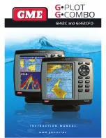
G142C and G142CFD

I N S T R U C T I O N   M A N U A L

w w w . g m e . n e t . a u

Summary of Contents for G-combo G142CFD

Page 1: ...G142C and G142CFD I N S T R U C T I O N M A N U A L w w w g m e n e t a u ...

Page 2: ......

Page 3: ...thout notice Copyright 2010 GME Australia all rights reserved Presentation Thank you for having purchased a GME product This handbook contains an explanation of how to install operate and maintain your unit SAFETY INSTRUCTIONS If you require technical advice or assistance contact your nearest GME dealer or visit our website www gme net au Screen Cleaning Precautions Use a tissue or lens cloth and ...

Page 4: ...Following a route 19 3 4 10 Goto Key 19 3 4 11 Distance and bearing calculator 20 3 4 12 Projected course 20 3 5 Sonar 20 3 5 1 Interpreting the display 20 3 5 2 Mode 20 3 5 3 Single and Dual frequency fish finding 21 3 5 4 Range 21 3 5 5 Gain 22 3 5 6 Sonar window display 22 3 5 7 No split 22 3 5 8 Split zoom and Full Screen zoom 23 3 5 9 Split bottom 23 3 5 10 Split 50 200 23 3 5 11 Split A Scop...

Page 5: ...rce 36 4 4 2 DGPS Source 37 4 4 3 Static Navigation 36 4 4 4 Speed Filter and Course Filter 36 4 4 5 Lat Lon d p s 36 4 4 6 Ship speed 36 4 4 7 Magnetic Variation 36 4 5 Track Log Settings 36 4 5 1 Track 36 4 5 2 Logs 36 4 6 Memory Settings 37 4 6 1 Save 37 4 6 2 Load 37 4 6 3 Delete 37 4 6 4 Format 37 4 6 5 Screen snapshot 37 4 7 AIS Settings 38 4 7 1 Display filter 38 4 7 2 Alarm option 38 4 7 3...

Page 6: ... 40 5 2 Connections 41 5 3 Power data cable 41 5 4 Alarm 41 5 5 GPS antenna 41 5 5 1 Internal antenna 41 5 5 2 External antenna 42 5 5 3 The antenna using NMEA 42 5 6 NMEA 0183 42 5 7 NMEA 2000 43 5 8 Sonar Transducers 43 5 9 Setup and test 43 Warranty 44 After Sales Service 44 ...

Page 7: ...rent 13 8 V 350 mA min no backlighting 480 mA max full backlighting External beeper or light output Switched to ground to sound alarm 30V DC 200 mA maximum Operating temperature 10 to 50 C ALARMS User set Arrival radius anchor XTE danger low battery loss of DGPS fix dangerous AIS vessels GPS NAVIGATION Chart card C MAP SD Card NT MAX NT or NT User card SD Card Maximum Memory size is 1GB standard 4...

Page 8: ... mm H x 183 mm W x 74 mm D Display 142 mm 5 6 diagonal TFT colour 480 x 640 pixels Supply voltage 10 to 34 V DC Supply current 13 8 V 800 mA min no backlighting 1000 mA max full backlighting External beeper or light output Switched to ground to sound alarm 30 V DC 200 mA maximum Operating temperature 10 to 50 C ALARMS User set Arrival radius anchor XTE danger too shallow too deep fish temperature ...

Page 9: ...PB BWR GGA GLL GSA GSV RMB RMC VTG XTE DBT DPT MTW VHW XDR NMEA 2000 Outputs for compat ible instruments Water Speed 128259 Water depth 128267 XTE 129283 NAV data 129284 NAV data 129285 COG SOG 129026 GNSS position 129029 Water temp 130310 SONAR FISHFINDING Depth range 0 m to 600 m Sonar output Power Variable up to 600 W RMS Dual frequency 50 kHz and 200 kHz Temperature Range 0 to 37 7 C 32 F to 9...

Page 10: ...k of display slides onto bracket 3 Turn knob clockwise to lock Removing the display unit 1 Turn the unit off 2 Turn the knob counter clockwise 3 Pull the display unit off bracket Note The G142C G142CFD with an internal GPS antenna is designed to be bracket mounted or flush mounted However if you flush mount inside of your boat GPS performance can be reduced 2 1 2 Flush Mounting 1 Find a suitable l...

Page 11: ...nserting the SD Card 1 Hold the SD card so that you can see the C Map label 2 Open the door gently push the SD card into the slot push the SD card in until you hear a click sound then close the door Removing the SD Card 1 Turn off the unit 2 Open the door and push in on the SD card until it is released 3 Close the door Insert C MAP SD card correctly DO NOT FORCE Close SD card door firmly at all ti...

Page 12: ...ds the data bar will disappear Tip Even though you set up a data bar for a specific window the data bar will not apply to all other windows 2 6 Compass The chartplotter computes compass direction from the constellation of GPS satellites For the GPS chartplotter to compute direction the vessel must be moving through the water Tip COG Course Over Ground The course your vessel is heading BRG Bearing ...

Page 13: ...favorite display 1 Organize a window as you prefer 2 Press PAGE to show the main window 3 Select Save icon at the bottom 4 Select an icon where you want to add your favorite display If you add the new favorite display on an existing favorite display the new display will overwrite the old display 2 8 Man overboard MOB During navigation the MOB feature provides a one touch method of storing a locati...

Page 14: ...ed to turn off the unit manually 3 2 Brightness Night mode and Background You can change the screen setting for the display To change settings press PWR quickly Brightness To change the brightness select Brightness and press to dim or to brighten Press ESC to return to the previous screen Night mode The chartplotter has preprogrammed settings allowing you to customize the look of the Chart window ...

Page 15: ...G COMBO INSTRUCTION MANUAL PAGE 15 ...

Page 16: ...at 8 Land 9 Sea 10 The cursor 11 A typical waypoint The built in world chart does not show enough detail for navigation When you use the Chartplotter to navigate always use a chart card which covers the region C MAP 3 4 2 Perspective view With a C Map chart inserted chart data may be projected in perspective mode during navigation This function allows setting the panoramic view of the chart As the...

Page 17: ...o 180 When reading the boat position make sure the position is not the cursor position 3 4 4 Chart scale The chart scale can be changed by pressing to show more detail information on the chart and by to show a wider view of the chart When you press or the scale of the chart is displayed in the chart in the top left corner 3 4 5 Finding a chart symbol This function is available when C MAP Max SD ca...

Page 18: ...of waypoints 3 4 8 Going to a waypoint or to a point on the chart A waypoint is a particular location on a trip whether it is a starting intermediate or destination point A waypoint is the simplest piece of information your equipment requires to get you to a destination in the shortest distance possible This unit can save up to 10 000 waypoints GOTO Cursor Option 1 Press PAGE and select the Chart ...

Page 19: ... MENU and select END To start route see 3 4 9 Skipping a waypoint while following a route 1 Press PAGE and select the chart window 2 Press MENU and select Skip 3 Repeat above step if necessary Cancelling a route 1 Press PAGE and select the Chart window 2 Press MENU and select Cancel route 3 4 10 Goto Key This key is very useful when you want to start navigating to a destination point When the key ...

Page 20: ...on 3 5 1 Interpreting the display 1 Depth 2 Single fish Fish symbols with depth 3 School of fish 4 Depth line 5 Bottom Hard bottoms such as rock and coral shown as wide bands 6 Soft bottoms such as mud weed and sand show as narrow bands 7 Range of display 8 Colour bar The window scrolls from right recent sonar record to left old sonar record 3 5 2 Mode The unit operates in two different modes You ...

Page 21: ...y combines the 200 kHz and the 50 kHz in the Sonar window Note The 50 kHz signal will travel deeper than the 200 kHz signal The display is useful for comparing the same picture with two different frequencies 3 5 4 Range Range is the depth of water displayed on the sonar window The basic range may be chosen in auto or manual mode Auto When the mode is set to auto the unit adjusts the depth automati...

Page 22: ...l size on the left hand side of the window Full screen zoom Display a zoomed section on full screen see section 3 5 8 Split bottom Display Sonar history and a bottom trace focus in a zoomed section see section 3 5 9 Split 50 200 Display the 50 kHz sonar history on the left and the 200 kHz sonar history on the right This display is useful for comparing the same history with two different frequencie...

Page 23: ... MENU Select full screen zoom Highlight bottom lock and press ENT Full screen zoom Displays only the zoom section of split zoom Split zoom Bottom Lock Full screen zoom 3 5 9 Split bottom Split bottom display provides a normal picture on the right half and a selectable range over and below the bottom line is expanded onto the left half of the screen This mode is useful for detecting bottom fish Use...

Page 24: ...ar 3 Destination waypoint 4 Boat s plotted course to destination 5 DTG scale Distance To Go 6 BTW scale Bearing to waypoint 7 CDI Course Deviation Indicator 8 XTE scale Cross Track Error 3 7 Gauges The Gauges window displays all the information you need during navigation such as water engine fuel related information etc To select the Gauges window press PAGE and select Data icon Selecting a Gauges...

Page 25: ... Move a waypoint from the waypoints window 1 Highlight a waypoint you want to move 2 Press MENU and select Edit 3 Change the existing latitude and longitude to new position 4 Select Save 3 8 3 Editing an existing waypoint To Edit a waypoint from the chart window 1 Move the cursor over the waypoint you want to edit If you move the cursor on the waypoint correctly waypoint information will be displa...

Page 26: ...ng to the final destination is called a route The unit can automatically advance to the next waypoint on a route so you do not have to change the destination waypoint repeatedly The unit has the capability to store 100 routes with maximum of 100 waypoints each To display the Routes window press PAGE and select the Routes window 3 9 1 Managing a route from the chart window Creating a new route wind...

Page 27: ...oute window Creating a route from the route window 1 Go to the Route window by pressing PAGE and select the Route icon 2 Press MENU select Create 3 If you want to enter a route name highlight name and press ENT 4 Press and press ENT 5 Press or to highlight a waypoint 6 Press ENT to insert a waypoint 7 Repeat step 5 and 6 until you create a route 8 Press ESC to exit Inserting a waypoint between two...

Page 28: ...ignal strengths status display press ENT again 3 1 1 Tides The Tides window will show tidal information as well as the moon phase for a specific date Displaying tidal information from the chart window 1 In the Chart window press MENU 2 Select Find and Tide station 3 Press or to move cursor and select a tide station 4 Press or to the position of selected tide station and press ENT 5 Select Tide hei...

Page 29: ...aler for more details To activate AIS function 1 Press and hold MENU and select System Configuration icon 2 Select Features then AIS 3 12 1 Viewing AIS Vessels When the unit is connected to an AIS unit which supports NMEA0183 or NMEA2000 you can check other vessels that are equipped with an AIS unit on the screen To check AIS information place the cursor on the AIS object the AIS information will ...

Page 30: ...and poll information received from other vessel through DSC VHF radio To activate the DSC function 1 Press and hold MENU select system configuraton icon 2 Select Features then DSC To go to the DSC windows 1 Press PAGE select DSC icon 2 Select one of two tabs Distress or Poll 3 13 1 Distress During a distress situation a vessel that is equipped with a DSC VHF radio and connected to GPS has the capa...

Page 31: ...till exist Distress Message When the distress message is received the distress message will pop up as below 3 13 2 Poll Poll A compatible radio with the unit can request the position of another DSC VHF radio equipped vessels around its position When the position of a vessel is received the location is displayed on the screen and it is logged into the Poll window To display the Poll tab press and h...

Page 32: ...ove the cursor to the message you want to delete 2 Press MENU and select Delete 3 15 Engine Faults The Engine Faults window shows you all the errors or malfunctions relating to the engine in real time If a problem is solved then corresponding error or malfunction indication will disappear 4 ADVANCED SETTINGS The system menu mainly consists of settings which do not require frequent adjustment To go...

Page 33: ...et the heading is to the top of screen at all times Course up When a course is set it this will be to the top of the screen This option is only available when you are navigating to a waypoint or following a route 4 2 2 Palette Palettes are used to enhance the visibility of the display depending on the surrounding light environments Four types of displays are provided Normal NOAA Sunlight and Night...

Page 34: ...limit of depth sounding bathymetric lines and depth area Sounding max Set the maximum depth limit of depth sounding bathymetric lines and depth area Tidal stream Turns the display tidal streams on or off Land Features Turns land features on or off Land elevation Turns land elevations on or off Safe Navigation Area Set the water depth for safe navigation and display safe navigation area in color 4 ...

Page 35: ...e fish symbol on or off Fish depth labels Turn the fish depth value on or off Fish filter Select a minimum fish size that will be displayed as a fish symbol Small Medium or Large Fish sensitivity Select the minimum strength fish echo that will be displayed as a fish symbol Low Medium or High 4 3 6 Advance Settings Interference filter Interference from other equipment operating nearby or on your bo...

Page 36: ...hip speed To have more precise boat speed and course you can select your boat speed Mid is highly recommended option for the most of common boat 4 4 7 Magnetic Variation This option compensates the difference between true north and magnetic north 4 5 Track Log Settings To go to the tracking and log settings 1 Press and hold MENU 2 Select the track log icon v The unit has the capability to store 10...

Page 37: ...er the file name and press ENT 2 If you select routes for saving data enter the file name and press ENT 3 If you select tracks for saving data enter the file name and press ENT Waypoints Tracks 4 6 2 Load Select a data you want to load into the load list then press ENT 4 6 3 Delete Select a data you want to delete then press ENT Also you can sort the file by name Press MENU and select sort by name...

Page 38: ...this option is selected it shows dangerous vessel only 4 7 2 Alarm option Dangerous Vessel Alarm When this option is selected an alarm will activate Even if this option is not selected dangerous vessels will still show on the chart TCPA Limit Set the Time of Closet Point of Approach limit CPA Limit Set the Closet Point of Approach limit Proximity alarm Trigger an alarm when any AIS equipped vessel...

Page 39: ... alarm when the rate of temperature change from the transducer is same as a set value 4 8 6 Low battery Triggers an alarm when battery voltage is lower than a set value 4 8 7 Navigation alarms Arrival radius Triggers an alarm when your boat is approaching the destination to a set value Anchor alarm Trigger an alarm when your boat moves more than a set value XTE Triggers an alarm when your boat mov...

Page 40: ...tly Keel offset A depth measured by a transducer is depending on where the transducer is installed You can adjust the depth of water in consideration of depth of transducer installed in the water Speed range Set a maximum speed of boat so it can be read in the unit 4 9 7 Time Local offset The time information supplied by the GPS satellites is in UTC Universal Time Coordinates To read the correct t...

Page 41: ...o NMEA devices such as VHF s AIS receivers digital instruments and autopilots 5 3 Power data cable Basic power Wire the display unit for basic power as picture below Auto power Wire the display unit for auto power as picture below During setup set up Auto power off 5 4 Alarm Wire the chartplotter for any external alarm beepers or lights as below picture The output from the unit to the external ala...

Page 42: ...antenna to give enhanced accuracy within range of land based differential beacons in areas where WAAS or EGNOS are not available Such a DGPS antenna has both a GPS receiver and a beacon receiver and it automatically applies the beacon correction to the GPS position To set the DGPS options None or WAAS EGNOS Connect the GPS directly to the input Set the option The new setting will be displayed if i...

Page 43: ...speed instrument If connected to a display unit use a cable compatible with the NMEA 2000 standard 5 8 Sonar Transducers The transducer is a sensor that transmits and receives sound waves into the water Fit the sonar transducer supplied following the instructions in the Transducer Installation Manual supplied with the chartplotter In case of installation of 50 200 kHz transducer water speed sensor...

Page 44: ...e care and skill and agree to investigate any complaint made in good faith that we have performed services unsatisfactorily If we are satisfied that the complaint is justified and as our sole liability to you under this warranty we agree to supply those services again at no extra charge to you 2 5 If you want warranty service under this clause you must give us an original or copy of the sales invo...

Reviews: