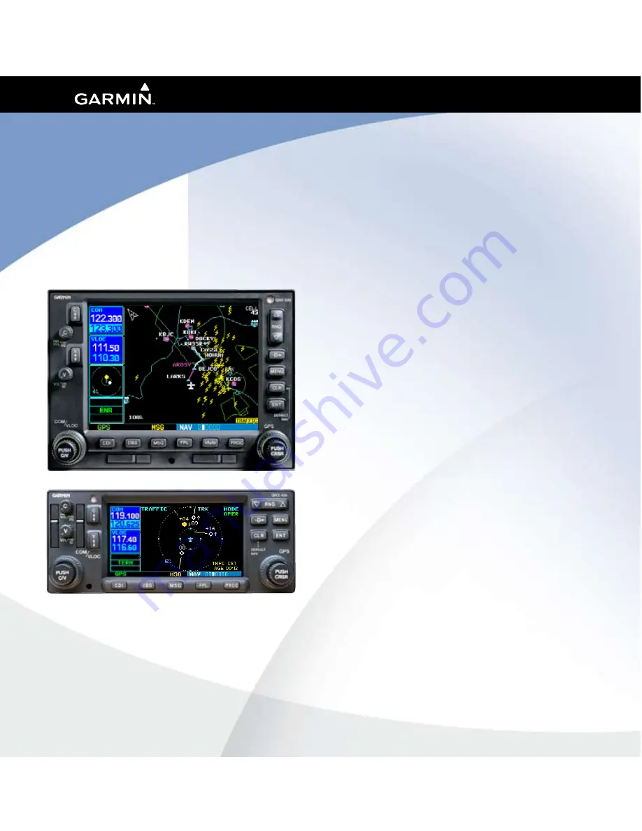
background image

400W / 500W Series

Display Interfaces

Pilot’s Guide Addendum

•   L-3 STORMSCOPE

®

 WX-500 Weather Mapping  

  Sensor
•  L-3 SKYWATCH

®

 Traffic Advisory System  

  (Model SKY497)
•  L-3 SKYWATCH

®

 HP Traffic Advisory System  

  (Model SKY899)
•  Bendix/King

®

 KTA870 TAS/KMH880  

  Multi-Hazard Awareness System
•  Ryan TCAD 9900B and 9900BX

Summary of Contents for 400W Series

Page 1: ...de Addendum L 3 STORMSCOPE WX 500 Weather Mapping Sensor L 3 SKYWATCH Traffic Advisory System Model SKY497 L 3 SKYWATCH HP Traffic Advisory System Model SKY899 Bendix King KTA870 TAS KMH880 Multi Haza...

Page 2: ...stored in any storage medium for any purpose without the express prior written consent of Garmin Garmin hereby grants permission to download a single copy of this manual and of any revision to this m...

Page 3: ...indications from the Garmin 400W 500W Series Unit with all available navigation sources including the information from other NAVAIDs visual sightings charts etc For safety always resolve any discrepan...

Page 4: ...guring Traffic Data on the Map Page 13 Highlighting Traffic Data Using Map Panning 14 Monitoring Traffic 14 Failure Response 15 Description of Traffic Advisory Criteria 15 SECTION 4 RYAN TCAD INTERFAC...

Page 5: ...Advisory System Model SKY497 L 3 SKYWATCH HP Traffic Advisory System Model SKY899 Bendix King KTA870 TAS KMH880 Multi Hazard Awareness System Ryan TCAD 9900B and 9900BX The interface capability allow...

Page 6: ...f Test The power up self test ensures that the WX 500 functions are operating properly An error message is displayed on the Message Page if data is no longer being received User Initiated Test In addi...

Page 7: ...are displayed in the top right corner of the Map Page and the bottom right corner of the Lightning Page The mode is described by the word STRIKE when in strike mode or CELL when in cell mode NOTE Cel...

Page 8: ...nob to select Weather and press ENT 5 The flashing cursor highlights Weather in the GROUP field Turn the large right knob to select the desired lighting mode field Turn the small right knob to select...

Page 9: ...nging the Storm Data Display Range Storm data can be displayed on the 2000 NM zoom scale but the data only goes out as far as the STORMSCOPE can report 200 nm The 500 NM zoom scale will display all li...

Page 10: ...ult NAV Map NAVCOM Position Satellite Status VNAV Traffic Lightning Terrain XM Wx Lightning Page 500W Series In addition to the Map Page storm data can also be viewed on the Lightning Page In the 500W...

Page 11: ...ct the desired Lightning Display Mode 1 From the default NAV Page turn the small right knob to select the Lightning Page 2 Press MENU to display an options menu 3 Select the desired display angle from...

Page 12: ...ders aircraft SKYWATCH Description Please refer to the SKYWATCH Pilot s Guide for a complete description of the SKYWATCH system Traffic Page showing Bendix King KTA 870 KMH traffic near the 40 nautica...

Page 13: ...See the SKYWATCH Pilot s Guide for information on voice announcements Switching Between Standby and Operating Modes The unit must be in operating mode for traffic to be displayed The ability to switch...

Page 14: ...WATCH Pilot s Guide Please refer to the SKYWATCH Pilot s Guide for information regarding altitude display ranges 3 Note that confirmation is not required The mode is changed immediately when using the...

Page 15: ...to select the Map Page 2 Press MENU to display the Page Menu Turn the small right knob to select Setup Map and press ENT 3 The flashing cursor highlights the GROUP field Turn the small right knob to s...

Page 16: ...er flashes on the map display A window also appears at the top of the map display showing the latitude longitude position of the pointer plus the bearing and distance to the pointer from your present...

Page 17: ...WATCH Pilot s Guide for detailed information on Failure Response Description of Traffic Advisory Criteria For a description of Traffic Advisory criteria and display interpretation please see the SKYWA...

Page 18: ...al collision threats TCAD computes relative altitude and range of threats from nearby Mode C and Mode S equipped aircraft TCAD will not detect aircraft without operating transponders or those that are...

Page 19: ...You can configure TCAD data on the Map Page using the Map Setup Menu To configure Traffic on the Map Page 1 Turn the small right knob to select the Map Page 2 Press MENU to display the Page Menu 3 Us...

Page 20: ...earing and distance to the pointer from your present position When the target pointer is placed on traffic the traffic range squawk code if available and tail number if available are displayed To use...

Page 21: ...or the 9900BX model this field is replaced with the SKYWATCH style altitude mode TCAD 9900B Operating Modes GND ground mode TML terminal mode STD standard mode ENR en route mode UNR unrestricted mode...

Page 22: ...a small map and can display the Traffic Page if the user presses ENT or return to the previous page if the user presses CLR Ryan TCAD Traffic Warning Window NOTE The Traffic Warning Window is disabled...

Page 23: ......

Page 24: ...Kansas 66062 U S A Garmin AT Inc 2345 Turner Rd S E Salem Oregon 97302 U S A Garmin Europe Ltd Liberty House Bulls Copse Road Hounsdown Business Park Southhampton SO40 9RB U K Garmin Corporation No 6...

Reviews: