DeLorme Earthmate GPS PN-20, User Manual
The DeLorme Earthmate GPS PN-20 is a powerful navigation device equipped with advanced features for outdoor adventures. To help you make the most of its capabilities, a comprehensive "Getting Started Manual" is available for free download at manualshive.com, providing detailed instructions on setup, usage, and maximizing its potential.
Share
Download


Reviews:
No comments
Related manuals for Earthmate GPS PN-20
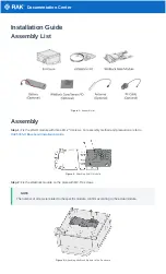
WisBlock Kit 3
Brand: RAK Pages: 6

G515
Brand: Navitel Pages: 109
Tracker 5380
Brand: Navman Pages: 64

DGPS 212
Brand: JRC Pages: 2

Raynav 780
Brand: Raymarine Pages: 127
CheckSmart Luggage Tracker
Brand: Victorinox Pages: 59

GT06R
Brand: UniGuard Pages: 6

CVPL-TR22
Brand: Chinavision Pages: 17

EZ-Guide Plus
Brand: Hardi Pages: 30

locate-15
Brand: ENAiKOON Pages: 28

OT-3G-08
Brand: APM Pages: 5

GPS 18-5Hz
Brand: Garmin Pages: 12

T356
Brand: ULBOTech Pages: 20

LGG100-GG
Brand: Javad Pages: 92

StarFinder-Aire
Brand: Laipac Pages: 22

KW-941
Brand: Furuno Pages: 6

C150
Brand: Cheetah Pages: 2

TRI NAV
Brand: Terra Pages: 26


