


Doc. P/N:
WSP-009-008
Version: V1.3
Issue Date:
April 2014
52
7.4
Chart Tab
The Chart Tab allows the user to configure the information that is presented on the charting displays.
This includes the ability to determine what features of the Navionics charts are enabled, how the water
column targets and vessel track are displayed, where and how depth information is displayed, and
various other settings.
7.4.1 Cartography
s
hOW
c
hart
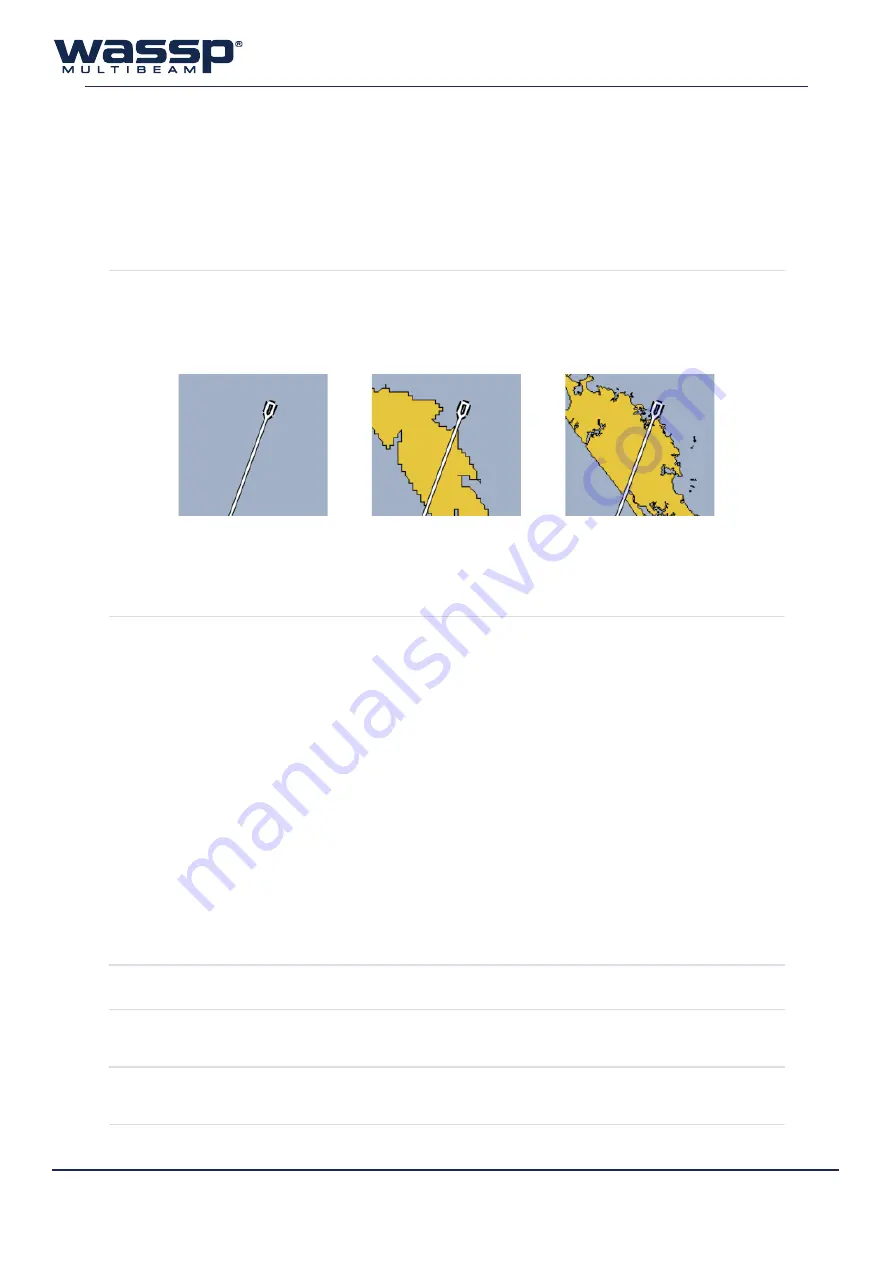
The user can elect to have the Navionics chart overlay enabled or disabled.
Without a Navionics chart connected, a rough country-level overlay is drawn
which is replaced with the Navionics data once the card is installed and a Rescan is
performed (see “6.4 Rescan” on page 36 for more information).
c
hart
l
ayers
Selects the layers which will be shown on the chart overlay. Any changes made to
the active layers must be activated by clicking ‘
SET
’.
►
Anchorage Areas
: Areas where vessels can anchor and shows marinas, jetties
and wharfs.
►
Cables
: Overlays locations of underwater cables.
►
Depth Contours
: Shows the depth contour lines from the chart card.
►
Depth Soundings
: Shows the single depth soundings from the chart card.
►
Nature Of Seabed
: Indicates what the seabed is at various locations.
►
Nav Aids
: Shows location of navigational lights, beacons, buoys and markers.
►
Port
: Show port shapes such as pylons.
►
Pipeline
: Show location of pipelines.
►
Wreck, Rocks
: Locations of wrecks and rocky areas.
►
Names
: Shows names of harbours and locations on the chart. Will also show
warnings and information.
►
Background Colour
: Pale Gray (default) or Black background options.
►
Maximum Colour Depth
: Set the maximum colour depth (default 800m).
7.4.2 Overlays
h
eadinG
l
ine
W
idth
Adjusts the thickness of the heading line of the vessel on the 2D charting displays
s
hOW
s
cale
On
2d
Overlays a dynamic scale on the 2D charting displays
Chart Disabled
Chart Enabled
(no Navionics Card)
Chart Enabled
(with Navionics Card)
Figure 31. Chart Enabled / Disabled Examples


