31
VII.
Height above ground
The SYS
’GPS is able to tell you how high from the ground you are thanks to topography data
recorded by the Shuttle Radar Topography Mission realized in 2000 by Endeavour space
shuttle (see
http://en.wikipedia.org/wiki/Shuttle_Radar_Topography_Mission
To send topography data into your instrument :
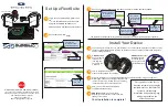
1) You must go to the dedicated page thanks to the SYS PC Tool, by clicking on
“
Topography
Download a topography
http://www.syride.com/en/topography
2)
This will bring you to a webpage. Move the red rectangle to the place where you’re flying, and
download the data.
3) Turn on and connect
your SYS’GPS with the USB cable.
4)
Then go back to the SYS PC Tool, and click on “
Topography
Send a topography
”, and
select the file you previously downloaded.
Caution, height above the ground has a precision of ±20m, plus
the precision of GPS (a few meters).
To display your height above ground, this information must be included in your screen
configuration (see previous chapter).
EN
Summary of Contents for SYS'GPS
Page 23: ...21 SYS GPS EN Guide d utilisation p1 User guide p21 Manual de usuario p43 Benutzerhandbuch p65...
Page 44: ...42...
Page 45: ...ES SYS GPS Guide d utilisation p1 User guide p21 Manual de usuario p43 Benutzerhandbuch p65...
Page 66: ...64...
Page 67: ...65 SYS GPS DE Guide d utilisation p1 User guide p21 Manual de usuario p43 Benutzerhandbuch p65...