Ú
Note:
The mariner can manually adjust the time zone for each waypoint. To modify the
Use PC time option
Tick on/off the
Use PC Time
check box to synchronize Windows time settings with
ECDIS900.
Scale indicator
Current scale
Displays the current scale of the chart. The panel can be located in the console area or in the
toolbar area.
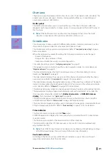
Below is an example of an approved scale view:
Overscale
If the current scale is two times larger than the compilation scale of the ENC cell, the scale
panel displays an overscale warning. The panel is highlighted in yellow and OVCS message is
displayed.
The overscale rate is displayed in the brackets.
If the rate is less than two (2), the standard scale panel is highlighted in yellow.
Below is an example of an overscale view:
The overscale warning is also displayed on Legend panel. Refer to
for more details.
Ú
Note:
Other scale warning also displays the
Better chart exists
message. This message
is displayed in the Legend panel normally for ships with ENC cell charts that has larger
scale than the current chart in use.
Navigation mode panel
GPS mode
The GPS or D.R. (Dead Reckoning) panel displays the current navigation mode.
The default standard mode is the GPS mode. The GPS name and data quality bar are
displayed on the panel.
If no data is received, the system switches to the D.R. mode and the
NO POSITION
warning
message is displayed.
Once the communication with the GPS is restored, the system reverts to the GPS mode.
Multi GPS
ECDIS900 can receive data from several GPS devices. In this case, one of the GPS must have
the Master role.
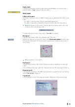
To change the Master GPS, right click on the panel and select GPS from the menu.
If the Master GPS data has worse quality than one of the slave GPS, the GPS panel is
highlighted in yellow. It is recommended to switch to the GPS with best received data.
Ú
Note:
The mariners are enable to change the Master GPS in the Monitoring station only.
Master GPS is synchronized in the all ECDIS workstations connected to the network.
Simulation mode
When the GPS fails and no log/gyro data are available, the system switches to the simulation
mode and the
NO POSITION
warning message is displayed.
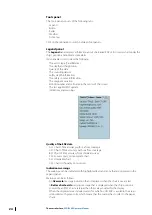
The ship position panel displays dotted line and a red cross on top of the ship’s icon indicates
the simulation. The
S
symbol is displayed on the chart area.
22
The user interface
| ECDIS900 Operator Manual

