


R&S FSH
Interference Analyzer (R&S FSH-K15/ -K16)
Working with Maps
Operating Manual 1173.6275.12 - 30
172
5.2.6 Collecting Measurement Data (R&S FSH-K17)
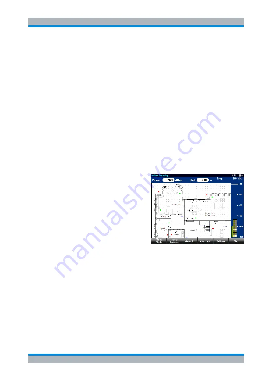
When you enter the "Indoor Mapping" application, the R&S FSH always shows the
signal strength you are currently receiving as a numeric value at the top of the display
or in the power bar at the right side of the display (if you have turned that feature on).
However, the main application of the "Maps" mode is to collect the signal strength of
various locations in enclosed areas, and save that data for later evaluation. This allows
you to analyze, for example, the coverage conditions within a building. Basically, the
method to collect this data is similar to that of collecting geotags in large scale map
mode.
When you perform a measurement at a particular spot on the map, the application
creates a tag (represented by a colored dot) and draws it on the map at your current
location. The color of the dot represents the signal strength received at that location
(see "
Selecting Colors for Geotags and Measurement Locations
Creating tags
You can create a tag on any place of the map. To do so, you first have to move the
cross-hairs in the map display to the position you are currently at with the cursor keys
or the rotary knob. For more information see "
Aligning the Map (R&S FSH-K17)
" on
page 162.
When the cross-hairs is at the right
location, proceed as follows to save
the measured data.
► Press the ENTER key.
The R&S FSH creates a tag at
your current position, represented
by a colored dot on the map.
(Alternatively, you can press the
"Indoor Position" softkey and create a
tag with the "Capture Position" menu
item.)
In addition to the graphical representation of the tags, the R&S FSH also stores
additional (numerical) data of the measurement in the tag. You can view the additional
information in the "Indoor Position List".
Managing tags
The application features an "Indoor Position List" that allows you to manage and edit
tags and (to some degree) the information they conatin. The "Indoor Position List"
contains all tags that you have created.
► Press the "Indoor Position" softkey.
► Select the "Indoor Position List" menu item.
The R&S FSH opens a list of tags that you have saved. In this list, the R&S FSH
shows some basic information about the geotag.


