


Interference Analyzer
R&S
®
Spectrum Rider FPH
270
User Manual 1321.1011.02 ─ 11
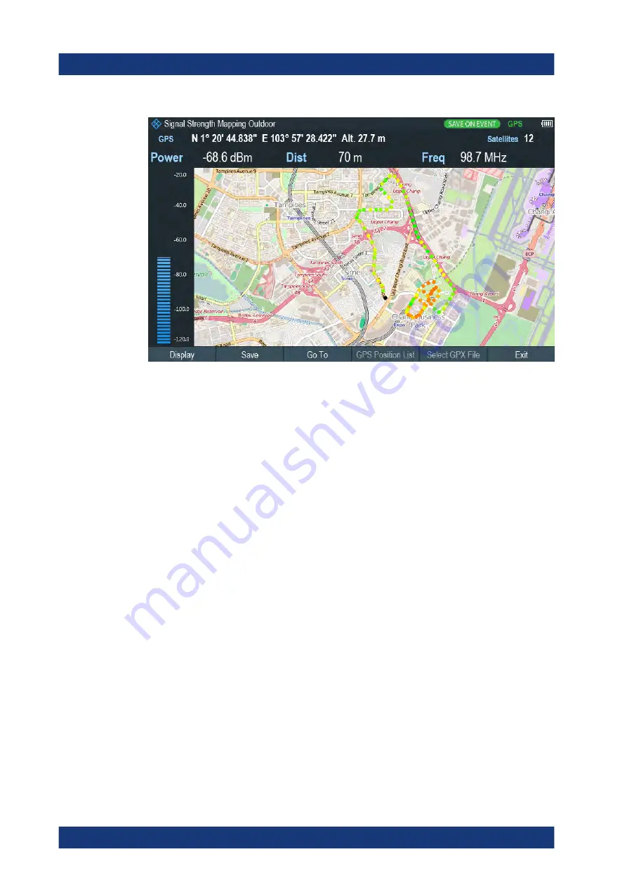
Figure 11-4: Save On Event map measurement
The R&S Spectrum Rider adds all geotags that you create to the "GPS Position List",
see
1. Press [MEAS] key.
2. Select "Settings" softkey
3. Select "Save on Event" softkey.
The R&S Spectrum Rider opens a submenu to activate the "Save on Event" func-
tion and define the "Event Source".
4. Select the "Event Source" menu item to define the event that triggers data storage.
The R&S Spectrum Rider opens a submenu to select the different event types. For
more information, see
5. Activate the "Save on Event" menu item.
The R&S Spectrum Rider turns on the "Save on Event" functionality.
Managing geotags
The application features a "GPS Position List" that allows you to manage and edit geo-
tags. The "GPS Position List" contains all geotags that you have created.
1. Select "GPS Position" softkey.
2. Select "GPS Position List" softkey.
The R&S Spectrum Rider opens the GPS position list dialog box.
The R&S Spectrum Rider opens a list of geotags that you have saved. In this list, the
R&S Spectrum Rider shows some basic information about the geotag.
Working with Maps
www.allice.de
Allice Messtechnik GmbH


