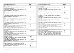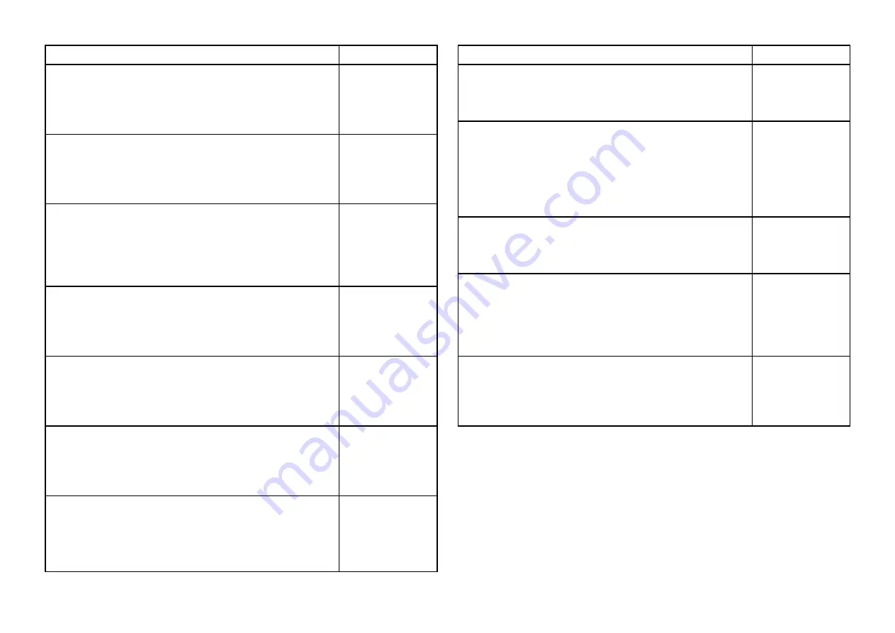
Menu item and description
Options
[Record depth data]
Enables depth and position data to be recorded to a
MicroSD memory card.
This setting is available when using LightHouse™ and
legacy LightHouse™ vector charts.
•
On
•
Off
[Waterline to tdcr]
Enter the distance between the waterline and your
depth transducer.
This setting is available when using LightHouse™ and
legacy LightHouse™ vector charts.
Numeric depth
value
[Save to]
When a suitable MicroSD card has been inserted, the
free space available for recording depth data and
RealBathy is displayed.
This setting is available when using LightHouse™ and
legacy LightHouse™ vector charts.
•
SD1
•
SD2
[RealBathy]
Displays on the chart previously recorded RealBathy™
data saved to a MicroSD memory card.
This setting is available when using LightHouse™ and
legacy LightHouse™ vector charts.
•
On
•
Off
[Visibility]
Determines the transparency of the RealBathy data
displayed onscreen.
This setting is available when using LightHouse™ and
legacy LightHouse™ vector charts.
•
0% to 100%
[Height correction]
Determines the level of height correction applied to
RealBathy and depth data.
This setting is available when using LightHouse™ and
legacy LightHouse™ vector charts.
•
None
•
Tidal
•
Lake level
[Density]
Selects the density of available depth contours.
This setting is available when using LightHouse™ and
legacy LightHouse™ vector charts.
•
Low
•
Medium
•
High
•
Very high
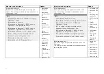
Menu item and description
Options
[Sonar logging]
Allows logging of depth and position data to your
Navionics chart card.
This setting is available when using Navionics® charts.
•
On
•
Off
[SonarChart Live]
Enables and disables the Navionics SonarChart Live
feature, which enables the realtime creation and display
of high resolution bathymetry charts.
When set to
[History]
, historical sonar chart live data
is displayed.
This setting is available when using Navionics® charts.
•
On
•
Off
•
History
[Visibility]
Determines the level of transparency used when
displaying SonarChart data.
This setting is available when using Navionics® charts.
•
0% to 100%
[Tide correction]
Enables sonar logging depth measurements to be offset
by tide height data from nearby tide stations.
Tide correction will be disabled when viewing historical
SonarChart Live data.
This setting is available when using Navionics® charts.
•
On
•
Off
[Shallow depth shading]
Enables and disables the identification of areas deemed
to be shallow. When set to On, a red hatched area is
displayed in areas shallower than the specified depth.
This setting is available when using Navionics® charts.
•
On
•
Off
205
Summary of Contents for LIGHTHOUSE 4
Page 2: ......
Page 4: ......
Page 20: ...APPENDIX C HARDWARE AND SOFTWARE COMPATIBILITY 478 APPENDIX D DOCUMENT CHANGE HISTORY 480 20...
Page 414: ...414...
Page 451: ...4 Select Delete again to confirm 5 Select OK YachtSense ecosystem 451...
Page 484: ......
Page 503: ......

