
VQT4E00 (ENG)
22
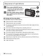
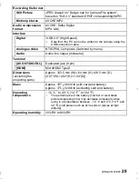
Recording using the GPS function
∫
About the “GPS”
∫
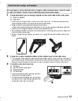
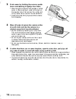
Receiving signals from GPS satellites
•
It is recommended to use by holding the camera still for a while at an outdoor location
clear to the sky, with the antenna pointed upward.
•
Radio waves from GPS satellites cannot be received properly at the following locations, so
the positioning may not be possible or a significant error may occur.
–
Indoor/underground or underwater/in the woods/travelling in a train or a car etc./close to or
between buildings/close to high voltage lines/inside a tunnel/close to mobile phones
working on 1.5 GHz band etc.
•
Do not cover the GPS antenna with your hands etc.
•
Do not carry the unit inside a metallic case or similar when positioning. Positioning is not
possible when the unit is covered by metal etc.
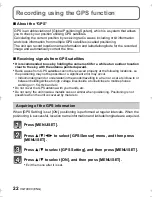
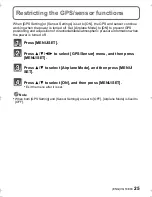
When [GPS Setting] is set [ON], positioning is performed at regular intervals. When the
positioning is successful, location name information and latitude/longitude are acquired.
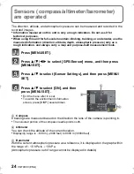
Press [MENU/SET].
Press
3
/
4
/
2
/
1
to select [GPS/Sensor] menu, and then press
[MENU/SET].
Press
3
/
4
to select [GPS Setting], and then press [MENU/SET].
Press
3
/
4
to select [ON], and then press [MENU/SET].
•
Exit the menu after it is set.
GPS is an abbreviation of [Global Positioning System], which is a system that allows
you to check your position utilising GPS satellites.
Calculating the current position by receiving radio waves including orbit information
and clock information from multiple GPS satellites is called positioning.
The unit can record location name information and latitude/longitude for the recorded
image and automatically correct the time.
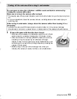
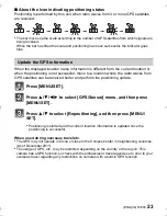
Acquiring of the GPS information
DMC-FT4&TS4EB-VQT4E00_mst.book 22 ページ 2012年1月23日 月曜日 午前9時52分