


26
Extended Menu Navigation
27
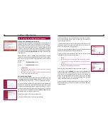
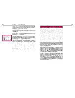
New speed limit
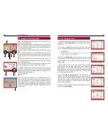
If you think you are at an especially dangerous location, you can easily
add a
New speed limit
. You will have to classify it more precisely
according to the type and speed limit. You can select from the following
types (scroll keys left / right):
a) speed limit (speeding),
b) traffic light (running a red light) and
c) traffic light with speed limit
d) locations of ”mobile” V-Traps
Then you can set a speed limit, if desired.
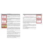
Your entry will then be added to a
List
you can display in the second
submenu. You can also delete entries from this list. Proceed as descri-
bed for the address book with the shift key.
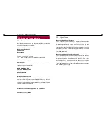
Options
In the submenu
Options
, item
Distance
, you can set the distance at
which you want the system to warn you with a graphic and acoustic
message when approaching a speed limit. You can also set the
Angle
(compared to your current position / direction) in which you want the
system to warn you of V-Traps. This gives you enough time to adjust
your driving style to the respective situation.
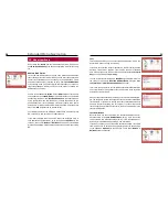
Under sub-item
Show
you can set whether you want the navigation
system to submit only warnings provided by the updates (
SCDB
), only
warnings you have entered (
User
), a combination of both (
All
), or no
messages at all.
The sub-item
Uninstall
enables you to completely uninstall the up-
date. If you have selected this menu item by mistake, there is a securi-
ty prompt which you have to confirm again to delete the update and the
speed limit functions.
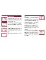
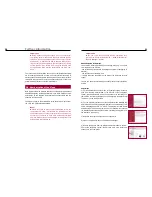
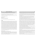
GPS Info
In the menu
GPS Info
you can display your present position in latitude
and longitude. In addition, you will get the exact number of received
satellites and the present speed. This is calculated from the changed
GPS data. The lowest display indicates the meters in altitude measured
in comparison to sea level.
Note:
If, for a period of two weeks, you have not moved your
vehicle or have not activated your navigation system, the
stored GPS data of the system are no longer valid. For that
reason the registration and processing of the new satellite
data may take more time than usual as the navigation sys-
tem aligns the old data with the new data.
By clicking on the ‘signal quality’ selection in the display, you reach a
view in which you are able to see the strength of the satellite reception.
The bigger the bars are, the better is the reception of the signal from
the corresponding satellite. For a route guidance, at least three satelli-
tes with a reception intensity of 15 or higher are necessary.
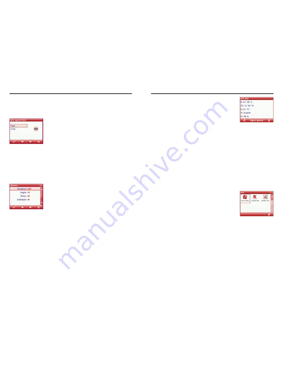
Info
In the menu
Info
you can get information about the service data of the
manufacturer and the release numbers of the existing hardware and
software. The sub-item
License info
informs you of the map’s license
number, the SD card serial number and the KEY number. Please read
the chapter “Installing Operating System Updates”.