background image


17

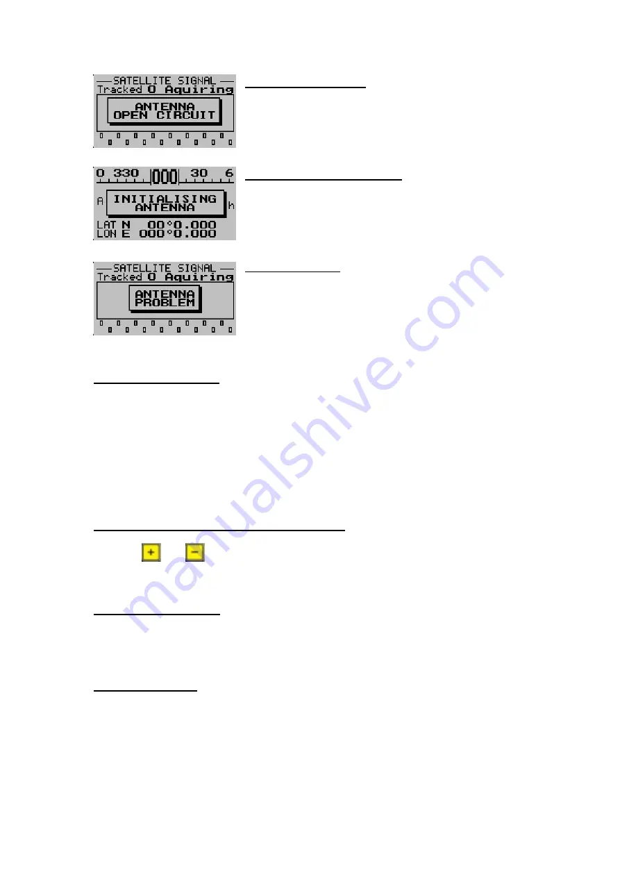
Open Circuit Message 

 
The message will disappear as soon as an antenna is 
attached to the unit. 


Initialising Antenna Message 

 
The GPS-1 is busy initializing the antenna. This message will 
disappear as soon as this initialization has been completed. 


Antenna Problem 


Please check the antenna and rear antenna connector for 
possible damage. 


Antenna Placement 

 
As stated previously, the world’s best GPS receiver can be rendered useless unless a correct 
antenna is chosen and the correct placement of the antenna is achieved. 
 

Note: 

The GPS antenna must be positioned such that it always has a full view of the sky, and 

no metal objects are blocking its view. 
 
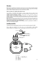
Please see the connection diagram on the last page to see where to connect the GPS 
antenna. 


Resetting the GPS-1 to factory defaults 


Press the 

 and 

 keys when applying power to the unit to reset the unit to the factory 

default settings. 

Caution:

 All waypoint and route information will be lost. 


Firmware Upgrades 


Please check our website for the latest firmware. The GPS-1 firmware can be upgraded by 
running the GPS-1 upgrade program and connecting the GPS-1 to the PC via a serial cable. 


PC Connectivity 
 

The GPS-1 can be connected to a PC to allow the user to manage their waypoints and 
routes. There are various PC programs supplied on the accompanied CD to do this. It is 
recommended that the user evaluate these programs and select the one that best suites his 
requirements. The communication settings is set as 9600,8,N,1 
 

Please note:

 The GPS-1 is made to emulate a Magellan GPS Tracker. This allows the user 

to use a wider range of GPS application programs. Please be aware that the Magellan GPS 

Summary of Contents for Stratomaster Maxi Singles GPS-1

Page 1: ...20 user defined routes 150 user defined waypoints Quick and easy to create and manage waypoints and routes Quick to find the nearest waypoint to the current position 5 navigation and information disp...

Page 2: ...stationary orbit currently over North America providing additional correction data The GPS 1 receives these additional signals to make a more accurate computation of position Please see http gps faa...

Page 3: ...Screen This screen is useful to display position data when no route or waypoint has been selected It displays information such as a bearing tape altitude ground speed and latitude and longitude as we...

Page 4: ...orientation in relation to the GPS 1 Horizon Position fix type HDOP Value 2D Fix or PDOP Value 3D Fix North Indicator 45 Degrees above Horizon Vertical Accuracy in meters Horizontal Accuracy in meter...

Page 5: ...chieved PDOP values in excess of 8 are considered poor Note A position fix with a PDOP of 30 could be as much as 150m from its true location Satellites that are dispersed throughout the sky will achie...

Page 6: ...ypoint current ground speed ETE Estimate Time Enroute as well as your track and a CDI Course Deviation Indicator Waypoint Descriptor Fix Indicator 2D 2D Fix has been achieved 3D 3D Fix has been achiev...

Page 7: ...nt position The distance and track is referenced to the current position Move the highlight over save and press to save once you have finished entering a waypoint name and latitude and longitude Press...

Page 8: ...aypoint that you want to edit Press to edit the waypoint Move the highlight over save and press to save once you have finished editing the waypoint name and latitude and longitude Press to cancel and...

Page 9: ...o your current position Goto a Waypoint Press the key once during normal operation to go to a predefined waypoint The goto waypoint menu will appear This will display all pre stored waypoints Use the...

Page 10: ...racters long A route can contain upto 30 waypoints Move the highlight over save and press to save once you have finished entering a route name and latitude and longitude Press to cancel and return to...

Page 11: ...keys to highlight which waypoint is to be deleted Press to delete the waypoint from the route View Route Select View Route to view a route Use the and keys to select the route to view Press to view t...

Page 12: ...e route memory Use the and keys to select the route to be deleted Press to select Note If all the waypoints are deleted all the routes will be deleted automatically Starting a route Press during the n...

Page 13: ...tes defined in the route memory Sunrise Sunset Calculator This sunrise sunset calculator uses a unique algorithm based on date and position to accurately determine the sunrise and sunset times This fe...

Page 14: ...e North Pole Magnetic Variation This is the angle between Magnetic and True North Magnetic variation varies both from place to place and with the passage of time This option is used in conjunction wit...

Page 15: ...es to startup Coldstart In coldstart the GPS receiver has no knowledge of the last position or time This is the case when no almanac or ephemeris data is available Warmstart A warmstart is performed w...

Page 16: ...stics NMEA stands for the National Marine Electronics Association For more information please visit www nmea org GPS Antenna s Even the best GPS receiver in the world will become useless unless a prop...

Page 17: ...ect the GPS antenna Resetting the GPS 1 to factory defaults Press the and keys when applying power to the unit to reset the unit to the factory default settings Caution All waypoint and route informat...

Page 18: ...he satellites identification number ETE Estimated Time Enroute This is how long it will take to reach your destination traveling at the current speed WAAS WAAS is a FAA funded project to improve the a...

Page 19: ...fitment of a fuse in line with a 33V transorb available from MGL Avionics to protect electronic instruments radios and intercom systems Only one such arrangement is required for a cluster of instrume...

Page 20: ...20...

Reviews: