Lynx
®
NGT-9000
Pilot’s Guide
2-20
Operation
“2D” - 2D Nav, no integrity [Sufficient satellites to compute
a lateral position, but not to compute either HPLSBAS or
HPLFD]
“3D” - 3D Nav, no integrity [Sufficient satellites to compute a
lateral and vertical position, but not to compute either HPLSBAS
or HPLFD]
“FDE” - RAIM/Alt (aided integrity) [HPLFD computed using
barometric altitude aiding is valid]
“WAAS” - RAIM [HPLSBAAS is valid or HPLFD computed
without using barometric altitude aiding is valid]
“Error” - SVERROR (trying to exclude) [Fault detection detects
a position failure which cannot be excluded within the time-to-
alert when integrity is being provided by FDE]
SIL: This value is always 3. Displayed GPS Satellite information is
shown as horizontal bars in increasing numerical order. The bars
are green-filled for greater signal strength and gray-filled when
no signal is detected. The bars should be at least 40-50% green-
filled .
Latitude and Longitude data: Shows the GPS computed own
aircraft latitude/longitude in degrees, minutes, seconds.
GPS Altitude (GALT): Shows the GPS computed own aircraft
altitude (Height Above Ellipsoid (HAE) in feet.
HFOM (Horizontal Figure of Merit): An indication of the quality of
the GPS position for horizontal position data.
VFOM (Vertical Figure of Merit): An indication of the quality of the
GPS position for vertical position data.
If no valid data is available for the GPS data a white dash is inserted.
•
•
•
•
•
•
•
•
•
•
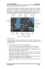
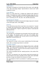
Figure 2-10: Traffic Options Screen - Status
Summary of Contents for Lynx NGT-9000+
Page 26: ...Lynx NGT 9000 Pilot s Guide 1 16 Description Page intentionally blank...
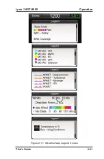
Page 57: ...Lynx NGT 9000 Pilot s Guide 2 31 Operation Figure 2 17 Weather Map Legend Screen...
Page 68: ...Lynx NGT 9000 Pilot s Guide 2 42 Operation Page intentionally blank...
Page 82: ...Lynx NGT 9000 Pilot s Guide 4 6 Troubleshooting Page intentionally blank...
Page 96: ...0040 17000 01 Revision E July 24 2015 Aviation Products...


