IntuVue RDR-4000 Weather Radar Pilot's Guide
Principles of Weather Radar Use
D201002000008
42
Rev 1, December 2014
areas where the REACT field is shown, expect the possibility of
additional weather that may need to be avoided.
o
Generally, consider cells with any magenta turbulence and hail
icons as the most hazardous cells, then in order of decreasing
severity:
Cells with turbulence and lightning indications (no hail
indications).
Cells with no hazard icon, but with turbulence indicated.
Cells with reflectivity only, with maximum reflectivity of red.
Cells with reflectivity only, with maximum reflectivity of yellow.
Cells with reflectivity only, with maximum reflectivity of green.
If a squall line or system of cells must be penetrated, plan a path
through the weather in a region of the least indicated hazard with the
lowest reflectivity, generally staying upwind of the most severe
hazards. In areas where the REACT field is shown, expect the
possibility of additional weather that may need to be avoided.
When REACT fields are shown, the geometry between the aircraft
and the attenuating weather may change as the flight progresses.
This may allow weather that was in the REACT area to later be
outside of the REACT field, and the radar will then more clearly
display weather in that area.
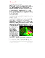
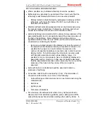
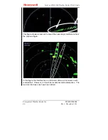
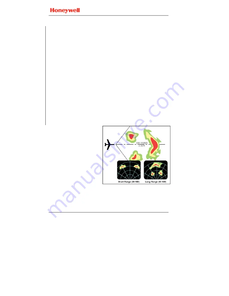
A
Blind Alley
or
Box
Canyon
situation can be
very dangerous. When
viewing the short ranges,
periodically switch to
longer-range displays to
observe distant conditions.
In the example shown to
the right, the short-range
returns show an obvious
corridor between two areas
of heavy rainfall but the
long-range setting shows a
larger area of heavy
rainfall.
Thunderstorms build and dissipate rapidly. Therefore, you SHOULD
NOT attempt to pre-plan a flight plan course between closely spaced
echoes, or under or over convective cells. Avoid individual storms in
flight either by visual sighting or by use of airborne radar.


