Steps
1. Click Radar.
2. Click Coordinate Calibration or GPS Calibration.
3. Set the radar calibration.
-
Set coordinate calibration. Refer to Manual Calibration and Auto Calibration for details.
-
Set GPS calibration. Refer to GPS Coordinate Calibration for details.
Note
The supported calibration modes vary with different models. The actual device prevails.
3.2.1 Manual Calibration
Steps
1. Click Coordinate Calibration.
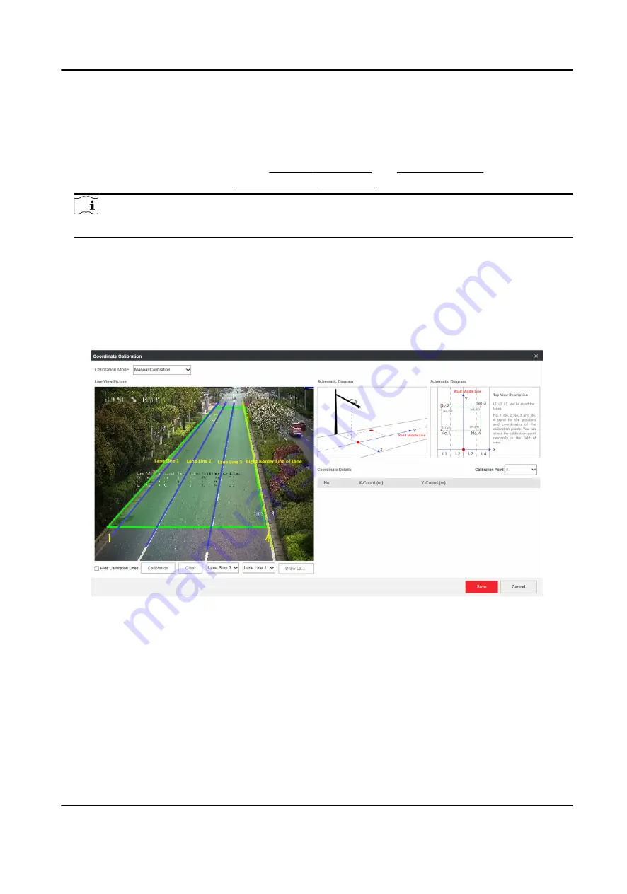
2. Select Calibration Mode as Manual Calibration.
Figure 3-2 Manual Calibration
3. Draw the lane lines.
1) Select the lane sum.
2) Select the lane line No.
3) Click Draw Lane Line.
The selected lane line will be displayed on the live view picture.
4) Drag the two end points of the line or drag the whole line to adjust its position according to
the actual scene.
5) Repeat the steps above to draw more lane lines.
4. Draw the calibration area.
All-Rounder Bi-Spectrum Incident Detection Traffic Camera User Manual
8


