


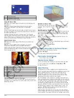


Tracks
A track is a recording of the path of your boat. The track
currently being recorded is called the active track, and it can be
saved. You can show tracks in each chart or 3D chart view.
Showing Tracks
From a chart or a 3D chart view, select
Menu
>
Chart Menu
>
Waypoints and Tracks
>
Tracks
>
On
.
A trailing line on the chart indicates your track.
Setting the Color of the Active Track
1
Select
Info
>
User Data
>
Tracks
>
Active Track Options
>
Track Color
.
2
Select a track color.
Saving the Active Track
The track currently being recorded is called the active track.
1
Select
Info
>
User Data
>
Tracks
>
Save Active Track
.
2
Select an option:
• Select the time the active track began.
• Select
Entire Log
.
3
Select
Save
.
Viewing a List of Saved Tracks
Select
Info
>
User Data
>
Tracks
>
Saved Tracks
.
Editing a Saved Track
1
Select
Info
>
User Data
>
Tracks
>
Saved Tracks
.
2
Select a track.
3
Select
Edit Track
.
4
Select an option:
• Select
Name
, and enter the new name.
• Select
Track Color
, and select a color.
Saving a Track as a Route
1
Select
Info
>
User Data
>
Tracks
>
Saved Tracks
.
2
Select a track.
3
Select
Select
>
Edit Track
>
Save Route
.
Browsing for and Navigating a Recorded Track
Before you can browse a list of tracks and navigate to them, you
must record and save at least one track (
).
1
Select
Info
>
User Data
>
Tracks
>
Saved Tracks
.
2
Select a track.
3
Select
Follow Track
.
4
Select an option:
• To navigate the track from the starting point used when
the track was created, select
Forward
.
• To navigate the track from the destination point used
when the track was created, select
Backward
.
5
Review the course indicated by the colored line.
6
Follow the line along each leg in the route, steering to avoid
land, shallow water, and other obstacles.
Deleting a Saved Track
1
Select
Info
>
User Data
>
Tracks
>
Saved Tracks
.
2
Select a track.
3
Select
Select
>
Delete
.
Deleting All Saved Tracks
Select
Info
>
User Data
>
Clear User Data
>
Saved Tracks
.
Retracing the Active Track
The track currently being recorded is called the active track.
1
Select
Info
>
User Data
>
Tracks
>
Follow Active Track
.
2
Select an option:
• Select the time the active track began.
• Select
Entire Log
.
3
Review the course indicated by the colored line.
4
Follow the colored line, steering to avoid land, shallow water,
and other obstacles.
Clearing the Active Track
Select
Info
>
User Data
>
Tracks
>
Clear Active Track
.
The track memory is cleared, and the active track continues
to be recorded.
Managing the Track Log Memory During Recording
1
Select
Info
>
User Data
>
Tracks
>
Active Track Options
.
2
Select
Record Mode
.
3
Select an option:
• To record a track log until the track memory is full, select
Fill
.
• To continuously record a track log, replacing the oldest
track data with new data, select
Wrap
.
Configuring the Recording Interval of the Track Log
You can indicate the frequency at which the track plot is
recorded. Recording more frequent plots is more accurate but
fills the track log faster. The resolution interval is recommended
for the most efficient use of memory.
1
Select
Info
>
User Data
>
Tracks
>
Active Track Options
>
Interval
>
Interval
.
2
Select an option:
• To record the track based on a distance between points,
select
Distance
>
Change
, and enter the distance.
• To record the track based on a time interval, select
Time
>
Change
, and enter the time interval.
• To record the track plot based on a variance from your
course, select
Resolution
>
Change
, and enter the
maximum error allowed from the true course before
recording a track point.
Stopping Navigation
While navigating, from the Navigation or Fishing chart, select
an option:
• Select
Menu
>
Stop Navigation
.
• When navigating with Auto Guidance, select
Menu
>
Navigation Options
>
Stop Navigation
.
Synchronizing User Data Across the Garmin
Marine Network
NOTICE
Before you synchronize the user data across the network, you
should backup your user data to prevent possible data loss. See
.
You can share waypoints, tracks, and routes with all compatible
devices connected to the Garmin Marine Network (Ethernet)
automatically.
NOTE:
This feature is not available on all models.
Select
Settings
>
Preferences
>
User Data Sharing
>
On
.
If a change is made to a waypoint, track, or route on one
chartplotter, that data is synchronized automatically across all
chartplotters on the Ethernet network.
Deleting All Saved Waypoints, Routes, and
Tracks
Select
Info
>
User Data
>
Clear User Data
>
All
>
OK
.
12
Navigation with a Chartplotter
CONFIDENTIAL