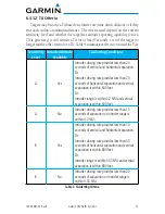
15
190-00587-02 Rev. E
Garmin GTS Traffic Systems
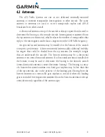
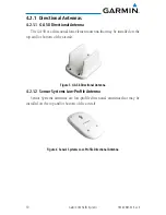
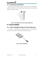
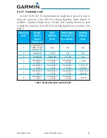
6.2 Traffic Information
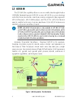
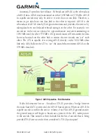
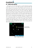
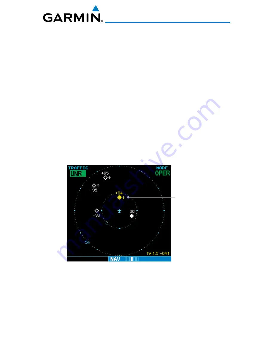
The function of the GTS Traffic System is to provide information regarding
nearby traffic to the crew. For each traffic target that is tracked by the GTS, the
system computes the bearing, range, relative altitude, and vertical trend for the
target. Relative altitude and vertical trend are available for targets with altitude
reporting capability. When ADS-B data is received for a traffic target, additional
information is available such as directionality, ground track, and other identifying
information (ICAO address, flight ID, tail number). Traffic information may be
available from several sources such as active surveillance, ADS-B, ADS-R, and
TIS-B. The GTS correlates data from multiple sources to create a single, fused
traffic picture for the flight crew. This traffic information is displayed to the
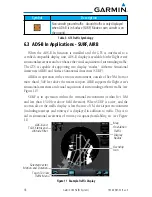
crew on an interfaced display. See the display device Pilot Guide for the display
capabilities and symbology (Table 3) used on that display. Figure 9 shows an
example traffic display showing range, bearing, relative altitude, and vertical
trend. Figure 10 shows an example traffic display capable of showing additional
data received via ADS-B.
Intruder Altitude
and Vertical Trend
Figure 9 Example Traffic Display
Summary of Contents for GTS 820 TAS
Page 1: ...GTS Traffic Systems Pilot s Guide...
Page 6: ...iv Garmin GTS Traffic Systems 190 00587 02 Rev E...
Page 39: ......