Garmin GPS, Beginner'S Manual
Introducing Fujitsu GPS - the ultimate navigation solution for your journeys! With our user-friendly interface and advanced features, finding your way has never been easier. Simply visit manualshive.com to download your free Fujitsu GPS User Manual and unlock endless possibilities in navigation. Get started now!
Share
Download


Reviews:
No comments
Related manuals for GPS

FenixN
Brand: RC Electronics Pages: 67
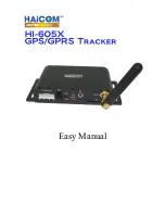
HI-605X
Brand: Haicom Pages: 41

eTrexLegend TM
Brand: Garmin Pages: 76

QFinder
Brand: Qstarz Pages: 3

853365
Brand: Westfalia Pages: 4

MojoMINI
Brand: Leica Pages: 4

GNAV12
Brand: Goodmans Pages: 48

GTRAKPRO
Brand: Gator Pages: 24

GT500
Brand: Queclink Pages: 11

GL521MG
Brand: Queclink Pages: 15

EA00004
Brand: Queclink Pages: 16

GV200G
Brand: Queclink Pages: 27

5 GPS navigation
Brand: Modecom Pages: 112

ADSGPS
Brand: Alfano Pages: 43

Star III
Brand: SiRF Pages: 22

HawkEye 7200A-BB2327
Brand: Blue Sky Network Pages: 27

GH-3100
Brand: L3 Communications Pages: 36

LC-90 Mark-II
Brand: Furuno Pages: 2


