background image


11


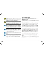
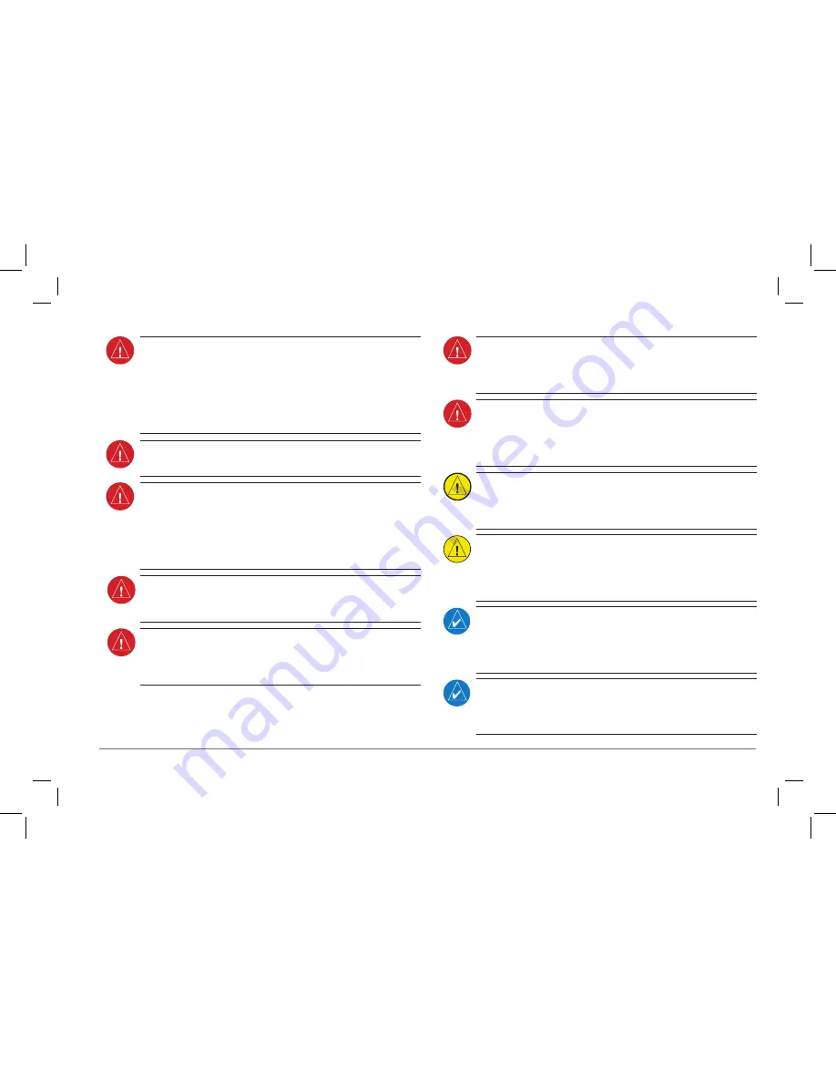
AvvERTENZA: 

gli enti governativi che gestiscono il funzionamento dei sistemi di 

navigazione satellitare (GPS/GLONASS) sono responsabili esclusivamente della relativa 
precisione e manutenzione. I sistemi di navigazione satellitare sono soggetti a modifiche 
che potrebbero influire sulla precisione e sulle prestazioni di tutti gli apparecchi GPS/
GLONASS. Alcune porzioni del sistema utilizzano GPS/GLONASS come ausilio alla 
navigazione elettronico di precisione (NAVAID). Pertanto, come tutti i NAVAID, le 
informazioni presentate dal sistema possono essere utilizzate in modo improprio o 
errato e divenire insicure.


AvvERTENZA: 

per ragioni di sicurezza, è necessario apprendere le procedure operative 

del sistema a terra.


AvvERTENZA: 

per ridurre il rischio di utilizzo non sicuro, esaminare attentamente e 

comprendere tutti gli aspetti della documentazione della Guida del pilota e del Manuale 
d’uso del velivolo. Fare pratica con le funzioni di base prima di utilizzarlo sul campo. 
Durante le operazioni di volo, confrontare con attenzione le indicazioni fornite dal 
sistema con tutte le fonti di navigazione disponibili, incluse le informazioni di altri ausili 
di navigazione, rilevamenti visivi, mappe, ecc. Per ragioni di sicurezza, risolvere sempre 
eventuali discrepanze prima di continuare la navigazione.


AvvERTENZA: 

i dati contenuti nei database del terreno e degli ostacoli provengono 

da agenzie governative. Garmin elabora e convalida i dati, ma non può garantire la 
precisione e la completezza degli stessi.


AvvERTENZA: 

non fare affidamento esclusivamente alle informazioni di navigazione 

presentate nella pagina di visualizzazione 3D di aera 660. Le informazioni di navigazione 
visualizzate provengono da dati satellitari e potrebbero essere diverse dalle informazioni 
di navigazione fornite dagli strumenti di navigazione primari.


AvvERTENZA: 

non utilizzare mai aera 660 per attraversare un temporale. La FAA 

Advisory Circular, Subject: Thunderstorms e l’Aeronautical Information Manual (AIM) 
consigliano di evitare “di almeno 20 miglia qualsiasi temporale identificato come forte 
o che restituisce un eco radar intenso.”


AvvERTENZA: 

non utilizzare le informazioni di avvicinamento fornite dal database di 

navigazione VFR all’interno dell’aera 660 per l’avvicinamento strumentale. Il database 
di navigazione VFR di aera 660 si limita a presentare esclusivamente i waypoint della 
tratta di avvicinamento finale di una procedura pubblicata. Tali waypoint e la linea di 
rotta associata vengono resi disponibili ai soli scopi di monitoraggio.


ATTENZIONE: 

il display è rivestito di una lente speciale che è molto sensibile ai detergenti 

aggressivi. EVITARE L’USO DI DETERGENTI CHIMICI E DI SOLVENTI CHE DANNEGGIANO 
IL RIVESTIMENTO. La pulizia del touchscreen deve essere effettuata con un panno pulito 
privo di lanugine (leggermente inumidito in acqua, se necessario)C


AvvISO: 

il sistema non contiene parti destinate alla manutenzione da parte dell’utente. 

Gli interventi di riparazione devono essere eseguiti esclusivamente presso i centri di 
assistenza Garmin autorizzati. Le riparazioni o le modifiche non autorizzate potrebbero 
invalidare sia la garanzia sia l’autorizzazione del pilota a utilizzare questo dispositivo 
in base alle normative FAA/FCC. 


NOTA: 

questo prodotto, la confezione e i componenti contengono sostanze chimiche 

note alle autorità californiane per la potenziale cancerogenità, mutagenesi e tossicità 
riproduttiva. Queste informazioni sono conformi alla normativa Proposition 65 della 
California. In caso di domande o per ulteriori informazioni, fare riferimento al nostro 
sito Web all’indirizzo www.garmin.com/prop65.


NOTA: 

le interferenze create dai ripetitori satellitari in uso all’interno degli hangar 

vicini possono impedire temporaneamente la visualizzazione dei dati sull’assetto e la 
direzione quando il velivolo è a terra. Allontanare il velivolo di oltre 100 iarde dalla 
sorgente dell’interferenza dovrebbe alleviare il problema.

Summary of Contents for AERA 660

Page 1: ...model 660 Quick Reference Guide Draft...

Page 2: ...stored in any storage medium for any purpose without the express written permission of Garmin Garmin hereby grants permission to download a single copy of this manual and of any revision to this manua...

Page 3: ...ument is to provide a resource with which to find operating instructions on the major features of the aera 660 quickly and easily This Quick Reference Guide is not intended to be a comprehensive opera...

Page 4: ...tment 4 Insert the battery into the battery compartment and push until it clicks into place Unit Overview Battery CHARGING THE BATTERY NOTE While in Charge Mode the unit draws a current from the aircr...

Page 5: ...iewing the GPS status From the Main Menu touch Info Satellite Status tab DISPLAY ORIENTATION The aera 660 can be viewed in either Portrait or Landscape Mode Changing the display orientation 1 From the...

Page 6: ...erview Overview GPS Navigation Flight Planning Hazard Avoidance Utilities Appendix Index SCROLLING AND PANNING Scrolling and panning on the touchscreen Drag up or down to scroll menus documents etc Or...

Page 7: ...10 Rev A 5 Overview Overview GPS Navigation Flight Planning Hazard Avoidance Utilities Appendix Index ZOOMING Zooming in and out on the touchscreen map displays Pinch fingers together zoom out or pul...

Page 8: ...on Flight Planning Hazard Avoidance Utilities Appendix Index DEDICATED PAGE ICONS Dedicated Page Icons are located vertically on the right side of the screen in landscape mode or horizontally along th...

Page 9: ...rd Avoidance Utilities Appendix Index Scroll up OR Returns to previous screen Scroll down OR Touch and hold to display the Main Menu Nearest Group Icons Nearest Page Only OR Weather Group Icons Weathe...

Page 10: ...e associated page or menu Map Displays the Map View Charts Displays the VFR or IFR charts 3D Vision Displays 3D Vision Nearest Displays the Nearest Page Waypoint Displays the Waypoint Information Acti...

Page 11: ...st NDBs Intersection Displays nearest intersections VRP Displays nearest Visual Reporting Point VRP Atlantic User WPT Displays nearest user waypoints City Displays nearest cities ARTCC Displays neares...

Page 12: ...ns to display the associated function Setup Displays third level Setup Icons User WPT Displays User Waypoints and Proximity Waypoints Flight Log Displays Flight Logs Track Log Displays Track Logs FPL...

Page 13: ...Displays backlight intensity timeout and color mode settings Sound Displays sound settings Units Displays unit settings Time Displays time settings Map Displays Navigation Map settings Position Displa...

Page 14: ...39 via Bluetooth 1 From the Main Menu touch Tools Setup Bluetooth 2 Ensure the Bluetooth on the GDL 39 is in Pairing Mode Press and hold the power button on the GDL 39 to enter pairing mode the blue L...

Page 15: ...agree not to export or re export the Software to any country in violation of the export control laws of the United States of America LIMITED WARRANTY This Garmin product is warranted to be free from d...

Page 16: ...TION INCLUDED IN THIS DATA EXPRESS OR IMPLIED INCLUDING BUT NOT LIMITED TO THE IMPLIED WARRANTIES OF MERCHANTABILITY AND FITNESS FOR A PARTICULAR PURPOSE THE INFORMATION IS PROVIDED AS IS AND AOPA DOE...

Page 17: ...liable for any claims losses or damages arising from or connected with the use of this product The user agrees to hold harmless the United States National Geospatial Intelligence Agency The user s sol...

Page 18: ...th Industry Canada Standard RSS 210 RSS 247 LE PR SENT APPAREIL EST CONFORME AUX CNR D INDUSTRIE CANADA APPLICABLES AUX APPAREILS RADIO EXEMPTS DE LICENCE L EXPLOITATION EST AUTORIS E AUX DEUX CONDITI...

Page 19: ...free 800 525 6726 p 503 391 3411 f 503 364 2138 Garmin Europe Ltd Liberty House Bulls Copse Road Hounsdown Business Park Southampton SO40 9RB U K Toll free within U K 0808 2380000 p 44 0370 8501243 f...

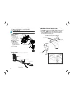
Page 20: ...or control arm Install the yoke mount as far from the panel as is practical 2 When in place tighten the Clamp Adjustment Knob to secure the yoke mount to the yoke shaft or control arm NOTE IWHU LQVWDO...

Page 21: ...all applicable cable connections per the below drawing 5HFRQ JXUH WKH RNH PRXQW IRU FHQWHU FROXPQ RNHV 1 Loosen and remove the Cradle Adjustment Knob spacer and rubber washer 2 Rotate the clamp assem...

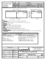
Page 22: ...s Links Document Illustrations eps bitmap etc Document Fonts Document Fonts 190 02017 00_0B pdf Portable Document Format for print 190 02017 00_0B_web pdf Portable Document Format for online REVISIONS...

Page 23: ...curit 6 Informazioni importanti sulla sicurezza e sul prodotto 9 Wichtige Sicherheits und Produktinformationen 13 Informaci n importante sobre el producto y tu seguridad 17 Informa es Importantes de S...

Page 24: ...played by pressure altimeters WARNING Do not use outdated database information Databases used must be updated regularly in order to ensure that the information remains current Pilots using any outdate...

Page 25: ...reted and therefore become unsafe WARNING For safety reasons operational procedures of the system must be learned on the ground WARNING To reduce the risk of unsafe operation carefully review and unde...

Page 26: ...com compliance INdUSTRy CANAdA COmPlIANCE Category I radiocommunication devices comply with Industry Canada Standard RSS 210 RSS 247 Category II radiocommunication devices comply with Industry Canada...

Page 27: ...TNESS FOR A PARTICULAR PURPOSE STATUTORY OR OTHERWISE THIS WARRANTY GIVES YOU SPECIFIC LEGAL RIGHTS WHICH MAY VARY FROM STATE TO STATE IN NO EVENT SHALL GARMIN BE LIABLE FOR ANY INCIDENTAL SPECIAL IND...

Page 28: ...it des informations qu elles contiennent L utilisation de bases de donn es obsol tes constitue une prise de risque assum e par le pilote AVERTISSEMENT n utilisez pas les donn es du fond cartographique...

Page 29: ...s op rationnelles du syst me doivent tre tudi es au sol AVERTISSEMENT pour r duire le risque d utilisation dangereuse vous devez tudier et assimiler tous les d tails de la documentation du Guide du pi...

Page 30: ...w garmin com compliance CONfORmIT AUx NORmES d INdUSTRIE CANAdA Les p riph riques de radiocommunication de cat gorie I sont conformes la norme RSS 210 RSS 247 d Industrie Canada Les p riph riques de r...

Page 31: ...rs ou accessoires les restrictions susmentionn es pourront ne pas vous concerner Garmin se r serve le droit exclusif de r parer ou de remplacer l appareil ou le logiciel ou de proposer le rembourse me...

Page 32: ...dal velivolo o dalle stazioni di terra possibile che il traffico presente non venga visualizzato sullo schermo AVVERTENZA non utilizzare informazioni meteo data link per le manovre in prossimit di con...

Page 33: ...per attraversare un temporale La FAA Advisory Circular Subject Thunderstorms e l Aeronautical Information Manual AIM consigliano di evitare di almeno 20 miglia qualsiasi temporale identificato come f...

Page 34: ...digitali di Classe B PER USO DOMESTICO O USO UFFICIO Tali limiti intendono fornire una pi adeguata protezione dalle interferenze nocive nelle installazioni domestiche e risultano pi severi rispetto ai...

Page 35: ...anwenden Es obliegt der Verantwortung des Piloten im entsprechenden Pilotenhandbuch nachzulesen ob die Sicherheitsinformationen f r ihre spezifischen Konfigurationen anwendbar sind WARNUNGEN VORSICHT...

Page 36: ...nden Bereichen zu einemVerlust von zuverl ssigen Daten zu K rperlage und Fahrtrich tung f hren N rdlich 72 n rdlicher Breite auf allen L ngengraden S dlich 70 s dlicher Breite auf allen L ngengraden N...

Page 37: ...nflug eines ver ffentlichtenVerfahrens zu bieten DieseWegpunkte und zugeh rigen Kurslinien werden nur zu berwachungszwecken bereitgestellt VORSICHT Die Displaylinse ist mit einer Spezialbeschichtung v...

Page 38: ...darf keine St rungen verursachen und 2 dieses Ger t muss empfangene St rungen aufnehmen einschlie lich St rungen die zu unerw nschtem Betrieb f hren k nnen Dieses Ger t erzeugt und verwendet Hochfreq...

Page 39: ...unci n Terrain Proximity solo se debe utilizar como ayuda para evitar la aproximaci n al suelo y no se ha certificado su uso en aplicaciones que requieran un sistema de aviso de aproximaci n al suelo...

Page 40: ...a indicaci n de error Por tanto es responsabilidad del piloto detectar dichos fallos mediante el cotejo con toda la informaci n relevante o correlacionada disponible en la cabina AVISO las entidades g...

Page 41: ...s repetidores de sat lite que funcionan dentro de los hangares cercanos pueden causar p rdidas intermitentes de las pantallas de altitud y rumbo mientras la aeronave est en tierra Mover la aeronave a...

Page 42: ...ir cualquier componente que no funcione correctamente Estas reparaciones o sustituciones se realizar n sin coste alguno para el cliente en concepto de piezas y mano de obra siempre y cuando el cliente...

Page 43: ...as com a exibi o de informa es de tr nsito para executar manobras de preven o de colis o A exibi o do tr fego n o oferece avisos anticolis o e sob nenhuma circunst ncias ou condi es isenta a responsab...

Page 44: ...avega o AVISO os dados presentes nos bancos de dados para terreno obst culos s o provenientes de ag ncias federais A Garmin processa e valida os dados de forma precisa mas n o garante sua exatid o e i...

Page 45: ...me si le brouillage est susceptible d en compromettre le fonctionnement Exposi o radiofrequ ncia Este dispositivo um transmissor e receptor m vel que utiliza a sua antena para enviar e receber baixos...

Page 46: ...o se aplicar a voc A Garmin se reserva o direito exclusivo de reparar ou substituir a unidade ou software ou oferecer um reembolso total do pre o de compra por sua decis o exclusiva TAL RECURSO CONSTI...

Page 47: ...2016 04 52 AM CST GPN 190 02017 00 Description ISPI Aviation aera 660 ML Part Type Manuals Printed Literature Lifecycle Phase Production Rev B ECO 138580 Item Attribution Document Review Required Ite...

Reviews: